Directions to Potter Heigham (North Norfolk) with public transport
The following transport lines have routes that pass near Potter Heigham
How to get to Potter Heigham by bus?
Click on the bus route to see step by step directions with maps, line arrival times and updated time schedules.
Bus stations near Potter Heigham in North Norfolk
- Lathams, Potter Heigham,2 min walk,
- Mill Road, Potter Heigham,9 min walk,
Bus lines to Potter Heigham in North Norfolk
- 6,Gorleston,
- X6,North Walsham,
- 717,Norwich City Centre,
- 834,Bacton,
What are the nearest stations to Potter Heigham?
The nearest stations to Potter Heigham are:
- Lathams, Potter Heigham is 75 meters away, 2 min walk.
- Mill Road, Potter Heigham is 640 meters away, 9 min walk.
Which bus lines stop near Potter Heigham?
These bus lines stop near Potter Heigham: 5B, X6.
What’s the nearest bus stop to Potter Heigham in North Norfolk?
The nearest bus stop to Potter Heigham in North Norfolk is Lathams, Potter Heigham. It’s a 2 min walk away.
What time is the first bus to Potter Heigham in North Norfolk?
The X6 is the first bus that goes to Potter Heigham in North Norfolk. It stops nearby at 06:50.
What time is the last bus to Potter Heigham in North Norfolk?
The X6 is the last bus that goes to Potter Heigham in North Norfolk. It stops nearby at 18:17.
See Potter Heigham, North Norfolk, on the map
Public Transit to Potter Heigham in North Norfolk
Wondering how to get to Potter Heigham in North Norfolk, United Kingdom? Moovit helps you find the best way to get to Potter Heigham with step-by-step directions from the nearest public transit station.
Moovit provides free maps and live directions to help you navigate through your city. View schedules, routes, timetables, and find out how long does it take to get to Potter Heigham in real time.
Looking for the nearest stop or station to Potter Heigham? Check out this list of stops closest to your destination: Lathams; Mill Road.
Bus:5BX66717834
Want to see if there’s another route that gets you there at an earlier time? Moovit helps you find alternative routes or times. Get directions from and directions to Potter Heigham easily from the Moovit App or Website.
We make riding to Potter Heigham easy, which is why over 1.5 million users, including users in North Norfolk, trust Moovit as the best app for public transit. You don’t need to download an individual bus app or train app, Moovit is your all-in-one transit app that helps you find the best bus time or train time available.
For information on prices of bus, costs and ride fares to Potter Heigham, please check the Moovit app.
Use the app to navigate to popular places including to the airport, hospital, stadium, grocery store, mall, coffee shop, school, college, and university.
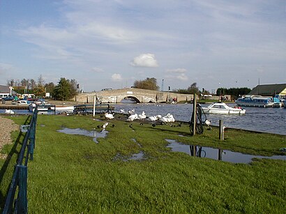
Potter Heigham Address: Bridge Road street in North Norfolk
Attractions near Potter Heigham
Potter Heigham Bridge,Lathams,Potter Heigham Delivery Office,Maycraft (Boat Service) Ltd,Basil,Coriander,Mint - E4322,Dill - E4324,Amazon Counter-Post Office Potter Heigham,Bastwick Tower Cat Hotel,J B Roofing & Property Maintenance Services,The Broads National Park,Repps Methodist Church,Amazon Counter-Repps Service Station,Repps Service Station,Repps-with-Bastwick,Stileaway,Potter Heigham,Potter Heigham,Train TerrainHow to get to popular attractions in North Norfolk with public transportation
Notcutts Garden Centre, Norwich,Ibis Hotel, Cambridge,Caister On Sea, Great Yarmouth,Lensfield Hotel, Cambridge,Holiday Inn Ipswich - Orwell, Ipswich,Impington Village College, South Cambridgeshire,Outwell, King'S Lynn And West Norfolk,Hinchingbrooke Country Park, Huntingdonshire,Castle Rising Castle, King'S Lynn And West Norfolk,Wickham Market, Suffolk Coastal,Long Melford, Babergh,Better Jesus Green Lido, Cambridge,John Lewis at Home, Ipswich,Saxmundham Railway Station (SAX), Suffolk Coastal,Newnham College, Cambridge,Murray Edwards College, Cambridge,Cambridge Assessment, Cambridge,Gislingham, Mid Suffolk,Sawtry community college, Huntingdonshire,Oliver Cromwell's House, East CambridgeshireGet around North Norfolk by public transport!
Travelling around North Norfolk has never been so easy. See step by step directions as you travel to any attraction, street or major public transport station. View bus and train timetables, arrival times, service alerts and detailed routes on a map, so you know exactly how to get to anywhere in North Norfolk.
When travelling to any destination around North Norfolk use Moovit's Live Directions with Get Off Notifications to know exactly where and how far to walk, how long to wait for your line , and how many stops are left. Moovit will alert you when it’s time to get off — no need to constantly re-check whether yours is the next stop.
Wondering how to use public transport in North Norfolk or how to pay for public transport in North Norfolk? Moovit public transport app can help you navigate your way with public transport easily, and at minimum cost. It includes public transport fees, ticket prices, and costs. Looking for a map of North Norfolk public transport lines? Moovit public transport app shows all public transport maps in North Norfolk with all bus routes and stops on an interactive map.
North Norfolk has 1 transport type(s), including: bus, operated by several transport agencies, including National Rail, Ambassador Travel, Harwich Harbour Ferry, Stephensons of Essex, Villager Minibus Sharnbrook, The Voluntary Network, Dews Coaches, Lord's Travel, Felixstowe Ferry Boat Yard, Hadleigh Community Transport, Beestons, Fenland Association for Community Transport, First Norfolk & Suffolk, National Rail and Mulleys Motorways