Directions to Ppc Newlands (Wynberg) with public transport
The following transport lines have routes that pass near Ppc Newlands
How to get to Ppc Newlands by train?
Click on the train route to see step by step directions with maps, line arrival times and updated time schedules.
Bus stops near Ppc Newlands in Wynberg
- Claremont, 12 min walk,
Train stations near Ppc Newlands in Wynberg
- Newlands, 25 min walk,
Bus lines to Ppc Newlands in Wynberg
- BAYVIEW - CLAREMONT, Bayview - Claremont,
- BELHAR - CLAREMONT, Belhar - Claremont,
What are the nearest stations to Ppc Newlands?
The nearest stations to Ppc Newlands are:
- Claremont is 896 meters away, 12 min walk.
- Newlands is 1942 meters away, 25 min walk.
Which train line stops near Ppc Newlands?
SOUTHERN LINE
What’s the nearest train station to Ppc Newlands in Wynberg?
The nearest train station to Ppc Newlands in Wynberg is Newlands. It’s a 25 min walk away.
What’s the nearest bus stop to Ppc Newlands in Wynberg?
The nearest bus stop to Ppc Newlands in Wynberg is Claremont. It’s a 12 min walk away.
What time is the first train to Ppc Newlands in Wynberg?
The SOUTHERN LINE is the first train that goes to Ppc Newlands in Wynberg. It stops nearby at 03:11.
What time is the last train to Ppc Newlands in Wynberg?
The SOUTHERN LINE is the last train that goes to Ppc Newlands in Wynberg. It stops nearby at 03:15.
What time is the first bus to Ppc Newlands in Wynberg?
The BAYVIEW - CLAREMONT is the first bus that goes to Ppc Newlands in Wynberg. It stops nearby at 05:45.
What time is the last bus to Ppc Newlands in Wynberg?
The BAYVIEW - CLAREMONT is the last bus that goes to Ppc Newlands in Wynberg. It stops nearby at 16:45.
See Ppc Newlands, Wynberg, on the map
Public Transit to Ppc Newlands in Wynberg
Wondering how to get to Ppc Newlands in Wynberg, South Africa? Moovit helps you find the best way to get to Ppc Newlands with step-by-step directions from the nearest public transit station.
Moovit provides free maps and live directions to help you navigate through your city. View schedules, routes, timetables, and find out how long does it take to get to Ppc Newlands in real time.
Looking for the nearest stop or station to Ppc Newlands? Check out this list of stops closest to your destination: Claremont; Newlands.
Bus: BAYVIEW - CLAREMONT, BELHAR - CLAREMONT.Train: SOUTHERN LINE.
Want to see if there’s another route that gets you there at an earlier time? Moovit helps you find alternative routes or times. Get directions from and directions to Ppc Newlands easily from the Moovit App or Website.
We make riding to Ppc Newlands easy, which is why over 1.5 million users, including users in Wynberg, trust Moovit as the best app for public transit. You don’t need to download an individual bus app or train app, Moovit is your all-in-one transit app that helps you find the best bus time or train time available.
For information on prices of train and bus, costs and ride fares to Ppc Newlands, please check the Moovit app.
Use the app to navigate to popular places including to the airport, hospital, stadium, grocery store, mall, coffee shop, school, college, and university.
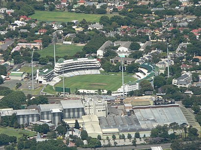
Ppc Newlands Address: Campground Road street in Wynberg
Attractions near Ppc Newlands
PPC Newlands Cricket Ground,Newlands Cricket Ground,Railway Stand,North West Grass Embankment,Oaks Grass Embankment,North Stand,President's Pavillion,Members Pavillion,Media Centre,Springbok Pub,Railway Gate,Gate A,Western Province Cricket Club,Gate B,Newlands,Metrorail-Newlands,Newlands Station,Vogue Fox,Anthony Lane Design Consultancy,Newlands Railway StationHow to get to popular attractions in Wynberg with public transportation
Varsity College Cape Town, Wynberg,MyCiti Bus Station Paarden Eiland, Goodwood,Rush Claremont, Wynberg,Northlink College Tygerberg Campus, Bellville,Westlake Business Park, Simon Town,Parklands Centre, Cape,Beautiful Beads, Wynberg,135 Main Road, Wynberg,Auditorium Canal Walk, Cape,College Of Cape Town (Thornton Campus), Wynberg,New Woodlands, Mitchells Plain,China Town - Hong Kong Mall, Somerset West,Delft South Africa, Kuils River,J.c. Le Roux, Stellenbosch,Hout Bay, Wynberg,Edgemead, Bellville,St Luke's Hospice, Wynberg,Kraaifontein, Kuils River,Capricorn Centre, Simon Town,Eerste River, Kuils RiverGet around Cape Town by public transport!
Travelling around Cape Town has never been so easy. See step by step directions as you travel to any attraction, street or major public transport station. View bus and train timetables, arrival times, service alerts and detailed routes on a map, so you know exactly how to get to anywhere in Cape Town.
When travelling to any destination around Cape Town use Moovit's Live Directions with Get Off Notifications to know exactly where and how far to walk, how long to wait for your line , and how many stops are left. Moovit will alert you when it’s time to get off — no need to constantly re-check whether yours is the next stop.
Wondering how to use public transport in Cape Town or how to pay for public transport in Cape Town? Moovit public transport app can help you navigate your way with public transport easily, and at minimum cost. It includes public transport fees, ticket prices, and costs. Looking for a map of Cape Town public transport lines? Moovit public transport app shows all public transport maps in Cape Town with all Bus, Train and Funicular routes and stops on an interactive map.
Cape Town has 3 transport type(s), including: Bus, Train and Funicular, operated by several transport agencies, including Golden Arrow, MyCiTi, Metrorail Western Cape, Intercape, City Sightseeing Cpt