How to get to Precise Homes by bus?
Click on the bus route to see step by step directions with maps, line arrival times and updated time schedules.
From Rangeview Intermediate School, Edmonton
52 minFrom Rutherford College, Te Atatu Central
51 minFrom Eastridge Shopping Centre, Mission Bay
47 minFrom 585 Great South Road, Penrose
62 minFrom Gentlemens Bay, Oceanic-Auckland Region East
67 minFrom Pak'Nsave Mt Albert, Springleigh
40 minFrom Te Atatu South, Edmonton
52 minFrom Imi Norgren New Zealand, Mt Wellington South
68 minFrom Hudthip Thai Massage, Mcleod
51 minFrom 56-60 Carbine Road, Mt Wellington South
70 min
How to get to Precise Homes by train?
Click on the train route to see step by step directions with maps, line arrival times and updated time schedules.
Bus stops near Precise Homes in Eden Terrace
Train station near Precise Homes in Eden Terrace
- Newmarket Train Station, 8 min walk,VIEW
Bus lines to Precise Homes in Eden Terrace
- 22N, New Lynn To City Centre Via New North Rd,VIEW
- 22R, City Centre To Rosebank Rd Via New North Rd,VIEW
- 24B, City Centre To Blockhouse Bay New Lynn Via Sandringham Rd,VIEW
- 24R, New Lynn To City Centre Via Sandingham Rd,VIEW
- 25B, Blockhouse Bay To City Centre Via Dominion Rd,VIEW
- 25L, Lynfield To City Centre Via Dominion Rd,VIEW
- 27H, Britomart To Waikowhai Via Mt Eden Rd And Hillsborough Rd,VIEW
- 27T, Three Kings To Britomart Via Mt Eden Rd,VIEW
- 27W, Waikowhai To Britomart Via Mt Eden Rd,VIEW
- 30, City Centre To Onehunga Via Manukau Rd,VIEW
- 295, City Centre To Royal Oak,VIEW
- 309, City Centre To Mangere Town Centre,VIEW
- 309X, Stop E the Civic To Mangere,VIEW
- 64, St Lukes To Newmarket Via Mt Eden,VIEW
- WX1, City Centre To Northwest Via Motorway,VIEW
- 11T, City Centre To Northwest Via Triangle Rd,VIEW
- 11W, City Centre To Northwest Via Waimumu Rd,VIEW
- 18, City Centre To New Lynn Via Great North Rd,VIEW
- 195, City Centre To New Lynn Via Green Bay,VIEW
- 209, City Centre To Titirangi Via New North Rd And Green Bay,VIEW
What are the nearest stations to Precise Homes?
The nearest stations to Precise Homes are:
- Symonds Street/Upper Symonds Street is 461 meters away, 7 min walk.
- Newmarket Train Station is 553 meters away, 8 min walk.
- Akiraho Street is 776 meters away, 11 min walk.
- Rainbow Bridge/Karangahape Road is 959 meters away, 13 min walk.
Which bus lines stop near Precise Homes?
These bus lines stop near Precise Homes: 11T, 11W, 22R, 27H, 27W, 309, 72X.
Which train line stops near Precise Homes?
WEST (Brit 2 To Swanson 1 Via Newmarket 1)
What’s the nearest train station to Precise Homes in Eden Terrace?
The nearest train station to Precise Homes in Eden Terrace is Newmarket Train Station. It’s a 8 min walk away.
What’s the nearest bus station to Precise Homes in Eden Terrace?
The nearest bus station to Precise Homes in Eden Terrace is Symonds Street/Upper Symonds Street. It’s a 7 min walk away.
What time is the first train to Precise Homes in Eden Terrace?
The WEST is the first train that goes to Precise Homes in Eden Terrace. It stops nearby at 05:27.
What time is the last train to Precise Homes in Eden Terrace?
The WEST is the last train that goes to Precise Homes in Eden Terrace. It stops nearby at 23:11.
What time is the first bus to Precise Homes in Eden Terrace?
The 27H is the first bus that goes to Precise Homes in Eden Terrace. It stops nearby at 05:19.
What time is the last bus to Precise Homes in Eden Terrace?
The INN is the last bus that goes to Precise Homes in Eden Terrace. It stops nearby at 00:31.
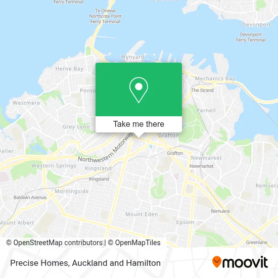
See Precise Homes, Eden Terrace, on the map
Public Transit to Precise Homes in Eden Terrace
Wondering how to get to Precise Homes in Eden Terrace? Moovit helps you find the best way to get to Precise Homes with step-by-step directions from the nearest public transit station.
Moovit provides free maps and live directions to help you navigate through your city. View schedules, routes, timetables, and find out how long does it take to get to Precise Homes in real time.
Looking for the nearest stop or station to Precise Homes? Check out this list of stops closest to your destination: Symonds Street/Upper Symonds Street; Newmarket Train Station; Akiraho Street; Rainbow Bridge/Karangahape Road.
Bus: 11T, 11W, 22R, 27H, 27W, 309, 72X, 22N, 24B, 24R, 25B, 64, WX1, 18, 195, INN, 105.Train: WEST, ONE, STH.
Want to see if there’s another route that gets you there at an earlier time? Moovit helps you find alternative routes or times. Get directions from and directions to Precise Homes easily from the Moovit App or Website.
We make riding to Precise Homes easy, which is why over 1.5 million users, including users in Eden Terrace, trust Moovit as the best app for public transit. You don’t need to download an individual bus app or train app, Moovit is your all-in-one transit app that helps you find the best bus time or train time available.
For information on prices of bus and train, costs and ride fares to Precise Homes, please check the Moovit app.
Use the app to navigate to popular places including to the airport, hospital, stadium, grocery store, mall, coffee shop, school, college, and university.
Precise Homes Address: Newton Road street in Eden Terrace
- Boston Scientific NZ,
- Bistro At New Market,
- Caltex Newton Road,
- 10 Macaulay Street,
- Auckland Accountants Limited,
- Bound To Last,
- DS Team Jiu Jitsu - Ribeiro Jiu Jitsu NZ,
- Speedy Signs,
- SMP Solutions,
- Auckland Collections Limited,
- Auckland Co Operative Taxi,
- Taxi House,
- The Pelican Club For Men,
- Inlets Surf Limited,
- Top Q Motors,
- The Pelican Club,
- Elite Xplorer,
- Intellium,
- Basque Road Reserve,
- The Clubroom Auckland
Places Near Precise Homes (Eden Terrace)
- Middlemore Hospital, Middlemore,
- 誠臻儒院 Cheng Zhen Buddhist Temple, Puhinui South,
- Mudbrick Vineyard & Restaurant, Waiheke Island,
- Ward 4 & 5 (AT & R) - Middlemore Hospital, Middlemore,
- Cosco, Auckland Central West,
- Commerce A, Building 114, Room G10, Auckland Central East,
- Ward 75 Orthopaedic Sugery Ward, Grafton East,
- John Bing Muay Thai Boxing Gym, St Lukes,
- Eden Park, Kingsland,
- Poderi Crisci, Waiheke Island,
- Piha Beach, Auckland Central West,
- Paramount Muay Thai Gym, Manurewa Central,
- Sylvia Park Shopping Centre, Mt Wellington South,
- Westlake Boys High School, Westlake,
- Auckland City Hospital, Grafton East,
- Auckland Hospital Main Building, Grafton East,
- OGGB Lecture Theatre 260-115 (Fisher & Paykel Appliances Auditorium), Auckland Central East,
- Ward 76 - General Surgical, Auckland Hospital, Grafton East,
- Science Centre Room G75 (303S-G75), Auckland Central East,
- Greenlane hospital, One Tree Hill Central
How to get to popular places in Auckland and Hamilton with public transport
Get around Eden Terrace by public transport!
Travelling around Eden Terrace has never been so easy. See step by step directions as you travel to any attraction, street or major public transport station. View bus and train timetables, arrival times, service alerts and detailed routes on a map, so you know exactly how to get to anywhere in Eden Terrace.
When travelling to any destination around Eden Terrace use Moovit's Live Directions with Get Off Notifications to know exactly where and how far to walk, how long to wait for your line , and how many stops are left. Moovit will alert you when it’s time to get off — no need to constantly re-check whether yours is the next stop.
Wondering how to use public transport in Eden Terrace or how to pay for public transport in Eden Terrace? Moovit public transport app can help you navigate your way with public transport easily, and at minimum cost. It includes public transport fees, ticket prices, and costs. Looking for a map of Eden Terrace public transport lines? Moovit public transport app shows all public transport maps in Eden Terrace with all Bus, Train and Ferry routes and stops on an interactive map.
Auckland and Hamilton has 3 transport type(s), including: Bus, Train and Ferry, operated by several transport agencies, including AT Metro, AT Metro Bus, Fullers360, SeaLink Pine Harbour, Belaire Ferries, Tranzit Group Ltd, New Zealand Bus, Bayes Coachlines, Howick and Eastern, Ritchies Transport, Waiheke Bus Company, Mahu City Express, Go Bus, Busit and SeaLink