Directions to Preston under Scar (Preston-Under-Scar) with public transport
The following transport lines have routes that pass near Preston under Scar
How to get to Preston under Scar by bus?
Click on the bus route to see step by step directions with maps, line arrival times and updated time schedules.
Bus stations near Preston under Scar in Preston-Under-Scar
- Preston under Scar Lane End,6 min walk,
Bus lines to Preston under Scar in Preston-Under-Scar
- 156,Gayle,
What are the nearest stations to Preston under Scar?
The nearest stations to Preston under Scar are:
- Preston under Scar Lane End is 440 meters away, 6 min walk.
Which bus lines stop near Preston under Scar?
These bus lines stop near Preston under Scar: 856, 857.
What’s the nearest bus stop to Preston under Scar in Preston-Under-Scar?
The nearest bus stop to Preston under Scar in Preston-Under-Scar is Preston under Scar Lane End. It’s a 6 min walk away.
See Preston under Scar, Preston-Under-Scar, on the map
Public Transit to Preston under Scar in Preston-Under-Scar
Wondering how to get to Preston under Scar in Preston-Under-Scar, United Kingdom? Moovit helps you find the best way to get to Preston under Scar with step-by-step directions from the nearest public transit station.
Moovit provides free maps and live directions to help you navigate through your city. View schedules, routes, timetables, and find out how long does it take to get to Preston under Scar in real time.
Looking for the nearest stop or station to Preston under Scar? Check out this list of stops closest to your destination: Preston under Scar Lane End.
Bus:856857156
Want to see if there’s another route that gets you there at an earlier time? Moovit helps you find alternative routes or times. Get directions from and directions to Preston under Scar easily from the Moovit App or Website.
We make riding to Preston under Scar easy, which is why over 1.5 million users, including users in Preston-Under-Scar, trust Moovit as the best app for public transit. You don’t need to download an individual bus app or train app, Moovit is your all-in-one transit app that helps you find the best bus time or train time available.
For information on prices of bus and train, costs and ride fares to Preston under Scar, please check the Moovit app.
Use the app to navigate to popular places including to the airport, hospital, stadium, grocery store, mall, coffee shop, school, college, and university.
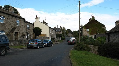
Preston under Scar Address: Light Lane street in Preston-Under-Scar
Attractions near Preston under Scar
Amsden,Redmire Station House,The Old Vicarage,Flax Mill,Redmire,Triple B Property Management,The Swan Caravan & Camping Site,Penhill House,The Smorthwaite Charity,Aysgarth Falls,Arnold's Holiday Cottages,The Fox & Hounds Inn,Fox and Hounds Inn,Moor Farm,Pen-9,Leyburn Old Glebe Nature Reserve,Washfold Farm,Tame Consultancy,Chantry Country & Leisure Park,The Old ChapelHow to get to popular attractions in Preston-Under-Scar with public transportation
Reighton Sands Holiday Park - Haven, Reighton,Beeston Hill Health Centre, Leeds,Dn11 0bf, Loversall,Hull New Theatre, Hull,Nuffield Health York Hospital, York,Junction 32 Outlet Shopping Village, Pontefract,XPO-ASOS, Little Houghton,Marks & Spencer Distribution Centre, Bradford,Skipton Market, Skipton,Horbury, Wakefield,Lincoln Wing - A Block Entrance, Leeds,LS98 1FD, Leeds,Nuffield Health Leeds Hospital, Leeds,Sundown Adventure Land, Leeds,Pinderfields Hospital, Wakefield,Leeds City Sightseeing, Leeds,Mayfield Alpacas, Sheffield,Murgatroyds Fish & Chips, Leeds,Tickhill Road Hospital, Doncaster,Shepcote Lane Police Station / Custody Suite, SheffieldGet around Preston-Under-Scar by public transport!
Travelling around Preston-Under-Scar has never been so easy. See step by step directions as you travel to any attraction, street or major public transport station. View bus and train timetables, arrival times, service alerts and detailed routes on a map, so you know exactly how to get to anywhere in Preston-Under-Scar.
When travelling to any destination around Preston-Under-Scar use Moovit's Live Directions with Get Off Notifications to know exactly where and how far to walk, how long to wait for your line , and how many stops are left. Moovit will alert you when it’s time to get off — no need to constantly re-check whether yours is the next stop.
Wondering how to use public transport in Preston-Under-Scar or how to pay for public transport in Preston-Under-Scar? Moovit public transport app can help you navigate your way with public transport easily, and at minimum cost. It includes public transport fees, ticket prices, and costs. Looking for a map of Preston-Under-Scar public transport lines? Moovit public transport app shows all public transport maps in Preston-Under-Scar with all bus or train routes and stops on an interactive map.
Preston-Under-Scar has 2 transport type(s), including: bus or train, operated by several transport agencies, including First Leeds, First South Yorkshire, First York, Arriva Yorkshire, Stagecoach Yorkshire, National Rail, First Bradford, First Halifax, Calder Valley & Huddersfield, East Yorkshire, The Keighley Bus Company, South Yorkshire Future Tram, The Harrogate Bus Company, National Rail, TM Travel and Coastliner