The Most Popular Urban Mobility App in East Midlands.
All local mobility options in one app
| Line | Direction | Time |
|---|---|---|
| 40X | City Hospital | 05:33 |
| 40X | City Hospital | 06:03 |
| 41 | Thorneywood | 06:18 |
| 40X | City Hospital | 06:33 |
| 39 | Thorneywood | 06:35 |
| 41 | Thorneywood | 06:43 |
| 40X | City Hospital | 06:53 |
| 42 | Thorneywood | 06:56 |
| 41 | Thorneywood | 07:03 |
| 39 | Thorneywood | 07:03 |
| 41 | Thorneywood | 07:13 |
| 40X | City Hospital | 07:23 |
| 39 | Thorneywood | 07:23 |
| 42 | Thorneywood | 07:26 |
| 41 | Thorneywood | 07:30 |
| 39 | Thorneywood | 07:33 |
| 41 | Thorneywood | 07:37 |
| 39 | Thorneywood | 07:43 |
| 41 | Thorneywood | 07:44 |
| 40X | City Hospital | 07:51 |
| 39 | Thorneywood | 07:53 |
| 41 | Thorneywood | 07:58 |
| 42 | Thorneywood | 07:58 |
| 39 | Thorneywood | 08:03 |
| 41 | Thorneywood | 08:05 |
The following transport lines have routes that pass near Pryzm, Nottingham
Click on the Bus route to see step by step directions with maps, line arrival times and updated time schedules.
Click on the Train route to see step by step directions with maps, line arrival times and updated time schedules.
The nearest stations to Pryzm, Nottingham are:
These Bus lines stop near Pryzm, Nottingham: 11C, 28, 3B|THREES, 6, CALVERTON, INDIGO, RAINBOW ONE, SKYLINK NOTTINGHAM, TWO
These Train lines stop near Pryzm, Nottingham: EAST MIDLANDS RAILWAY, NORTHERN
These Light rail lines stop near Pryzm, Nottingham: TRAM
The nearest light rail station to Pryzm, Nottingham in East Midlands is Old Market Square Tram Stop, Nottingham. It’s a 12 min walk away.
The nearest bus stops to Pryzm, Nottingham in East Midlands are Victoria Centre, Nottingham and East Street, Nottingham. The closest one is a 2 min walk away.
The TRAM is the first Light rail that goes to Pryzm, Nottingham in East Midlands. It stops nearby at 05:21.
The TRAM is the last Light rail that goes to Pryzm, Nottingham in East Midlands. It stops nearby at 00:39.
The 3B|THREES is the first Bus that goes to Pryzm, Nottingham in East Midlands. It stops nearby at 03:00.
The N34 is the last Bus that goes to Pryzm, Nottingham in East Midlands. It stops nearby at 02:45.
Looking for directions to Pryzm, Nottingham in East Midlands, United Kingdom?
Download the Moovit App to find the current schedule and step-by-step directions for Bus, Train or Light rail routes that pass through Pryzm, Nottingham.
Looking for the nearest stops closest to Pryzm, Nottingham ? Check out this list of closest stops to your destination: Victoria Centre; East Street; Lincoln Street; Curzon Street; Old Market Square Tram Stop.
Bus:Train:Light rail:
We make riding on public transit to Pryzm, Nottingham easy, which is why over 1.5 million users, including users in East Midlands trust Moovit as the best app for public transit.
Use the app to navigate to popular places including to the airport, hospital, stadium, grocery store, mall, coffee shop, school, college, and university.
Pryzm, Nottingham stop’s code is ntmatgpw
The first line to this stop is 40X, at 05:33, and the last line is 39 at 00:05.
King Edward Court, Nottingham, England, United Kingdom
This stop serves Nottingham City Transport’s lines
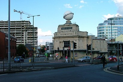
Pryzm Nottingham is a chain nightclub located on Upper Parliament Street in Nottingham, England.Wiki