See Punt Road Oval, East Melbourne, on the map
Directions to Punt Road Oval (East Melbourne) with public transport
The following transport lines have routes that pass near Punt Road Oval
 Bus:
Bus: - Train:
- Tram:
How to get to Punt Road Oval by bus?
Click on the bus route to see step by step directions with maps, line arrival times and updated time schedules.
How to get to Punt Road Oval by train?
Click on the train route to see step by step directions with maps, line arrival times and updated time schedules.
Train stations near Punt Road Oval in East Melbourne
- Richmond,5 min walk,
Tram stations near Punt Road Oval in East Melbourne
- 8-Richmond Station/Swan St (Cremorne),5 min walk,
Bus stations near Punt Road Oval in East Melbourne
- Swan St/Punt Rd (Richmond),11 min walk,
- Anderson St/Alexandra Ave (South Yarra),12 min walk,
Bus lines to Punt Road Oval in East Melbourne
- 246,Elsternwick,
- 605,Gardenvale,
What are the nearest stations to Punt Road Oval?
The nearest stations to Punt Road Oval are:
- Richmond is 223 meters away, 5 min walk.
- 8-Richmond Station/Swan St (Cremorne) is 236 meters away, 5 min walk.
- Swan St/Punt Rd (Richmond) is 776 meters away, 11 min walk.
- Anderson St/Alexandra Ave (South Yarra) is 838 meters away, 12 min walk.
Which bus lines stop near Punt Road Oval?
These bus lines stop near Punt Road Oval: 246, 605.
Which train lines stop near Punt Road Oval?
These train lines stop near Punt Road Oval: ALAMEIN, GLEN WAVERLEY, MERNDA, PAKENHAM, SANDRINGHAM.
Which tram line stops near Punt Road Oval?
48
What’s the nearest tram station to Punt Road Oval in East Melbourne?
The nearest tram station to Punt Road Oval in East Melbourne is 8-Richmond Station/Swan St (Cremorne). It’s a 5 min walk away.
What’s the nearest train station to Punt Road Oval in East Melbourne?
The nearest train station to Punt Road Oval in East Melbourne is Richmond. It’s a 5 min walk away.
What’s the nearest bus stop to Punt Road Oval in East Melbourne?
The nearest bus stop to Punt Road Oval in East Melbourne is Swan St/Punt Rd (Richmond). It’s a 11 min walk away.
What time is the first tram to Punt Road Oval in East Melbourne?
The 70 is the first tram that goes to Punt Road Oval in East Melbourne. It stops nearby at 05:13.
What time is the last tram to Punt Road Oval in East Melbourne?
The 70 is the last tram that goes to Punt Road Oval in East Melbourne. It stops nearby at 00:22.
What time is the first train to Punt Road Oval in East Melbourne?
The FRANKSTON is the first train that goes to Punt Road Oval in East Melbourne. It stops nearby at 04:49.
What time is the last train to Punt Road Oval in East Melbourne?
The SANDRINGHAM is the last train that goes to Punt Road Oval in East Melbourne. It stops nearby at 00:21.
What time is the first bus to Punt Road Oval in East Melbourne?
The 246 is the first bus that goes to Punt Road Oval in East Melbourne. It stops nearby at 05:32.
What time is the last bus to Punt Road Oval in East Melbourne?
The 246 is the last bus that goes to Punt Road Oval in East Melbourne. It stops nearby at 00:30.
How much is the bus fare to Punt Road Oval?
The bus fare to Punt Road Oval costs about $5.30.
See Punt Road Oval, East Melbourne, on the map
Public Transit to Punt Road Oval in East Melbourne
Wondering how to get to Punt Road Oval in East Melbourne, Australia? Moovit helps you find the best way to get to Punt Road Oval with step-by-step directions from the nearest public transit station.
Moovit provides free maps and live directions to help you navigate through your city. View schedules, routes, timetables, and find out how long does it take to get to Punt Road Oval in real time.
Looking for the nearest stop or station to Punt Road Oval? Check out this list of stops closest to your destination: Richmond; 8-Richmond Station/Swan St (Cremorne); Swan St/Punt Rd (Richmond); Anderson St/Alexandra Ave (South Yarra).
Bus:Train:Tram:
Want to see if there’s another route that gets you there at an earlier time? Moovit helps you find alternative routes or times. Get directions from and directions to Punt Road Oval easily from the Moovit App or Website.
We make riding to Punt Road Oval easy, which is why over 1.5 million users, including users in East Melbourne, trust Moovit as the best app for public transit. You don’t need to download an individual bus app or train app, Moovit is your all-in-one transit app that helps you find the best bus time or train time available.
For information on prices of bus, train and tram, costs and ride fares to Punt Road Oval, please check the Moovit app.
Use the app to navigate to popular places including to the airport, hospital, stadium, grocery store, mall, coffee shop, school, college, and university.
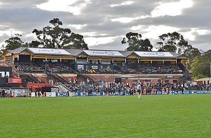
Punt Road Oval Address: Punt Road street in East Melbourne
Attractions near Punt Road Oval
Swinburne Centre,Richmond Football Club,Cricketers Arms Hotel,Vri Fencing Club,287 Punt Road,Mordax Verity Nomine,Richmond Football Club Museum,7d-Aami Park / Melbourne Park (Melbourne City),Stop 7d: Aami Park,AAMI Park/Melbourne Park,Cremorne,Punt Road,Sensible Father of Two,Rome2rio,126,Richmond Station,Richmond Social Club,Public Toilets,O2 Dance Studio,ReadytechgoHow to get to popular attractions in East Melbourne with public transportation
Ikea, Springvale,Luna Park, St Kilda,Royal Children's Hospital, Parkville,Westfield Fountain Gate Shopping Centre, Narre Warren,Swanston Street - Flinders Street Station, Melbourne,Werribee Station, Werribee,DXC Technology, Docklands,Watergardens Station, Sydenham,Swinburne University Of Technology (Hawthorn Campus), Hawthorn,Chelsea Station, Chelsea,Ikea, Richmond,State Library Of Victoria, Melbourne,St Vincent's Hospital, Fitzroy,Westfield Doncaster, Doncaster,Highpoint Shopping Centre, Maribyrnong,Berwick, Berwick,Spotswood Station, Spotswood,Preston Market, Preston,Stockland The Pines, Doncaster East,Chadstone, ChadstoneGet around East Melbourne by public transport!
Travelling around East Melbourne has never been so easy. See step by step directions as you travel to any attraction, street or major public transport station. View bus and train timetables, arrival times, service alerts and detailed routes on a map, so you know exactly how to get to anywhere in East Melbourne.
When travelling to any destination around East Melbourne use Moovit's Live Directions with Get Off Notifications to know exactly where and how far to walk, how long to wait for your line , and how many stops are left. Moovit will alert you when it’s time to get off — no need to constantly re-check whether yours is the next stop.
Wondering how to use public transport in East Melbourne or how to pay for public transport in East Melbourne? Moovit public transport app can help you navigate your way with public transport easily, and at minimum cost. It includes public transport fees, ticket prices, and costs. Looking for a map of East Melbourne public transport lines? Moovit public transport app shows all public transport maps in East Melbourne with all bus, train or tram routes and stops on an interactive map.
East Melbourne has 3 transport type(s), including: bus, train or tram, operated by several transport agencies, including PTV Metropolitan Trains, PTV Metropolitan Bus, Yarra Trams, PTV Regional Bus, SkyBus, Interstate Services, V/Line and V/Line (Coach)