Directions to Quay Park (Auckland Harbourside) with public transport
The following transport lines have routes that pass near Quay Park
How to get to Quay Park by bus?
Click on the bus route to see step by step directions with maps, line arrival times and updated time schedules.
How to get to Quay Park by train?
Click on the train route to see step by step directions with maps, line arrival times and updated time schedules.
Bus stops near Quay Park in Auckland Harbourside
- Stop B Waterloo Quadrant, 1 min walk,
- Stop A Waterloo Quadrant, 1 min walk,
- Alten Road, 3 min walk,
- Woolworths Quay Street, 4 min walk,
- Auckland High Court, 4 min walk,
- Churchill Street, 5 min walk,
Train stations near Quay Park in Auckland Harbourside
- Britomart Train Station, 12 min walk,
- The Strand Train Station, 28 min walk,
Ferry stations near Quay Park in Auckland Harbourside
- Ferry Terminal - Downtown, 17 min walk,
- Hamer St, 55 min walk,
Bus lines to Quay Park in Auckland Harbourside
- 27H, Britomart To Waikowhai Via Mt Eden Rd And Hillsborough Rd,
- 27T, Three Kings To Britomart Via Mt Eden Rd,
- 27W, Waikowhai To Britomart Via Mt Eden Rd,
- 321, Middlemore Station To Britomart Via Greenlane Hospital,
- 70, Panmure To Britomart Via Ellerslie,
- 70H, Britomart To Howick And Botany Via Ellerslie And Panmure,
- 72X, Britomart To Howick And Botany Express Via Motorway And Panm,
- MEX, Snells Beach To Parnell,
- TMK, Britomart To Glen Innes Via Tamaki Dr And St Heliers,
- 76, Britomart To Glen Innes Via Orakei,
- 774, Britomart To West Tamaki Rd Via Tamaki Dr And Long Dr,
- 775, Britomart To Glendowie Via Tamaki Dr,
- 931, University Of Auckland To Chatswood Via Customs St,
- 933, University Of Auckland To Beach Haven Wharf Via Customs St,
- 939, University Of Auckland To Windy Ridge Via Customs St,
- INN, Inner Link Clockwise,
- 755, Benson Rd To Britomart Via Portland Rd,
What are the nearest stations to Quay Park?
The nearest stations to Quay Park are:
- Stop B Waterloo Quadrant is 1 meters away, 1 min walk.
- Stop A Waterloo Quadrant is 28 meters away, 1 min walk.
- Alten Road is 178 meters away, 3 min walk.
- Woolworths Quay Street is 265 meters away, 4 min walk.
- Auckland High Court is 286 meters away, 4 min walk.
- Churchill Street is 312 meters away, 5 min walk.
- Britomart Train Station is 892 meters away, 12 min walk.
- Ferry Terminal - Downtown is 1261 meters away, 17 min walk.
- The Strand Train Station is 2076 meters away, 28 min walk.
- Hamer St is 4203 meters away, 55 min walk.
Which bus lines stop near Quay Park?
These bus lines stop near Quay Park: 321, 70, 755, 933, INN.
Which train lines stop near Quay Park?
These train lines stop near Quay Park: STH, WEST.
What’s the nearest train station to Quay Park in Auckland Harbourside?
The nearest train station to Quay Park in Auckland Harbourside is Britomart Train Station. It’s a 12 min walk away.
What’s the nearest bus stop to Quay Park in Auckland Harbourside?
The nearest bus stops to Quay Park in Auckland Harbourside are Stop B Waterloo Quadrant and Stop A Waterloo Quadrant. The closest one is a 1 min walk away.
What’s the nearest ferry station to Quay Park in Auckland Harbourside?
The nearest ferry station to Quay Park in Auckland Harbourside is Ferry Terminal - Downtown. It’s a 17 min walk away.
What time is the first train to Quay Park in Auckland Harbourside?
The WEST is the first train that goes to Quay Park in Auckland Harbourside. It stops nearby at 05:24.
What time is the last train to Quay Park in Auckland Harbourside?
The WEST is the last train that goes to Quay Park in Auckland Harbourside. It stops nearby at 22:29.
What time is the first bus to Quay Park in Auckland Harbourside?
The 27H is the first bus that goes to Quay Park in Auckland Harbourside. It stops nearby at 05:26.
What time is the last bus to Quay Park in Auckland Harbourside?
The INN is the last bus that goes to Quay Park in Auckland Harbourside. It stops nearby at 00:27.
What time is the first ferry to Quay Park in Auckland Harbourside?
The DEV is the first ferry that goes to Quay Park in Auckland Harbourside. It stops nearby at 05:45.
What time is the last ferry to Quay Park in Auckland Harbourside?
The MTIA is the last ferry that goes to Quay Park in Auckland Harbourside. It stops nearby at 01:05.
How much is the train fare to Quay Park?
The train fare to Quay Park costs about $2.34 - $7.40.
How much is the bus fare to Quay Park?
The bus fare to Quay Park costs about $2.34 - $7.40.
See Quay Park, Auckland Harbourside, on the map
Public Transit to Quay Park in Auckland Harbourside
Wondering how to get to Quay Park in Auckland Harbourside, New Zealand? Moovit helps you find the best way to get to Quay Park with step-by-step directions from the nearest public transit station.
Moovit provides free maps and live directions to help you navigate through your city. View schedules, routes, timetables, and find out how long does it take to get to Quay Park in real time.
Looking for the nearest stop or station to Quay Park? Check out this list of stops closest to your destination: Stop B Waterloo Quadrant; Stop A Waterloo Quadrant; Alten Road; Woolworths Quay Street; Auckland High Court; Churchill Street; Britomart Train Station; Ferry Terminal - Downtown; The Strand Train Station; Hamer St.
Bus: 321, 70, 755, 933, INN, 27H, 27T, 27W, 70H, 72X, MEX.Train: STH, WEST, EAST, HUIA.Ferry: BAYS, BIRK, DEV, GULF, HCRU.
Want to see if there’s another route that gets you there at an earlier time? Moovit helps you find alternative routes or times. Get directions from and directions to Quay Park easily from the Moovit App or Website.
We make riding to Quay Park easy, which is why over 1.5 million users, including users in Auckland Harbourside, trust Moovit as the best app for public transit. You don’t need to download an individual bus app or train app, Moovit is your all-in-one transit app that helps you find the best bus time or train time available.
For information on prices of bus and train, costs and ride fares to Quay Park, please check the Moovit app.
Use the app to navigate to popular places including to the airport, hospital, stadium, grocery store, mall, coffee shop, school, college, and university.
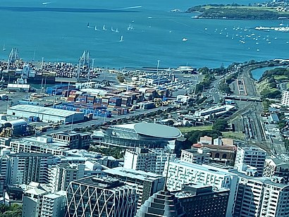
Quay Park Address: Mahuhu Crescent street in Auckland Harbourside
Attractions near Quay Park
How to get to popular places in Auckland and Hamilton with public transport
Get around Auckland Harbourside by public transport!
Travelling around Auckland Harbourside has never been so easy. See step by step directions as you travel to any attraction, street or major public transport station. View bus and train timetables, arrival times, service alerts and detailed routes on a map, so you know exactly how to get to anywhere in Auckland Harbourside.
When travelling to any destination around Auckland Harbourside use Moovit's Live Directions with Get Off Notifications to know exactly where and how far to walk, how long to wait for your line , and how many stops are left. Moovit will alert you when it’s time to get off — no need to constantly re-check whether yours is the next stop.
Wondering how to use public transport in Auckland Harbourside or how to pay for public transport in Auckland Harbourside? Moovit public transport app can help you navigate your way with public transport easily, and at minimum cost. It includes public transport fees, ticket prices, and costs. Looking for a map of Auckland Harbourside public transport lines? Moovit public transport app shows all public transport maps in Auckland Harbourside with all bus or train routes and stops on an interactive map.
Auckland Harbourside has 2 transport type(s), including: bus or train, operated by several transport agencies, including AT Metro, AT Metro Bus, Fullers360, SeaLink Pine Harbour, Belaire Ferries, Tranzit Group Ltd, New Zealand Bus, Pavlovich Transport Solutions, Bayes Coachlines, Howick and Eastern, Ritchies Transport, Waiheke Bus Company, Mahu City Express, Go Bus and SeaLink