Directions to Qut Student Guild (City) with public transport
The following transport lines have routes that pass near Qut Student Guild
How to get to Qut Student Guild by bus?
Click on the bus route to see step by step directions with maps, line arrival times and updated time schedules.
How to get to Qut Student Guild by train?
Click on the train route to see step by step directions with maps, line arrival times and updated time schedules.
Bus stops near Qut Student Guild in City
- Alice Street Stop 95 Near George St, 6 min walk,
- George Street Stop 123 Near Alice St, 6 min walk,
- Main St at River Terrace, Stop 8 - Temp Location, 7 min walk,
- George Street Stop 114 Near Alice St, 7 min walk,
- Parliament Stop 94a Margaret St, 7 min walk,
- Margaret Street Stop 94 Near George St, 8 min walk,
- Mary St Stop 169 Near Albert St, 9 min walk,
- Mary Street Stop 50 Near Albert St, 10 min walk,
Ferry stations near Qut Student Guild in City
- South Bank Ferry Terminal, 18 min walk,
Train stations near Qut Student Guild in City
- South Bank Station, 25 min walk,
Bus lines to Qut Student Guild in City
- 114, Tarragindi - City,
- 118, Forest Lake - City,
- 136, Parkinson - City Precincts,
- 138, Algester - City,
- 153, Drewvale - City Rocket,
- 162, Eight Mile Plains - City Rocket,
- P173, Mt Gravatt Central - City Pre-paid Rocket,
- P206, Carindale - City Precincts/valley Pre-paid Rocket,
- P207, Carina - City Pre-paid Rocket,
- P208, Carindale - City Pre-paid Rocket,
- P137, Sunnybank Hills - City Pre-paid Rocket,
- 156, Stretton - City Rocket,
- 186, Wishart - City Rocket,
- P201, Carindale Heights - City Pre-paid Rocket,
- P205, Carindale Heights - City Pre-paid Rocket,
- P217, Carindale - City Pre-paid Rocket,
- P331, Bracken Ridge - City Pre-paid Rocket,
- P332, Zillmere - Uq Pre-paid Rocket,
- P341, Taigum - City Pre-paid Rocket,
- P344, Carseldine - City Precincts Pre-paid Express,
What are the nearest stations to Qut Student Guild?
The nearest stations to Qut Student Guild are:
- Alice Street Stop 95 Near George St is 399 meters away, 6 min walk.
- George Street Stop 123 Near Alice St is 451 meters away, 6 min walk.
- Main St at River Terrace, Stop 8 - Temp Location is 469 meters away, 7 min walk.
- George Street Stop 114 Near Alice St is 482 meters away, 7 min walk.
- Parliament Stop 94a Margaret St is 520 meters away, 7 min walk.
- Margaret Street Stop 94 Near George St is 574 meters away, 8 min walk.
- Mary St Stop 169 Near Albert St is 670 meters away, 9 min walk.
- Mary Street Stop 50 Near Albert St is 745 meters away, 10 min walk.
- South Bank Ferry Terminal is 1359 meters away, 18 min walk.
- South Bank Station is 1852 meters away, 25 min walk.
Which bus lines stop near Qut Student Guild?
These bus lines stop near Qut Student Guild: 130, 175, 222, 300, 330, 333, 353, 375, 470.
Which train line stops near Qut Student Guild?
FERN
What’s the nearest train station to Qut Student Guild in City?
The nearest train station to Qut Student Guild in City is South Bank Station. It’s a 25 min walk away.
What’s the nearest bus stop to Qut Student Guild in City?
The nearest bus stops to Qut Student Guild in City are Alice Street Stop 95 Near George St and George Street Stop 123 Near Alice St. The closest one is a 6 min walk away.
What’s the nearest ferry station to Qut Student Guild in City?
The nearest ferry station to Qut Student Guild in City is South Bank Ferry Terminal. It’s a 18 min walk away.
What time is the first train to Qut Student Guild in City?
The CLEV is the first train that goes to Qut Student Guild in City. It stops nearby at 05:59.
What time is the last train to Qut Student Guild in City?
The CLEV is the last train that goes to Qut Student Guild in City. It stops nearby at 00:02.
What time is the first bus to Qut Student Guild in City?
The 234 is the first bus that goes to Qut Student Guild in City. It stops nearby at 06:15.
What time is the last bus to Qut Student Guild in City?
The 234 is the last bus that goes to Qut Student Guild in City. It stops nearby at 22:15.
What time is the first ferry to Qut Student Guild in City?
The CITY HOPPER - NORTH QUAY is the first ferry that goes to Qut Student Guild in City. It stops nearby at 05:38.
What time is the last ferry to Qut Student Guild in City?
The CITY HOPPER - NORTH QUAY is the last ferry that goes to Qut Student Guild in City. It stops nearby at 00:27.
See Qut Student Guild, City, on the map
Public Transit to Qut Student Guild in City
Wondering how to get to Qut Student Guild in City, Australia? Moovit helps you find the best way to get to Qut Student Guild with step-by-step directions from the nearest public transit station.
Moovit provides free maps and live directions to help you navigate through your city. View schedules, routes, timetables, and find out how long does it take to get to Qut Student Guild in real time.
Looking for the nearest stop or station to Qut Student Guild? Check out this list of stops closest to your destination: Alice Street Stop 95 Near George St; George Street Stop 123 Near Alice St; Main St at River Terrace; George Street Stop 114 Near Alice St; Parliament Stop 94a Margaret St; Margaret Street Stop 94 Near George St; Mary St Stop 169 Near Albert St; Mary Street Stop 50 Near Albert St; South Bank Ferry Terminal; South Bank Station.
Bus: 130, 175, 222, 300, 330, 333, 353, 375, 470, 114, 118, 136, 138, 153, P137, 156, 186, P201, P205, 40, 234.Train: FERN, AIRP, BRFG, BRSH, CABO, CLEV.Ferry: CITY CAT DOWNSTREAM - NORTHSHORE HAMILTON, CITY CAT UPSTREAM - UQ, CITY HOPPER - NORTH QUAY, CITY HOPPER - SYDNEY STREET.
Want to see if there’s another route that gets you there at an earlier time? Moovit helps you find alternative routes or times. Get directions from and directions to Qut Student Guild easily from the Moovit App or Website.
We make riding to Qut Student Guild easy, which is why over 1.5 million users, including users in City, trust Moovit as the best app for public transit. You don’t need to download an individual bus app or train app, Moovit is your all-in-one transit app that helps you find the best bus time or train time available.
For information on prices of bus and train, costs and ride fares to Qut Student Guild, please check the Moovit app.
Use the app to navigate to popular places including to the airport, hospital, stadium, grocery store, mall, coffee shop, school, college, and university.
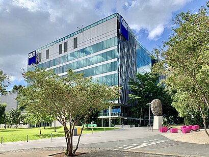
Qut Student Guild Address: Gardens Point Rd Brisbane City, 4000 Brisbane street in City
Attractions near Qut Student Guild
Queensland University Of Technology,Old Government House,Old Government House QLD Australia,Old Government House,M-O Link,Merlo Coffee Brisbane City Qut Gardens Point,Brisbane City Physiotherapy-Core Physiotherapy & E,Qut Christians,QUT CCC Block - The Bakery,Queensland University of Technology,P Block Parking,Brisbane City Botanic Gardens,QUT Gardens Point,Queensland Governmenet House,QUT Gardens Theatre,Gerbino's-Brisbane CBD,Z-406,Qut Bookshop,QUT Muslim Prayer Room,Queensland University Of Technology, Gardens Point Campus - Z BlockHow to get to popular attractions in City with public transportation
Stafford City, Stafford,Dfo, Pinkenba,Cavendish Road State High School, Holland Park,Dendy Cinemas, Hamilton,Paddington Central, Paddington,The Norman Hotel, Woolloongabba,All Hallows School, Fortitude Valley,Warner Bros. Movie World, Oxenford,Frascott Park, Varsity Lakes,Waxy's Irish Pub,Currumbin, Currumbin,James Cook University, City,Broadwater Parklands, Southport,UQ Centre, St Lucia,Forest Lake, Forest Lake,Stafford Heights, Stafford Heights,Princess Alexandra Hospital, Woolloongabba,Chez Nous Cafe, City,Noosa Heads, Noosa Heads,Ashmore, AshmoreGet around Brisbane by public transport!
Travelling around Brisbane has never been so easy. See step by step directions as you travel to any attraction, street or major public transport station. View bus and train timetables, arrival times, service alerts and detailed routes on a map, so you know exactly how to get to anywhere in Brisbane.
When travelling to any destination around Brisbane use Moovit's Live Directions with Get Off Notifications to know exactly where and how far to walk, how long to wait for your line , and how many stops are left. Moovit will alert you when it’s time to get off — no need to constantly re-check whether yours is the next stop.
Wondering how to use public transport in Brisbane or how to pay for public transport in Brisbane? Moovit public transport app can help you navigate your way with public transport easily, and at minimum cost. It includes public transport fees, ticket prices, and costs. Looking for a map of Brisbane public transport lines? Moovit public transport app shows all public transport maps in Brisbane with all Bus, Train, Light rail and Ferry routes and stops on an interactive map.
Brisbane has 4 transport type(s), including: Bus, Train, Light rail and Ferry, operated by several transport agencies, including TransLink SEQ, TransLink, Christensens Bus and Coach, North Stradbroke Island Buses, Griffith Uni Intercampus bus