See Raffles City Shopping Centre, Singapore, on the map
Directions to Raffles City Shopping Centre (Singapore) with public transport
The following transport lines have routes that pass near Raffles City Shopping Centre
 Bus:
Bus: - Metro:
How to get to Raffles City Shopping Centre by bus?
Click on the bus route to see step by step directions with maps, line arrival times and updated time schedules.
How to get to Raffles City Shopping Centre by metro?
Click on the metro route to see step by step directions with maps, line arrival times and updated time schedules.
Bus stations near Raffles City Shopping Centre in Singapore
- Bras Basah Rd - Raffles Hotel (02049),5 min walk,
Metro stations near Raffles City Shopping Centre in Singapore
- City Hall (EW13|NS25),5 min walk,
Bus lines to Raffles City Shopping Centre in Singapore
- 14,Bedok Int ↔ Clementi Int,
- 16,Bedok Int ↔ Bt Merah Int,
- 36,Changi Airport PTB2 ↺ Tomlinson Rd,
- 77,Bt Batok Int ↔ Marina Ctr Ter,
- 106,Bt Batok Int ↔ Shenton Way Ter,
- 111,Ghim Moh Ter ↺ Temasek Ave,
- 130,Ang Mo Kio Int ↔ Shenton Way Ter,
- 131,St. Michael’s Ter ↔ Bt Merah Int,
- 133,Ang Mo Kio Int ↔ Shenton Way Ter,
- 167,Sembawang Int ↔ Bt Merah Int,
- 502,Soon Lee Bus Pk ↺ Bayfront Ave,
- 518,Pasir Ris Int ↺ Bayfront Ave,
- 640,[AM]: Anson Rd [PM]: Canberra Rd,
- 652,[AM]: Shenton Way (Opp MAS Bldg) [PM]: Upp Thomson Rd (Bef Sembawang Hill FC),
- 656,[AM]: Shenton Way (Opp MAS Bldg) [PM]: Canberra Rd (Blk 508 CP),
- 660,[AM]: Shenton Way (Opp MAS Bldg) [PM]: Buangkok Green (Blk 969),
- 663,[AM]: Shenton Way (Opp MAS Bldg) [PM]: Yishun Ave 6 (Opp Blk 406),
- 665,[AM]: Shenton Way (Opp MAS Bldg) [PM]: Marsiling Dr (Blk 203),
- 722,[AM]: Cecil St (Opp GB Building),
- 857,Yishun Int ↺ Suntec City,
What are the nearest stations to Raffles City Shopping Centre?
The nearest stations to Raffles City Shopping Centre are:
- Bras Basah Rd - Raffles Hotel (02049) is 340 meters away, 5 min walk.
- City Hall (EW13|NS25) is 355 meters away, 5 min walk.
Which bus lines stop near Raffles City Shopping Centre?
These bus lines stop near Raffles City Shopping Centre: 10, 100, 131, 61.
Which metro line stops near Raffles City Shopping Centre?
EAST WEST LINE
What’s the nearest metro station to Raffles City Shopping Centre in Singapore?
The nearest metro station to Raffles City Shopping Centre in Singapore is City Hall (EW13|NS25). It’s a 5 min walk away.
What’s the nearest bus stop to Raffles City Shopping Centre in Singapore?
The nearest bus stop to Raffles City Shopping Centre in Singapore is Bras Basah Rd - Raffles Hotel (02049). It’s a 5 min walk away.
See Raffles City Shopping Centre, Singapore, on the map
Public Transit to Raffles City Shopping Centre in Singapore
Wondering how to get to Raffles City Shopping Centre in Singapore, Singapore? Moovit helps you find the best way to get to Raffles City Shopping Centre with step-by-step directions from the nearest public transit station.
Moovit provides free maps and live directions to help you navigate through your city. View schedules, routes, timetables, and find out how long does it take to get to Raffles City Shopping Centre in real time.
Looking for the nearest stop or station to Raffles City Shopping Centre? Check out this list of stops closest to your destination: Bras Basah Rd - Raffles Hotel (02049); City Hall (EW13|NS25).
Bus:Metro:
Want to see if there’s another route that gets you there at an earlier time? Moovit helps you find alternative routes or times. Get directions from and directions to Raffles City Shopping Centre easily from the Moovit App or Website.
We make riding to Raffles City Shopping Centre easy, which is why over 1.5 million users, including users in Singapore, trust Moovit as the best app for public transit. You don’t need to download an individual bus app or train app, Moovit is your all-in-one transit app that helps you find the best bus time or train time available.
For information on prices of metro and bus, costs and ride fares to Raffles City Shopping Centre, please check the Moovit app.
Use the app to navigate to popular places including to the airport, hospital, stadium, grocery store, mall, coffee shop, school, college, and university.
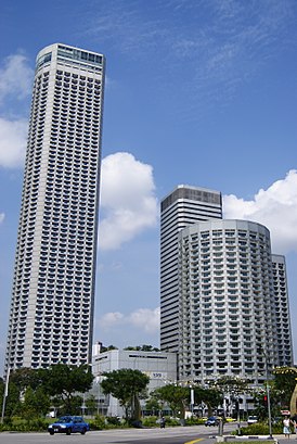
Raffles City Shopping Centre Address: 252 North Bridge Rd. street in Singapore
Attractions near Raffles City Shopping Centre
Havaianas@Raffles City Shopping Centre,St. Marc Café,Fairmont Signiture Room Level 12,Solemate,Imperial Treasure Yi Dian Xin,The Raffles Marketplace,Mos Cafe,Godiva Chocolatier,Burger King,Equinox Head Office,Aster Pau (紫苑生煎包),The Pizza Place,Streats Asian Cafe,Shahi Maharani,Capitol Optical,Gnc Live Well @ City Link,Subway,Teppei Daidokoro,Make Up Store @ Raffles City,The Urban ClinicHow to get to popular attractions in Singapore with public transportation
ZARA, Singapore,Blue Riverview, Northwest,PUTIEN Restaurant 莆田菜馆, Singapore,Lim Chu Kang Chinese Cemetery 1065, Southwest,That Aquarium (Y618), Northwest,BUS STOP 27211 NTU LWN, Southwest,Dyna-Mac Engineering Services Pte. Ltd., Southwest,West Coast Park Playground, Southwest,Ion Orchard, Singapore,NTUC FairPrice, Southwest,Waterfront Plaza, Singapore,Imm, Southwest,Emerson Process Management Asia Pacific Pte Ltd, Southwest,Stamford Tyres, Southwest,UNIQLO, Singapore,Blue Riverview Playground, Northwest,Villa Verde, Southwest,Earle Swensen's, Singapore,313@Somerset, Singapore,KOI Café, SingaporeGet around Singapore by public transport!
Travelling around Singapore has never been so easy. See step by step directions as you travel to any attraction, street or major public transport station. View bus and train timetables, arrival times, service alerts and detailed routes on a map, so you know exactly how to get to anywhere in Singapore.
When travelling to any destination around Singapore use Moovit's Live Directions with Get Off Notifications to know exactly where and how far to walk, how long to wait for your line , and how many stops are left. Moovit will alert you when it’s time to get off — no need to constantly re-check whether yours is the next stop.
Wondering how to use public transport in Singapore or how to pay for public transport in Singapore? Moovit public transport app can help you navigate your way with public transport easily, and at minimum cost. It includes public transport fees, ticket prices, and costs. Looking for a map of Singapore public transport lines? Moovit public transport app shows all public transport maps in Singapore with all metro or bus routes and stops on an interactive map.
Singapore has 2 transport type(s), including: metro or bus, operated by several transport agencies, including SMRT, SBS Transit, SMRT, MRT/LRT Replacement Services, SBS Transit, SBS Transit, SMRT, Tower Transit, Go-Ahead Singapore, Premium Bus, City Direct Bus, Changi Airport, Sentosa Development Corporation, Sentosa Development Corporation and Cross Border Bus