Railway Station, Cromer stop - Saturday schedule
| Line | Direction | Time |
|---|---|---|
| 18 | North Walsham | 10:08 |
| 18 | North Walsham | 13:08 |
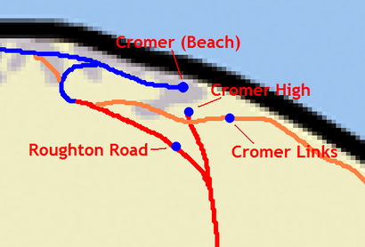
See Railway Station, Cromer, East Anglia, on the map
Directions to Railway Station, Cromer (East Anglia) with public transport
The following transport lines have routes that pass near Railway Station, Cromer
 Bus:
Bus: - Train:
How to get to Railway Station, Cromer by bus?
Click on the bus route to see step by step directions with maps, line arrival times and updated time schedules.
How to get to Railway Station, Cromer by train?
Click on the train route to see step by step directions with maps, line arrival times and updated time schedules.
Bus stations near Railway Station, Cromer in East Anglia
- Railway Station, Cromer,1 min walk,
- Canada Road, Cromer,3 min walk,
- Bus Interchange, Cromer,6 min walk,
Train stations near Railway Station, Cromer in East Anglia
- Rnr,20 min walk,
Bus lines to Railway Station, Cromer in East Anglia
- 15,Sheringham,
- 15A,Cromer,
- 16,Holt,
- 17,Sheringham,
- 18,Cromer,
- 19,Holt,
- 20,Holt,
- 33,North Walsham,
- CH1,Sheringham,
- CH2,North Walsham,
- 5,Holt,
- 6A,Cromer,
- 35B,Swafield,
- X40,Norwich City Centre,
- X41,Norwich City Centre,
- 44A,Norwich City Centre,
- X44,Sheringham,
What are the nearest stations to Railway Station, Cromer?
The nearest stations to Railway Station, Cromer are:
- Railway Station, Cromer is 29 meters away, 1 min walk.
- Canada Road, Cromer is 185 meters away, 3 min walk.
- Bus Interchange, Cromer is 390 meters away, 6 min walk.
- Rnr is 1490 meters away, 20 min walk.
Which bus lines stop near Railway Station, Cromer?
These bus lines stop near Railway Station, Cromer: CH1, CH2, X40, X44.
Which train line stops near Railway Station, Cromer?
GREATER ANGLIA
What’s the nearest train station to Railway Station, Cromer in East Anglia?
The nearest train station to Railway Station, Cromer in East Anglia is Rnr. It’s a 20 min walk away.
What’s the nearest bus stop to Railway Station, Cromer in East Anglia?
The nearest bus stop to Railway Station, Cromer in East Anglia is Railway Station, Cromer. It’s a 1 min walk away.
What time is the first train to Railway Station, Cromer in East Anglia?
The GREATER ANGLIA is the first train that goes to Railway Station, Cromer in East Anglia. It stops nearby at 05:51.
What time is the last train to Railway Station, Cromer in East Anglia?
The GREATER ANGLIA is the last train that goes to Railway Station, Cromer in East Anglia. It stops nearby at 23:58.
What time is the first bus to Railway Station, Cromer in East Anglia?
The X44 is the first bus that goes to Railway Station, Cromer in East Anglia. It stops nearby at 06:05.
What time is the last bus to Railway Station, Cromer in East Anglia?
The 44A is the last bus that goes to Railway Station, Cromer in East Anglia. It stops nearby at 23:43.
See Railway Station, Cromer, East Anglia, on the map
Public transport to Railway Station, Cromer stop (ID: NFOAMDMA) in East Anglia
Looking for directions to Railway Station, Cromer in East Anglia, United Kingdom?
Download the Moovit App to find the current schedule and step-by-step directions for Bus or Train routes that pass through Railway Station, Cromer.
Looking for the nearest stops closest to Railway Station, Cromer ? Check out this list of closest stops to your destination: Railway Station; Canada Road; Bus Interchange; Rnr.
Bus:Train:
We make riding on public transit to Railway Station, Cromer easy, which is why over 1.5 million users, including users in East Anglia trust Moovit as the best app for public transit.
Use the app to navigate to popular places including to the airport, hospital, stadium, grocery store, mall, coffee shop, school, college, and university.
Railway Station, Cromer stop’s code is NFOAMDMA
The first line to this stop is 18, at 10:08, and the last line is 18 at 13:08.
This stop serves Sanders Coaches’s lines
Bus stops near Railway Station, Cromer
Railway Station, Cromer,Canada Road, Cromer,Bus Interchange, CromerTrain station near Railway Station, Cromer
RnrPopular public transport stations in East Anglia
Station Road, Yaxham,Cromer Road, West Runton,Postwick Park & Ride Site, Postwick,Mount Place, Bury St Edmunds,Hobson Avenue, Trumpington,Norwich Gates, Sandringham,Edwards Road, Sprowston,Tesco, Pleasurewood Hills,Barrack Corner, Ipswich,Renwick Park, West Runton,Wensum Park, Norwich,Station Road, Histon,Street Farm Road, Saxmundham,Castle Meadow, Norwich City Centre,Golf Club, Cromer,Colneis Road Lay-By, Felixstowe,The Busway Science Park, Cambridge,Jubilee Avenue, Dereham,Drummer Street, Cambridge,Post Office, Great HockhamGet around East Anglia by public transport!
Travelling around East Anglia has never been so easy. See step by step directions as you travel to any attraction, street or major public transport station. View bus and train timetables, arrival times, service alerts and detailed routes on a map, so you know exactly how to get to anywhere in East Anglia.
When travelling to any destination around East Anglia use Moovit's Live Directions with Get Off Notifications to know exactly where and how far to walk, how long to wait for your line , and how many stops are left. Moovit will alert you when it’s time to get off — no need to constantly re-check whether yours is the next stop.
Wondering how to use public transport in East Anglia or how to pay for public transport in East Anglia? Moovit public transport app can help you navigate your way with public transport easily, and at minimum cost. It includes public transport fees, ticket prices, and costs. Looking for a map of East Anglia public transport lines? Moovit public transport app shows all public transport maps in East Anglia with all bus or train routes and stops on an interactive map.
East Anglia has 2 transport type(s), including: bus or train, operated by several transport agencies, including National Rail, Ambassador Travel, Harwich Harbour Ferry, Stephensons of Essex, Villager Minibus Sharnbrook, The Voluntary Network, Dews Coaches, Lord's Travel, Felixstowe Ferry Boat Yard, Hadleigh Community Transport, Beestons, Fenland Association for Community Transport, First Norfolk & Suffolk, National Rail and Mulleys Motorways