How to get to Ralph Lauren by bus?
Click on the bus route to see step by step directions with maps, line arrival times and updated time schedules.
From Mobil, Forestville
66 minFrom Shangri- la Pure Life Massage, Malvern
55 minFrom Central Markets, Adelaide
44 minFrom Flinders University, Bedford Park
85 minFrom Jarvis Words, St Peters
79 minFrom Hackney Road, North Adelaide
87 minFrom Avenues Alteration, College Park
66 minFrom Seacliff Surf Life Saving Club, Seacliff
83 minFrom Little Bunny at Walkerville Massage, Gilberton
72 min
Bus stops near Ralph Lauren in Adelaide Airport
- Zone B Harbour Town Interchange, 3 min walk,VIEW
- Zone A Harbour Town Interchange, 4 min walk,VIEW
- Stop 14B West Beach Rd - North side, 10 min walk,VIEW
- Stop 14B West Beach Rd - South side, 10 min walk,VIEW
- Stop 13A Northern Ave - South side, 17 min walk,VIEW
- Stop 13A Northern Ave - North side, 17 min walk,VIEW
Light Rail stations near Ralph Lauren in Adelaide Airport
- Stop 15 Brighton Rd, 34 min walk,VIEW
Bus lines to Ralph Lauren in Adelaide Airport
- J1, Glenelg,VIEW
- J1G, Golden Grove,VIEW
- J1T, Tea Tree Plaza,VIEW
- J2, Greenwith (continues as 548),VIEW
- 300, Arndale,VIEW
- J2G, Glenelg,VIEW
- 300H, Glen Osmond,VIEW
- 300J, Klemzig,VIEW
- 300M, Marion,VIEW
- 669, Glenelg (School Bus),VIEW
- 671, Brighton Secondary School (School Bus),VIEW
- 670, Findon (School Bus),VIEW
- 656, Henley Beach South (School Bus),VIEW
- 654, St Michael's Primary Campus (School Bus),VIEW
What are the nearest stations to Ralph Lauren?
The nearest stations to Ralph Lauren are:
- Zone B Harbour Town Interchange is 183 meters away, 3 min walk.
- Zone A Harbour Town Interchange is 215 meters away, 4 min walk.
- Stop 14B West Beach Rd - North side is 696 meters away, 10 min walk.
- Stop 14B West Beach Rd - South side is 739 meters away, 10 min walk.
- Stop 13A Northern Ave - South side is 1314 meters away, 17 min walk.
- Stop 13A Northern Ave - North side is 1314 meters away, 17 min walk.
- Stop 15 Brighton Rd is 2646 meters away, 34 min walk.
Which bus lines stop near Ralph Lauren?
These bus lines stop near Ralph Lauren: J1, J2, J2G.
What’s the nearest bus station to Ralph Lauren in Adelaide Airport?
The nearest bus station to Ralph Lauren in Adelaide Airport is Zone B Harbour Town Interchange. It’s a 3 min walk away.
What time is the first light rail to Ralph Lauren in Adelaide Airport?
The GLNELG is the first light rail that goes to Ralph Lauren in Adelaide Airport. It stops nearby at 06:15.
What time is the last light rail to Ralph Lauren in Adelaide Airport?
The GLNELG is the last light rail that goes to Ralph Lauren in Adelaide Airport. It stops nearby at 01:19.
What time is the first bus to Ralph Lauren in Adelaide Airport?
The J1 is the first bus that goes to Ralph Lauren in Adelaide Airport. It stops nearby at 06:45.
What time is the last bus to Ralph Lauren in Adelaide Airport?
The J1 is the last bus that goes to Ralph Lauren in Adelaide Airport. It stops nearby at 23:03.
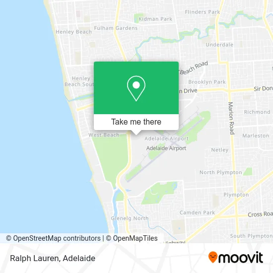
See Ralph Lauren, Adelaide Airport, on the map
Public Transit to Ralph Lauren in Adelaide Airport
Wondering how to get to Ralph Lauren in Adelaide Airport? Moovit helps you find the best way to get to Ralph Lauren with step-by-step directions from the nearest public transit station.
Moovit provides free maps and live directions to help you navigate through your city. View schedules, routes, timetables, and find out how long does it take to get to Ralph Lauren in real time.
Looking for the nearest stop or station to Ralph Lauren? Check out this list of stops closest to your destination: Zone B Harbour Town Interchange; Zone A Harbour Town Interchange; Stop 14B West Beach Rd - North side; Stop 14B West Beach Rd - South side; Stop 13A Northern Ave - South side; Stop 13A Northern Ave - North side; Stop 15 Brighton Rd.
Bus: J1, J2, J2G, J1G, J1T, 300, 300H, 300J, 300M, 669, 671, 670, 656, 654.
Want to see if there’s another route that gets you there at an earlier time? Moovit helps you find alternative routes or times. Get directions from and directions to Ralph Lauren easily from the Moovit App or Website.
We make riding to Ralph Lauren easy, which is why over 1.5 million users, including users in Adelaide Airport, trust Moovit as the best app for public transit. You don’t need to download an individual bus app or train app, Moovit is your all-in-one transit app that helps you find the best bus time or train time available.
For information on prices of bus and light rail, costs and ride fares to Ralph Lauren, please check the Moovit app.
Use the app to navigate to popular places including to the airport, hospital, stadium, grocery store, mall, coffee shop, school, college, and university.
Ralph Lauren Address: Adelaide Airport SA 5950 street in Adelaide Airport
- Baku Swimwear,
- Ned's,
- Serafina,
- Rona Cafe,
- Pure Zone,
- Jacqui-E,
- Under Armour,
- Femme Connection Harbour Town Women's Fashion,
- Asian Fresh,
- Wittner,
- Peter Alexander,
- Seed Heritage,
- I Pro Phone Accessories,
- Boss Outlet,
- Connor Harbourtown Adelaide Airport,
- Soul Origin Harbour Town,
- Guess,
- Zi Life,
- Karaambar Kamyoncular Dernei,
- TK Maxx
Places Near Ralph Lauren (Adelaide Airport)
- Westfield West Lakes, West Lakes,
- Adelaide Zoo, Adelaide,
- Adelaide Central Market, Adelaide,
- Puff and Present Emporium, Glenelg North,
- Flinders Medical Centre, Bedford Park,
- Regency TAFE, Regency Park,
- Semaphore Beach, Semaphore,
- Womens and Childrens Hospital, North Adelaide,
- A Trip A Trip A Trip P, Port Noarlunga,
- Chinatown, Adelaide,
- Calvary Adelaide Hospital, Adelaide,
- Lyell McEwin Hospital, Elizabeth Vale,
- IKEA, Adelaide Airport,
- Flinders Medical Centre (Hospital), Bedford Park,
- Westfield Marion Shopping Centre, Oaklands Park,
- Morphettville Racecourse, Morphettville,
- Westfield Tea Tree Plaza, Modbury,
- Flinders Private Hospital, Bedford Park,
- St Andrews Hospital, Adelaide,
- Marion Shopping Centre, Oaklands Park
How to get to popular places in Adelaide with public transport
Get around Adelaide Airport by public transport!
Travelling around Adelaide Airport has never been so easy. See step by step directions as you travel to any attraction, street or major public transport station. View bus and train timetables, arrival times, service alerts and detailed routes on a map, so you know exactly how to get to anywhere in Adelaide Airport.
When travelling to any destination around Adelaide Airport use Moovit's Live Directions with Get Off Notifications to know exactly where and how far to walk, how long to wait for your line , and how many stops are left. Moovit will alert you when it’s time to get off — no need to constantly re-check whether yours is the next stop.
Wondering how to use public transport in Adelaide Airport or how to pay for public transport in Adelaide Airport? Moovit public transport app can help you navigate your way with public transport easily, and at minimum cost. It includes public transport fees, ticket prices, and costs. Looking for a map of Adelaide Airport public transport lines? Moovit public transport app shows all public transport maps in Adelaide Airport with all Bus, Train, Light rail and Ferry routes and stops on an interactive map.
Adelaide has 4 transport type(s), including: Bus, Train, Light rail and Ferry, operated by several transport agencies, including Adelaide Metro (Busways), SouthLink, Torrens Transit, Adelaide Metro Train and Adelaide Metro (Rail Commissioner Tram)