Directions to Randwick Presbyterian Church with public transportation
The following transport lines have routes that pass near Randwick Presbyterian Church
How to get to Randwick Presbyterian Church by bus?
Click on the bus route to see step by step directions with maps, line arrival times and updated time schedules.
How to get to Randwick Presbyterian Church by train?
Click on the train route to see step by step directions with maps, line arrival times and updated time schedules.
Bus stops near Randwick Presbyterian Church
- Alison Rd Opp Abbey St, 1 min walk,
- Belmore Rd Near Alison Rd, 1 min walk,
- Belmore Rd Opp Silver St, 2 min walk,
Bus routes to Randwick Presbyterian Church
- 356, Eastgardens to Bondi Junction,
- 374, Coogee to Central Belmore Park via Bream St,
- 374X, Coogee to City Museum via Bream St (Express Service),
- 624E, Bondi Junction to Randwick Girls HS,
- 634E, Eastgardens to Bondi Junction,
- 636E, Randwick High Schools to Gardeners & Botany Rds,
- 650E, Brigidine College Randwick to Mascot,
- 664E, St. Clares College Waverley to Matraville,
- 672E, Kincoppal Rose Bay to Maroubra Junction,
- 680E, Cranbrook School Bellevue Hill to Randwick Junction,
- 686E, Waverley College to Malabar,
- 694E, Waverley College to Matraville,
- 695E, Waverley College to Maroubra Junction,
- 698E, Waverley College to Mascot,
- 716E, Rose Bay Secondary College to Randwick Junction,
- 373, Coogee to City Museum (Loop Service),
- 373X, Coogee to City Museum (Express Service),
- 375, Eastgardens to Randwick (Loop Service),
- 377X, Maroubra Beach to City Museum via South Coogee (Express Service),
- 390X, La Perouse to Bondi Junction (Express Service),
What are the nearest stations to Randwick Presbyterian Church?
The nearest stations to Randwick Presbyterian Church are:
- Alison Rd Opp Abbey St is 37 meters away, 1 min walk.
- Belmore Rd Near Alison Rd is 41 meters away, 1 min walk.
- Belmore Rd Opp Silver St is 88 meters away, 2 min walk.
Which bus lines stop near Randwick Presbyterian Church?
These bus lines stop near Randwick Presbyterian Church: 348, 370, 372, 373, 374.
Which train lines stop near Randwick Presbyterian Church?
These train lines stop near Randwick Presbyterian Church: SCO, T4.
What’s the nearest bus stop to Randwick Presbyterian Church?
The nearest bus stops to Randwick Presbyterian Church are Alison Rd Opp Abbey St and Belmore Rd Near Alison Rd. The closest one is a 1 min walk away.
See Randwick Presbyterian Church on the map
Public Transportation to Randwick Presbyterian Church
Wondering how to get to Randwick Presbyterian Church, Australia? Moovit helps you find the best way to get to Randwick Presbyterian Church with step-by-step directions from the nearest public transit station.
Moovit provides free maps and live directions to help you navigate through your city. View schedules, routes, timetables, and find out how long does it take to get to Randwick Presbyterian Church in real time.
Looking for the nearest stop or station to Randwick Presbyterian Church? Check out this list of stops closest to your destination: Alison Rd Opp Abbey St; Belmore Rd Near Alison Rd; Belmore Rd Opp Silver St.
Bus: 348, 370, 372, 373, 374, 356, 374X, 624E, 634E, 373X, 375, 377X, 390X, 617E, 618E, 651E, 653E, 654E.Train: SCO, T4.
Want to see if there’s another route that gets you there at an earlier time? Moovit helps you find alternative routes or times. Get directions from and directions to Randwick Presbyterian Church easily from the Moovit App or Website.
We make riding to Randwick Presbyterian Church easy, which is why over 1.5 million users, including users in Randwick, trust Moovit as the best app for public transit. You don’t need to download an individual bus app or train app, Moovit is your all-in-one transit app that helps you find the best bus time or train time available.
For information on prices of bus and train, costs and ride fares to Randwick Presbyterian Church, please check the Moovit app.
Use the app to navigate to popular places including to the airport, hospital, stadium, grocery store, mall, coffee shop, school, college, and university.
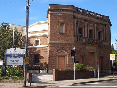
Randwick Presbyterian Church Address: Alison Road street in Randwick
Attractions near Randwick Presbyterian Church
Reborn,27 Cook Street,Look The,Cook Street,Move by Aric & Masha,Simon'S Pharmacy,Coogee Boys Preparatory School,Bugrashov,Ataiui Sushi Restaurant,Akarui,Adrenalyn Web Marketing,Young King Hot Bread,Dressed By Foxy's,Sushi Cafe,Hunt W.R. & Co,Elegance Hairstyle,Student Flights,Regal Delicatessen,Tum's Thai,Yoga LightHow to get to popular attractions in Randwick with public transportation
Adriano Zumbo Pâtissier, Pyrmont,Gosford Station (Main Concourse), Gosford,Lidcombe Station (Concourse), Lidcombe,The Beresford Hotel, Surry Hills,Westfield Hurstville, Hurstville,Charlestown Square Shopping Centre, Charlestown (NSW),Westfield Tuggerah, Tuggerah,Campus Centre, Randwick,Broadway Shopping Centre, Glebe (NSW),Starbucks, Sydney,Central, Haymarket,Sydney Airport (SYD), Mascot,MarketPlace Leichhardt, Leichhardt (NSW),Fairfield Station, Fairfield (NSW),The Star Casino, Pyrmont,Glenfield Station, Glenfield (NSW),Paddington Town Hall, Paddington (NSW),St Marys Station, St Marys (NSW),OMD, Pyrmont,Bavarian Bier Cafe, SydneyGet around Sydney by public transport!
Travelling around Sydney has never been so easy. See step by step directions as you travel to any attraction, street or major public transport station. View bus and train timetables, arrival times, service alerts and detailed routes on a map, so you know exactly how to get to anywhere in Sydney.
When travelling to any destination around Sydney use Moovit's Live Directions with Get Off Notifications to know exactly where and how far to walk, how long to wait for your line , and how many stops are left. Moovit will alert you when it’s time to get off — no need to constantly re-check whether yours is the next stop.
Wondering how to use public transport in Sydney or how to pay for public transport in Sydney? Moovit public transport app can help you navigate your way with public transport easily, and at minimum cost. It includes public transport fees, ticket prices, and costs. Looking for a map of Sydney public transport lines? Moovit public transport app shows all public transport maps in Sydney with all Bus, Train, Metro, Light rail and Ferry routes and stops on an interactive map.
Sydney has 5 transport type(s), including: Bus, Train, Metro, Light rail and Ferry, operated by several transport agencies, including Sydney Metro, Sydney Trains, Sydney Light Rail, Sydney Ferries, Intercity Trains, Intercity Train, NSW TrainLink, CDC NSW R14, U-Go Mobility, Keolis Downer Northern Beaches, Manly Fast Ferry, Transdev John Holland Buses, Busways, Busways North West, Dysons Buslines