Directions to Rangeview Intermediate School (Edmonton) with public transport
The following transport lines have routes that pass near Rangeview Intermediate School
 Bus: 13, 135.
- Train: WEST.
How to get to Rangeview Intermediate School by bus?
Click on the bus route to see step by step directions with maps, line arrival times and updated time schedules.
How to get to Rangeview Intermediate School by train?
Click on the train route to see step by step directions with maps, line arrival times and updated time schedules.
Bus stops near Rangeview Intermediate School in Edmonton
- St Giles Presbyterian, 4 min walk,
- Te Atatu South Shops, 5 min walk,
Train station near Rangeview Intermediate School in Edmonton
- Sunnyvale Train Station, 26 min walk,
Bus lines to Rangeview Intermediate School in Edmonton
- 135, Henderson To Te Atatu (Totara Rd),
- 13, Te Atatu Peninsula Loop To Henderson,
What are the nearest stations to Rangeview Intermediate School?
The nearest stations to Rangeview Intermediate School are:
- St Giles Presbyterian is 282 meters away, 4 min walk.
- Te Atatu South Shops is 374 meters away, 5 min walk.
- Sunnyvale Train Station is 2022 meters away, 26 min walk.
Which bus line stops near Rangeview Intermediate School?
13 (Te Atatu Peninsula Loop To Henderson)
Which train line stops near Rangeview Intermediate School?
WEST (Brit 2 To Swanson 1 Via Newmarket 1)
What’s the nearest train station to Rangeview Intermediate School in Edmonton?
The nearest train station to Rangeview Intermediate School in Edmonton is Sunnyvale Train Station. It’s a 26 min walk away.
What’s the nearest bus station to Rangeview Intermediate School in Edmonton?
The nearest bus station to Rangeview Intermediate School in Edmonton is St Giles Presbyterian. It’s a 4 min walk away.
What time is the first train to Rangeview Intermediate School in Edmonton?
The WEST is the first train that goes to Rangeview Intermediate School in Edmonton. It stops nearby at 06:06.
What time is the last train to Rangeview Intermediate School in Edmonton?
The WEST is the last train that goes to Rangeview Intermediate School in Edmonton. It stops nearby at 23:00.
What time is the first bus to Rangeview Intermediate School in Edmonton?
The 13 is the first bus that goes to Rangeview Intermediate School in Edmonton. It stops nearby at 05:37.
What time is the last bus to Rangeview Intermediate School in Edmonton?
The 13 is the last bus that goes to Rangeview Intermediate School in Edmonton. It stops nearby at 00:44.
See Rangeview Intermediate School, Edmonton, on the map
Public Transit to Rangeview Intermediate School in Edmonton
Wondering how to get to Rangeview Intermediate School in Edmonton? Moovit helps you find the best way to get to Rangeview Intermediate School with step-by-step directions from the nearest public transit station.
Moovit provides free maps and live directions to help you navigate through your city. View schedules, routes, timetables, and find out how long does it take to get to Rangeview Intermediate School in real time.
Looking for the nearest stop or station to Rangeview Intermediate School? Check out this list of stops closest to your destination: St Giles Presbyterian; Te Atatu South Shops; Sunnyvale Train Station.
Bus: 13, 135.Train: WEST.
Want to see if there’s another route that gets you there at an earlier time? Moovit helps you find alternative routes or times. Get directions from and directions to Rangeview Intermediate School easily from the Moovit App or Website.
We make riding to Rangeview Intermediate School easy, which is why over 1.5 million users, including users in Edmonton, trust Moovit as the best app for public transit. You don’t need to download an individual bus app or train app, Moovit is your all-in-one transit app that helps you find the best bus time or train time available.
For information on prices of bus and train, costs and ride fares to Rangeview Intermediate School, please check the Moovit app.
Use the app to navigate to popular places including to the airport, hospital, stadium, grocery store, mall, coffee shop, school, college, and university.
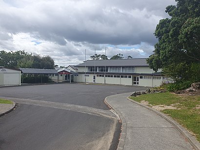
Rangeview Intermediate School Address: Bosnyak Drive street in Edmonton
Rangeview Intermediate School is a school in Te Atatū South, West Auckland, New Zealand.Wiki
- Lloyd Morgan Lions Club Park,
- New Era Roofing Limited,
- St John,
- Hot AS Hub,
- E Tipu E Rea Whanau Services,
- Curtain Express,
- Seanz Acupuncture Clinic at Henderson,
- Asl Studios,
- Asb,
- Strid House,
- 255 Edmonton Road,
- The Bond Experience,
- Major Tom Adventures,
- Coach Tiwai,
- Buy Verified Cashapp Accounts,
- Edmonton Community Kindergarten,
- Woolworths,
- Userorg - Business Insights Software,
- Damee Hair,
- The Pilates Workshop
Places Near Rangeview Intermediate School (Edmonton)
- Paramount Muay Thai Gym, Manurewa Central,
- Ward 4 & 5 (AT & R) - Middlemore Hospital, Middlemore,
- Sylvia Park Shopping Centre, Mt Wellington South,
- Commerce A, Building 114, Room G10, Auckland Central East,
- Mudbrick Vineyard & Restaurant, Waiheke Island,
- Cosco, Auckland Central West,
- Mt Smart Stadium, Penrose,
- Piha Beach, Auckland Central West,
- Middlemore Hospital, Middlemore,
- Auckland City Hospital, Grafton East,
- Eden Park, Kingsland,
- Westlake Boys High School, Westlake,
- Cable Bay Winery, Waiheke Island,
- Science Centre Room G75 (303S-G75), Auckland Central East,
- Ward 75 Orthopaedic Sugery Ward, Grafton East,
- Auckland Hospital Main Building, Grafton East,
- Greenlane hospital, One Tree Hill Central,
- John Bing Muay Thai Boxing Gym, St Lukes,
- Poderi Crisci, Waiheke Island,
- Ward 76 - General Surgical, Auckland Hospital, Grafton East
How to get to popular places in Auckland and Hamilton with public transport
Get around Edmonton by public transport!
Travelling around Edmonton has never been so easy. See step by step directions as you travel to any attraction, street or major public transport station. View bus and train timetables, arrival times, service alerts and detailed routes on a map, so you know exactly how to get to anywhere in Edmonton.
When travelling to any destination around Edmonton use Moovit's Live Directions with Get Off Notifications to know exactly where and how far to walk, how long to wait for your line , and how many stops are left. Moovit will alert you when it’s time to get off — no need to constantly re-check whether yours is the next stop.
Wondering how to use public transport in Edmonton or how to pay for public transport in Edmonton? Moovit public transport app can help you navigate your way with public transport easily, and at minimum cost. It includes public transport fees, ticket prices, and costs. Looking for a map of Edmonton public transport lines? Moovit public transport app shows all public transport maps in Edmonton with all Bus, Train and Ferry routes and stops on an interactive map.
Auckland and Hamilton has 3 transport type(s), including: Bus, Train and Ferry, operated by several transport agencies, including AT Metro, AT Metro Bus, Fullers360, SeaLink Pine Harbour, Belaire Ferries, Tranzit Group Ltd, New Zealand Bus, Bayes Coachlines, Howick and Eastern, Ritchies Transport, Waiheke Bus Company, Mahu City Express, Go Bus, Busit and SeaLink