Directions to Rangeville with public transportation
The following transport lines have routes that pass near Rangeville
How to get to Rangeville by bus?
Click on the bus route to see step by step directions with maps, line arrival times and updated time schedules.
Bus stations near Rangeville
- Mackenzie St at East Creek,3 min walk,
Bus routes to Rangeville
- 904,Unisq, Toowoomba,
What are the nearest stations to Rangeville?
The nearest stations to Rangeville are:
- Mackenzie St at East Creek is 211 meters away, 3 min walk.
Which bus lines stop near Rangeville?
These bus lines stop near Rangeville: 904, 905, 906.
What’s the nearest bus stop to Rangeville?
The nearest bus stop to Rangeville is Mackenzie St at East Creek. It’s a 3 min walk away.
See Rangeville on the map
Public Transportation to Rangeville
Wondering how to get to Rangeville, Australia? Moovit helps you find the best way to get to Rangeville with step-by-step directions from the nearest public transit station.
Moovit provides free maps and live directions to help you navigate through your city. View schedules, routes, timetables, and find out how long does it take to get to Rangeville in real time.
Looking for the nearest stop or station to Rangeville? Check out this list of stops closest to your destination: Mackenzie St at East Creek.
Bus:904905906
Want to see if there’s another route that gets you there at an earlier time? Moovit helps you find alternative routes or times. Get directions from and directions to Rangeville easily from the Moovit App or Website.
We make riding to Rangeville easy, which is why over 1.5 million users, including users in Toowoomba, trust Moovit as the best app for public transit. You don’t need to download an individual bus app or train app, Moovit is your all-in-one transit app that helps you find the best bus time or train time available.
For information on prices of bus, costs and ride fares to Rangeville, please check the Moovit app.
Use the app to navigate to popular places including to the airport, hospital, stadium, grocery store, mall, coffee shop, school, college, and university.
Location: Toowoomba
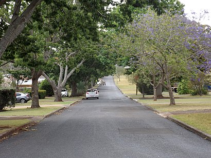
Rangeville is a residential locality in Toowoomba in the Toowoomba Region, Queensland, Australia. In the 2021 census, Rangeville had a population of 8,668 people.Wiki
Popular routes to Rangeville
Popular routes from Rangeville
Attractions near Rangeville
Hope Horizons Vintage & 2nd Hand Clothing Store,The Lott,Better You Remedial Massage,Dr Robert Greenhill,Rosie Volker,High St at High Street Plaza,Aromas,Yxy Enterprise Pty L,bp,Sullivan Nicolaides Pathology Toowoomba High St,BP Shop,Koala Carte Sushi & Chicken,The Noodle Way,Next Era Solar,Aussie Buziness Partners,Kelly Consolidated P,Halo Properties,High Street at Rangeville State School (HNR),Lash Queen Toowoomba,Collective Light StudioHow to get to popular attractions in Toowoomba with public transportation
Movie World Gold Coast, Mount Lofty,Horton's Auto Electrical, South Toowoomba,Newtown Hotel P/L, Newtown,Damien Joyce, Kearneys Spring,RB Finance QLD, Central Toowoomba,Ray Baulch & Associates, Central Toowoomba,1300smiles Dentists, Wilsonton,Mim Dade Naturopath, Central Toowoomba,Dance - Queensland Jam Factory - Commercial Industry Dance Studio, Central Toowoomba,Aaron Wockner Tiling-Waterproofing & Stone Masonary, Newtown,Woolworths-Clifford Gardens Shopping Centre, Newtown,Bed Bath N' Table, Central Toowoomba,Australian Red Cross Shop, Central Toowoomba,Drill Quip, Wilsonton,Supanews Grand Central, Central Toowoomba,O'Quinn St Oval, South Toowoomba,Groom Park Hall Association Inc, Central Toowoomba,Fiona Gibson Clinically Phychologist, East Toowoomba,Commonwealth Oval, Central Toowoomba,Cocacolaepp, South ToowoombaGet around Toowoomba by public transport!
Travelling around Toowoomba has never been so easy. See step by step directions as you travel to any attraction, street or major public transport station. View bus and train timetables, arrival times, service alerts and detailed routes on a map, so you know exactly how to get to anywhere in Toowoomba.
When travelling to any destination around Toowoomba use Moovit's Live Directions with Get Off Notifications to know exactly where and how far to walk, how long to wait for your line , and how many stops are left. Moovit will alert you when it’s time to get off — no need to constantly re-check whether yours is the next stop.
Wondering how to use public transport in Toowoomba or how to pay for public transport in Toowoomba? Moovit public transport app can help you navigate your way with public transport easily, and at minimum cost. It includes public transport fees, ticket prices, and costs. Looking for a map of Toowoomba public transport lines? Moovit public transport app shows all public transport maps in Toowoomba with all bus routes and stops on an interactive map.
Toowoomba has 1 transport type(s), including: bus, operated by several transport agencies, including Bus Qld Toowoomba