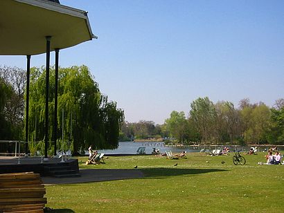
See Regent's Park, Marylebone, on the map
Directions to Regent's Park (Marylebone) with public transport
The following transport lines have routes that pass near Regent's Park
 Bus:
Bus: - Train:
- Tube:
How to get to Regent's Park by bus?
Click on the bus route to see step by step directions with maps, line arrival times and updated time schedules.
How to get to Regent's Park by train?
Click on the train route to see step by step directions with maps, line arrival times and updated time schedules.
How to get to Regent's Park by Tube?
Click on the Tube route to see step by step directions with maps, line arrival times and updated time schedules.
Tube stations near Regent's Park in Marylebone
- Regent's Park,1 min walk,
- Great Portland Street,3 min walk,
- Warren Street,9 min walk,
- Baker Street,9 min walk,
Bus stations near Regent's Park in Marylebone
- Regent's Park Station (A),2 min walk,
- Albany Street (C),3 min walk,
- Great Portland Street Station (G),3 min walk,
Bus lines to Regent's Park in Marylebone
- 18,Euston - Sudbury,
- N18,Trafalgar Square - Harrow Weald, Bus Garage,
- 27,Chalk Farm - Hammersmith Grove,
- N27,Chalk Farm - Hammersmith,
- 205,Bow Church - Paddington,
- N205,Leyton, Downsell Road - Paddington,
- 453,Marylebone - Deptford Bridge,
- 88,Parliament Hill Fields,
- 30,Marble Arch,
What are the nearest stations to Regent's Park?
The nearest stations to Regent's Park are:
- Regent's Park is 1 meters away, 1 min walk.
- Regent's Park Station (A) is 131 meters away, 2 min walk.
- Albany Street (C) is 166 meters away, 3 min walk.
- Great Portland Street is 192 meters away, 3 min walk.
- Great Portland Street Station (G) is 200 meters away, 3 min walk.
- Warren Street is 631 meters away, 9 min walk.
- Baker Street is 656 meters away, 9 min walk.
Which bus lines stop near Regent's Park?
These bus lines stop near Regent's Park: 18, 205, 27, 30, 453.
Which train lines stop near Regent's Park?
These train lines stop near Regent's Park: CHILTERN RAILWAYS, ELIZABETH, OVERGROUND, THAMESLINK.
Which Tube lines stop near Regent's Park?
These Tube lines stop near Regent's Park: BAKERLOO, CIRCLE, HAMMERSMITH & CITY, METROPOLITAN.
What’s the nearest Tube station to Regent's Park in Marylebone?
The nearest Tube station to Regent's Park in Marylebone is Regent's Park. It’s a 1 min walk away.
What’s the nearest bus stop to Regent's Park in Marylebone?
The nearest bus stop to Regent's Park in Marylebone is Regent's Park Station (A). It’s a 2 min walk away.
What time is the first Tube to Regent's Park in Marylebone?
The CIRCLE is the first Tube that goes to Regent's Park in Marylebone. It stops nearby at 04:57.
What time is the last Tube to Regent's Park in Marylebone?
The CIRCLE is the last Tube that goes to Regent's Park in Marylebone. It stops nearby at 00:56.
What time is the first bus to Regent's Park in Marylebone?
The 453 is the first bus that goes to Regent's Park in Marylebone. It stops nearby at 03:02.
What time is the last bus to Regent's Park in Marylebone?
The N18 is the last bus that goes to Regent's Park in Marylebone. It stops nearby at 03:49.
See Regent's Park, Marylebone, on the map
Public Transit to Regent's Park in Marylebone
Wondering how to get to Regent's Park in Marylebone, United Kingdom? Moovit helps you find the best way to get to Regent's Park with step-by-step directions from the nearest public transit station.
Moovit provides free maps and live directions to help you navigate through your city. View schedules, routes, timetables, and find out how long does it take to get to Regent's Park in real time.
Looking for the nearest stop or station to Regent's Park? Check out this list of stops closest to your destination: Regent's Park; Regent's Park Station (A); Albany Street (C); Great Portland Street; Great Portland Street Station (G); Warren Street; Baker Street.
Bus:Train:Tube:
Want to see if there’s another route that gets you there at an earlier time? Moovit helps you find alternative routes or times. Get directions from and directions to Regent's Park easily from the Moovit App or Website.
We make riding to Regent's Park easy, which is why over 1.5 million users, including users in Marylebone, trust Moovit as the best app for public transit. You don’t need to download an individual bus app or train app, Moovit is your all-in-one transit app that helps you find the best bus time or train time available.
For information on prices of Tube, bus and train, costs and ride fares to Regent's Park, please check the Moovit app.
Use the app to navigate to popular places including to the airport, hospital, stadium, grocery store, mall, coffee shop, school, college, and university.
Regent's Park Address: Marylebone Road street in Marylebone
Popular routes to Regent's Park, Marylebone
Attractions near Regent's Park
Regents Park Station Bus Stop,Marylebone Rd,Regent's Park London Underground Station,Central London County Court,Jubilee Line Air Shaft,Trinity College London,Hale Clinic (The Hale Clinic),Doja Purkit,St. Marylebone Parish Church,W1b 1sh,Nw1 4lj,Pinero House,152 Harley Street,150 Harley Street Ent,W1w 5pn,Lister Fertility Clinic at the Portland Hospital,International Students House Hotel London,Park Crescent Conference Centre,Alliance Medical,229 The VenueHow to get to popular attractions in Marylebone with public transportation
Lewisham Shopping Centre, Lewisham,Royal Observatory Greenwich, Greenwich,Nuffield Health Fitness & Wellbeing Centre, Willesden,King's Cross St Pancras Underground Station, Pentonville,Central Middlesex Hospital, Park Royal,Windsor Castle, Windsor,Terminal 4, Heathrow,Hayes Railway Station, Hayes (Kent),Barnet, Finchley,Acton, Acton,Westfield Stratford City, Stratford,The Whittington Hospital, Upper Holloway,Cineworld, Ashford,Stanmore, Stanmore,Crouch End, Crouch End,Renaissance London Heathrow Hotel, Heathrow,Nuffield Health Newbury Fitness & Wellbeing Gym, Newbury (W Berks),Reading College, Reading,Oxford Brookes University, Wheatley Campus, South Oxfordshire,Queen's Club, West KensingtonGet around Marylebone by public transport!
Travelling around Marylebone has never been so easy. See step by step directions as you travel to any attraction, street or major public transport station. View bus and train timetables, arrival times, service alerts and detailed routes on a map, so you know exactly how to get to anywhere in Marylebone.
When travelling to any destination around Marylebone use Moovit's Live Directions with Get Off Notifications to know exactly where and how far to walk, how long to wait for your line , and how many stops are left. Moovit will alert you when it’s time to get off — no need to constantly re-check whether yours is the next stop.
Wondering how to use public transport in Marylebone or how to pay for public transport in Marylebone? Moovit public transport app can help you navigate your way with public transport easily, and at minimum cost. It includes public transport fees, ticket prices, and costs. Looking for a map of Marylebone public transport lines? Moovit public transport app shows all public transport maps in Marylebone with all Tube, bus or train routes and stops on an interactive map.
Marylebone has 3 transport type(s), including: Tube, bus or train, operated by several transport agencies, including London Underground, London Buses, Transport for London, London Tramlink, Transport for London, National Rail, Bluestar, Berry's Coaches, Oxford Bus Company, Stagecoach West, Community First Wessex, Cresta Coaches, D & P Boat Hire, First Portsmouth, Fareham & Gosport and FYTbus