Reinwood Rd Hawes Avenue stop - Sunday schedule
| Line | Direction | Time |
|---|---|---|
| 536 | Halifax Bus Station | 09:38 |
| 536 | Halifax Bus Station | 11:38 |
| 536 | Halifax Bus Station | 13:38 |
| 536 | Halifax Bus Station | 15:38 |
| 536 | Halifax Bus Station | 17:38 |
Directions to Reinwood Rd Hawes Avenue stop (Huddersfield) with public transport
The following transport lines have routes that pass near Reinwood Rd Hawes Avenue
How to get to Reinwood Rd Hawes Avenue stop by bus?
Click on the bus route to see step by step directions with maps, line arrival times and updated time schedules.
How to get to Reinwood Rd Hawes Avenue stop by train?
Click on the train route to see step by step directions with maps, line arrival times and updated time schedules.
Bus stops near Reinwood Rd Hawes Avenue stop in Huddersfield
- Reinwood Road Chesil Bank, 1 min walk,
- Vicarage Rd Meg Lane, 8 min walk,
Bus lines to Reinwood Rd Hawes Avenue stop in Huddersfield
- 377, Lindley Moor Road at Mount Roundabout,
- 378, Lindley Moor Road at Mount Roundabout,
- 536, Halifax Bus Station,
- 356, Huddersfield Busstn,
What are the nearest stations to Reinwood Rd Hawes Avenue?
The nearest stations to Reinwood Rd Hawes Avenue are:
- Reinwood Road Chesil Bank is 41 meters away, 1 min walk.
- Vicarage Rd Meg Lane is 591 meters away, 8 min walk.
Which bus lines stop near Reinwood Rd Hawes Avenue?
These bus lines stop near Reinwood Rd Hawes Avenue: 377, 378, 501.
Which train line stops near Reinwood Rd Hawes Avenue?
NORTHERN (Huddersfield)
What’s the nearest bus station to Reinwood Rd Hawes Avenue in Huddersfield?
The nearest bus station to Reinwood Rd Hawes Avenue in Huddersfield is Reinwood Road Chesil Bank. It’s a 1 min walk away.
What time is the first bus to Reinwood Rd Hawes Avenue in Huddersfield?
The 356 is the first bus that goes to Reinwood Rd Hawes Avenue in Huddersfield. It stops nearby at 06:58.
What time is the last bus to Reinwood Rd Hawes Avenue in Huddersfield?
The 536 is the last bus that goes to Reinwood Rd Hawes Avenue in Huddersfield. It stops nearby at 21:39.
Reinwood Rd Hawes Avenue station
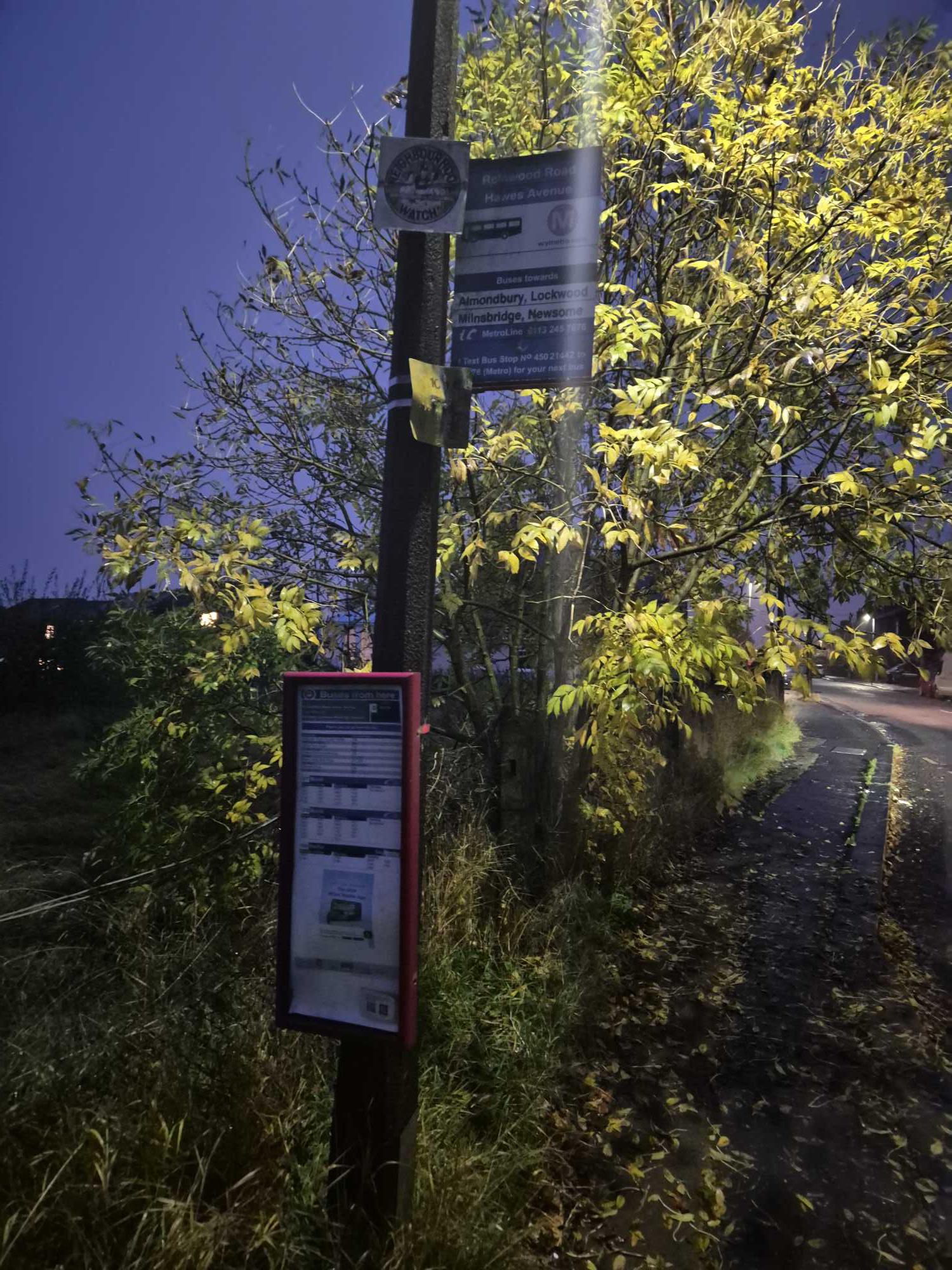 Taken by Anonymous
See Reinwood Rd Hawes Avenue stop, Huddersfield, on the map
Public transport to Reinwood Rd Hawes Avenue stop (ID: 45021442) in Huddersfield
Looking for directions to Reinwood Rd Hawes Avenue in Huddersfield, United Kingdom?
Download the Moovit App to find the current schedule and step-by-step directions for Bus or Train routes that pass through Reinwood Rd Hawes Avenue.
Looking for the nearest stops closest to Reinwood Rd Hawes Avenue ? Check out this list of closest stops to your destination: Reinwood Road Chesil Bank; Vicarage Rd Meg Lane.
Bus: 377, 378, 501, 536, 356, 356.Train: NORTHERN.
We make riding on public transit to Reinwood Rd Hawes Avenue easy, which is why over 1.5 million users, including users in Huddersfield trust Moovit as the best app for public transit.
Use the app to navigate to popular places including to the airport, hospital, stadium, grocery store, mall, coffee shop, school, college, and university.
Reinwood Rd Hawes Avenue stop’s code is 45021442
The first line to this stop is 536, at 09:38, and the last line is 536 at 17:38.
This stop serves TLC Travel and Team Pennine’s lines
Popular public transport stations in Huddersfield
Get around Huddersfield by public transport!
Travelling around Huddersfield has never been so easy. See step by step directions as you travel to any attraction, street or major public transport station. View bus and train timetables, arrival times, service alerts and detailed routes on a map, so you know exactly how to get to anywhere in Huddersfield.
When travelling to any destination around Huddersfield use Moovit's Live Directions with Get Off Notifications to know exactly where and how far to walk, how long to wait for your line , and how many stops are left. Moovit will alert you when it’s time to get off — no need to constantly re-check whether yours is the next stop.
Wondering how to use public transport in Huddersfield or how to pay for public transport in Huddersfield? Moovit public transport app can help you navigate your way with public transport easily, and at minimum cost. It includes public transport fees, ticket prices, and costs. Looking for a map of Huddersfield public transport lines? Moovit public transport app shows all public transport maps in Huddersfield with all Bus, Train and Light rail routes and stops on an interactive map.
Yorkshire has 3 transport type(s), including: Bus, Train and Light rail, operated by several transport agencies, including First Leeds, First South Yorkshire, First York, First West Yorkshire Ltd, Arriva Yorkshire, Stagecoach Yorkshire, National Rail, First Bradford, First Halifax, Calder Valley & Huddersfield, East Yorkshire, The Keighley Bus Company, South Yorkshire Future Tram, The Harrogate Bus Company, TM Travel and Coastliner