See Republic Street, Valletta, on the map
Directions to Republic Street (Valletta) with public transport
The following transport lines have routes that pass near Republic Street
 Bus:
Bus:
How to get to Republic Street by bus?
Click on the bus route to see step by step directions with maps, line arrival times and updated time schedules.
Bus stations near Republic Street in Valletta
- Arcisqof,3 min walk,
- Valletta A1,6 min walk,
- Valletta A2,6 min walk,
- Valletta A3,6 min walk,
- Valletta B8,7 min walk,
- Valletta B7,8 min walk,
- Valletta C1,8 min walk,
Bus lines to Republic Street in Valletta
- 133,Valletta,
- 122,Mater Dei,
- 130,Valletta Waterfront,
- N13,San Giljan,
- 1,Isla,
- 2,Valletta,
- 3,Kalkara,
- 4,Bormla,
- 43,Naxxar Stivala,
- 46,Ghaghur,
- 260,Valletta,
- 44,Manikata Ballut - Tuffieha,
- 47,Sta Margerita,
- 238,Mgarr,
- TD13,Valletta,
- 50,Rabat,
- 58,Birkirkara,
- 58A,Birkirkara,
What are the nearest stations to Republic Street?
The nearest stations to Republic Street are:
- Arcisqof is 162 meters away, 3 min walk.
- Valletta A1 is 439 meters away, 6 min walk.
- Valletta A2 is 453 meters away, 6 min walk.
- Valletta A3 is 453 meters away, 6 min walk.
- Valletta B8 is 538 meters away, 7 min walk.
- Valletta B7 is 553 meters away, 8 min walk.
- Valletta C1 is 576 meters away, 8 min walk.
Which bus lines stop near Republic Street?
These bus lines stop near Republic Street: 13, 250, 42, 45, 48, 50, 91, X4.
What’s the nearest bus stop to Republic Street in Valletta?
The nearest bus stop to Republic Street in Valletta is Arcisqof. It’s a 3 min walk away.
What time is the first bus to Republic Street in Valletta?
The 2 is the first bus that goes to Republic Street in Valletta. It stops nearby at 05:15.
What time is the last bus to Republic Street in Valletta?
The N13 is the last bus that goes to Republic Street in Valletta. It stops nearby at 01:30.
See Republic Street, Valletta, on the map
Public Transit to Republic Street in Valletta
Wondering how to get to Republic Street in Valletta, Malta? Moovit helps you find the best way to get to Republic Street with step-by-step directions from the nearest public transit station.
Moovit provides free maps and live directions to help you navigate through your city. View schedules, routes, timetables, and find out how long does it take to get to Republic Street in real time.
Looking for the nearest stop or station to Republic Street? Check out this list of stops closest to your destination: Arcisqof; Valletta A1; Valletta A2; Valletta A3; Valletta B8; Valletta B7; Valletta C1.
Bus:
Want to see if there’s another route that gets you there at an earlier time? Moovit helps you find alternative routes or times. Get directions from and directions to Republic Street easily from the Moovit App or Website.
We make riding to Republic Street easy, which is why over 1.5 million users, including users in Valletta, trust Moovit as the best app for public transit. You don’t need to download an individual bus app or train app, Moovit is your all-in-one transit app that helps you find the best bus time or train time available.
For information on prices of bus, costs and ride fares to Republic Street, please check the Moovit app.
Use the app to navigate to popular places including to the airport, hospital, stadium, grocery store, mall, coffee shop, school, college, and university.
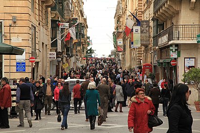
Republic Street Address: Republic St, Valletta, Malta street in Valletta
Attractions near Republic Street
Savita,The Cumberland Boutique Hotel,St. John St / Great Siege Sq,Bov International Clients,Screen Professional Haircare Valletta,West Street Apartments,Savoy,Alsons,National Museum Of Archaeology,San Giovanni,The Savoy,Challenger Gym (Valletta),L'Erbolario Malta - Valletta,Replay Malta,Rex Since 1922,L'Occitane,Melita Street,The Cumberland Hotel by NEU Collective Valletta,Triq San Gwann (Great Siege Square),Django Jazz BarHow to get to popular attractions in Valletta with public transportation
Paceville, San Ġiljan,Café Del Mar, Naxxar,Argento Hotel, San Ġiljan,Xagħra, Xaghra,Bayview Hotel And Apartments Gzira, Gzira,Medina (L-Imdina), Mdina,Zurrieq, Zurrieq,Belmonte Heights, Tas-Sliema,Hamrun, Hamrun,Buġibba, Naxxar,Seabank Resort & Spa, Mellieħa,Żebbuġ (Ħaż-Żebbuġ), Haż-Żebbuġ,Buġibba Beach, Naxxar,The Westin Dragonara Resort, San Ġiljan,Golden Tulip Vivaldi Hotel, San Ġiljan,Sliema Front, Tas-Sliema,Qormi, Qormi,Aeroporto di Malta (MLA) (Ajruport Internazzjonali ta' Malta), Hal Luqa,Paola Square, Paola,Vittoriosa Yacht Marina | Grand Harbour MarinaGet around Valletta by public transport!
Travelling around Valletta has never been so easy. See step by step directions as you travel to any attraction, street or major public transport station. View bus and train timetables, arrival times, service alerts and detailed routes on a map, so you know exactly how to get to anywhere in Valletta.
When travelling to any destination around Valletta use Moovit's Live Directions with Get Off Notifications to know exactly where and how far to walk, how long to wait for your line , and how many stops are left. Moovit will alert you when it’s time to get off — no need to constantly re-check whether yours is the next stop.
Wondering how to use public transport in Valletta or how to pay for public transport in Valletta? Moovit public transport app can help you navigate your way with public transport easily, and at minimum cost. It includes public transport fees, ticket prices, and costs. Looking for a map of Valletta public transport lines? Moovit public transport app shows all public transport maps in Valletta with all bus routes and stops on an interactive map.
Valletta has 1 transport type(s), including: bus, operated by several transport agencies, including Malta Public Transport, Valletta Ferry Services, Gozo Channel and Comino Ferries Co-Op Ltd.