See Retford Station, Bassetlaw, on the map
Directions to Retford Station (Bassetlaw) with public transport
The following transport lines have routes that pass near Retford Station
 Bus:
Bus: - Train:
How to get to Retford Station by bus?
Click on the bus route to see step by step directions with maps, line arrival times and updated time schedules.
Bus stations near Retford Station in Bassetlaw
- Thrumpton Lane, Retford,8 min walk,
- Cheyne Walk, Ordsall,10 min walk,
Train stations near Retford Station in Bassetlaw
- Retford,15 min walk,
Bus lines to Retford Station in Bassetlaw
- SA,Retford - New Ollerton,
- 27,Oaks High School - Misson,
- 29,Retford - Doncaster,
- 43,Worksop - Retford,
- 47,Retford,
- 47A,Ordsall,
What are the nearest stations to Retford Station?
The nearest stations to Retford Station are:
- Thrumpton Lane, Retford is 583 meters away, 8 min walk.
- Cheyne Walk, Ordsall is 707 meters away, 10 min walk.
- Retford is 1149 meters away, 15 min walk.
Which bus line stops near Retford Station?
37
What’s the nearest train station to Retford Station in Bassetlaw?
The nearest train station to Retford Station in Bassetlaw is Retford. It’s a 15 min walk away.
What’s the nearest bus stop to Retford Station in Bassetlaw?
The nearest bus stop to Retford Station in Bassetlaw is Thrumpton Lane, Retford. It’s a 8 min walk away.
See Retford Station, Bassetlaw, on the map
Public Transit to Retford Station in Bassetlaw
Wondering how to get to Retford Station in Bassetlaw, United Kingdom? Moovit helps you find the best way to get to Retford Station with step-by-step directions from the nearest public transit station.
Moovit provides free maps and live directions to help you navigate through your city. View schedules, routes, timetables, and find out how long does it take to get to Retford Station in real time.
Looking for the nearest stop or station to Retford Station? Check out this list of stops closest to your destination: Thrumpton Lane; Cheyne Walk; Retford.
Bus:Train:
Want to see if there’s another route that gets you there at an earlier time? Moovit helps you find alternative routes or times. Get directions from and directions to Retford Station easily from the Moovit App or Website.
We make riding to Retford Station easy, which is why over 1.5 million users, including users in Bassetlaw, trust Moovit as the best app for public transit. You don’t need to download an individual bus app or train app, Moovit is your all-in-one transit app that helps you find the best bus time or train time available.
For information on prices of bus, costs and ride fares to Retford Station, please check the Moovit app.
Use the app to navigate to popular places including to the airport, hospital, stadium, grocery store, mall, coffee shop, school, college, and university.
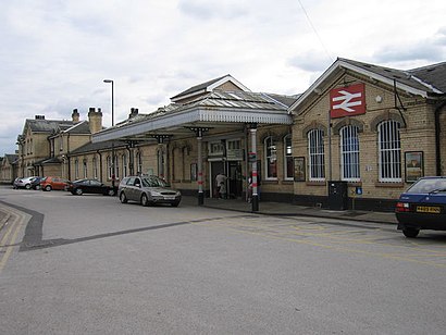
Retford Station Address: Station Road Retford Retford DN22 7 street in Bassetlaw
Attractions near Retford Station
NatWest,Costa,Signature Elite Protection,Coopers Cabin Craft Limited,Gemini Centurion,Bow Bells Woo,Station Lodge,Upj Motorsport Piglets Shop,Retford Western Junction,Bookkeepere,Retford Diy Supplies,J.O.S. Joinery,R L Management Consultancy,UPS Solutions Logistics,Green Bee Interiors,Retford School of Music,Hypnomore,MJC 177,GWH Fabrications,S&K StoresHow to get to popular attractions in Bassetlaw with public transportation
Linney Group Ltd., Mansfield,Currys PC World, Lincoln,Sherwood, Nottingham,University Of Nottingham, Nottingham,Peterborough Power Signal Box, Peterborough,Matalan, Corby,Donut Roundabout Car Park, Chesterfield,Oakham Railway Station (OKM), Rutland,Morrisons, Bassetlaw,Hucknall Tram Stop, Ashfield,Caroline Chisholm School, Northampton,Leicester Royal Infirmary, Leicester,Sir Robert Pattinson Academy, North Kesteven,Ratcliffe Power Station, Rushcliffe,Nottingham Council House, Nottingham,Morrisons Distribution Centre, Northampton,Ideal World Studios, Peterborough,Spider Bridge, Derby,Kingsway Hospital, Derby,Holiday Inn Express Peterborough, PeterboroughGet around Bassetlaw by public transport!
Travelling around Bassetlaw has never been so easy. See step by step directions as you travel to any attraction, street or major public transport station. View bus and train timetables, arrival times, service alerts and detailed routes on a map, so you know exactly how to get to anywhere in Bassetlaw.
When travelling to any destination around Bassetlaw use Moovit's Live Directions with Get Off Notifications to know exactly where and how far to walk, how long to wait for your line , and how many stops are left. Moovit will alert you when it’s time to get off — no need to constantly re-check whether yours is the next stop.
Wondering how to use public transport in Bassetlaw or how to pay for public transport in Bassetlaw? Moovit public transport app can help you navigate your way with public transport easily, and at minimum cost. It includes public transport fees, ticket prices, and costs. Looking for a map of Bassetlaw public transport lines? Moovit public transport app shows all public transport maps in Bassetlaw with all bus routes and stops on an interactive map.
Bassetlaw has 1 transport type(s), including: bus, operated by several transport agencies, including National Rail, Ashbourne Community Transport, Delaine Buses, Arriva Midlands, Centrebus, Our Centre, Hulleys of Baslow, D & G Bus, Stagecoach East Midlands, North Lincolnshire Council, National Rail, Roberts Coaches, Lawson's of Corby, Hawkes Coaches and East Yorkshire