How to get to Rhema Broadcasting Group Inc by bus?
Click on the bus route to see step by step directions with maps, line arrival times and updated time schedules.
From Waikaraka Cycleway and walkway, Te Papapa
71 minFrom Hudthip Thai Massage, Mcleod
53 minFrom Ambury Park Farm, Ambury
77 minFrom Edmund Hillary Retirement Village, Mt Wellington West
52 minFrom Rockfield Road, Penrose
56 minFrom Khan Corporation Lim, Glen Eden East
70 minFrom Mt Wellies Childcare, Mt Wellington South
64 minFrom Baan Suk Jai Thai Massage, Wakeling
50 minFrom Imi Norgren New Zealand, Mt Wellington South
68 minFrom Sacred Heart College, Glen Innes North
66 min
How to get to Rhema Broadcasting Group Inc by train?
Click on the train route to see step by step directions with maps, line arrival times and updated time schedules.
Bus stops near Rhema Broadcasting Group Inc in Newton
Train stations near Rhema Broadcasting Group Inc in Newton
Bus lines to Rhema Broadcasting Group Inc in Newton
- 22N, New Lynn To City Centre Via New North Rd,VIEW
- 22R, City Centre To Rosebank Rd Via New North Rd,VIEW
- 24B, City Centre To Blockhouse Bay New Lynn Via Sandringham Rd,VIEW
- 24R, New Lynn To City Centre Via Sandingham Rd,VIEW
- 25B, Blockhouse Bay To City Centre Via Dominion Rd,VIEW
- 25L, Lynfield To City Centre Via Dominion Rd,VIEW
- 27H, Britomart To Waikowhai Via Mt Eden Rd And Hillsborough Rd,VIEW
- 27T, Three Kings To Britomart Via Mt Eden Rd,VIEW
- 27W, Waikowhai To Britomart Via Mt Eden Rd,VIEW
- 30, City Centre To Onehunga Via Manukau Rd,VIEW
- 295, City Centre To Royal Oak,VIEW
- 309, City Centre To Mangere Town Centre,VIEW
- 309X, Stop E the Civic To Mangere,VIEW
- 252, Civic Centre To Lynfield Via Dominion Rd,VIEW
- 253, Civic Centre To Blockhouse Bay Via Dominion Rd,VIEW
- INN, Inner Link Clockwise,VIEW
- 866, Newmarket To Albany Station Via Auckland Hospital & Ponsonby,VIEW
- 966, Newmarket To Beach Haven Via Auckland Hospital And Ponsonby,VIEW
- CTY, Wynyard Quarter To Karangahape Rd Via Queen St,VIEW
- WX1, City Centre To Northwest Via Motorway,VIEW
What are the nearest stations to Rhema Broadcasting Group Inc?
The nearest stations to Rhema Broadcasting Group Inc are:
- Symonds Street/Upper Symonds Street is 438 meters away, 7 min walk.
- Queen Street/Karangahape Road is 532 meters away, 8 min walk.
- Pitt Street is 578 meters away, 8 min walk.
- Rainbow Bridge/Karangahape Road is 770 meters away, 11 min walk.
- Parnell Train Station is 2094 meters away, 27 min walk.
- Newmarket Train Station is 2985 meters away, 39 min walk.
Which bus lines stop near Rhema Broadcasting Group Inc?
These bus lines stop near Rhema Broadcasting Group Inc: 18, 24B, 27W, 295, 30, 309, 72X, WX1.
Which train line stops near Rhema Broadcasting Group Inc?
WEST (Brit 2 To Swanson 2 Via Newmarket 1)
What’s the nearest train station to Rhema Broadcasting Group Inc in Newton?
The nearest train station to Rhema Broadcasting Group Inc in Newton is Parnell Train Station. It’s a 27 min walk away.
What’s the nearest bus station to Rhema Broadcasting Group Inc in Newton?
The nearest bus station to Rhema Broadcasting Group Inc in Newton is Symonds Street/Upper Symonds Street. It’s a 7 min walk away.
What time is the first train to Rhema Broadcasting Group Inc in Newton?
The WEST is the first train that goes to Rhema Broadcasting Group Inc in Newton. It stops nearby at 05:27.
What time is the last train to Rhema Broadcasting Group Inc in Newton?
The WEST is the last train that goes to Rhema Broadcasting Group Inc in Newton. It stops nearby at 23:11.
What time is the first bus to Rhema Broadcasting Group Inc in Newton?
The WX1 is the first bus that goes to Rhema Broadcasting Group Inc in Newton. It stops nearby at 05:20.
What time is the last bus to Rhema Broadcasting Group Inc in Newton?
The INN is the last bus that goes to Rhema Broadcasting Group Inc in Newton. It stops nearby at 00:31.
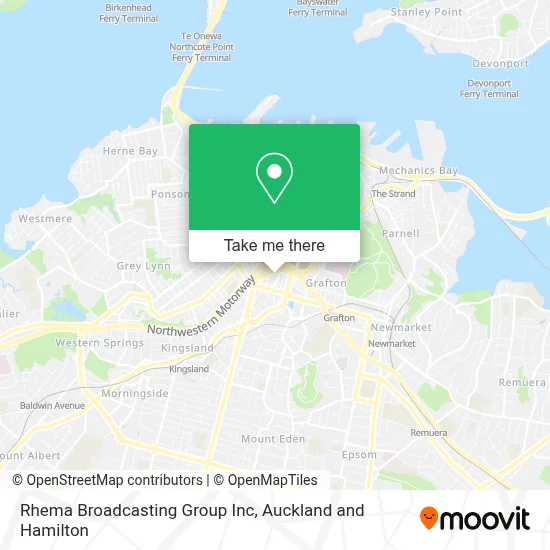
See Rhema Broadcasting Group Inc, Newton, on the map
Public Transit to Rhema Broadcasting Group Inc in Newton
Wondering how to get to Rhema Broadcasting Group Inc in Newton? Moovit helps you find the best way to get to Rhema Broadcasting Group Inc with step-by-step directions from the nearest public transit station.
Moovit provides free maps and live directions to help you navigate through your city. View schedules, routes, timetables, and find out how long does it take to get to Rhema Broadcasting Group Inc in real time.
Looking for the nearest stop or station to Rhema Broadcasting Group Inc? Check out this list of stops closest to your destination: Symonds Street/Upper Symonds Street; Queen Street/Karangahape Road; Pitt Street; Rainbow Bridge/Karangahape Road; Parnell Train Station; Newmarket Train Station.
Bus: 18, 24B, 27W, 295, 30, 309, 72X, WX1, 22N, 22R, 24R, 25B, 252, 253, INN, 866, 966, CTY.Train: WEST, STH, ONE.
Want to see if there’s another route that gets you there at an earlier time? Moovit helps you find alternative routes or times. Get directions from and directions to Rhema Broadcasting Group Inc easily from the Moovit App or Website.
We make riding to Rhema Broadcasting Group Inc easy, which is why over 1.5 million users, including users in Newton, trust Moovit as the best app for public transit. You don’t need to download an individual bus app or train app, Moovit is your all-in-one transit app that helps you find the best bus time or train time available.
For information on prices of bus and train, costs and ride fares to Rhema Broadcasting Group Inc, please check the Moovit app.
Use the app to navigate to popular places including to the airport, hospital, stadium, grocery store, mall, coffee shop, school, college, and university.
Rhema Broadcasting Group Inc Address: Dacre Street street in Newton
- Fibreoptic Light & Design Ltd,
- City Kickboxing,
- Deadly Ponies (2010) Limited,
- The Upper Queen Carpark,
- Modicum,
- GEHWOL NZ,
- Dacre Reserve,
- The NZTech Podcast Studios,
- Labtec Photographic Processing Ltd,
- Hair Today,
- Photoshack,
- Print Matters Print Production & Design,
- Barcode Technologies Ltd,
- France Street South,
- Localist HQ,
- Kylin Image Photography,
- Producto,
- Thai Rain Forest Restaurant,
- Intellium,
- Planning Consultants - Auckland
Places Near Rhema Broadcasting Group Inc (Newton)
- Paramount Muay Thai Gym, Manurewa Central,
- Piha Beach, Auckland Central West,
- Auckland Hospital Main Building, Grafton East,
- Mudbrick Vineyard & Restaurant, Waiheke Island,
- Ward 4 & 5 (AT & R) - Middlemore Hospital, Middlemore,
- John Bing Muay Thai Boxing Gym, St Lukes,
- Ward 76 - General Surgical, Auckland Hospital, Grafton East,
- OGGB Lecture Theatre 260-115 (Fisher & Paykel Appliances Auditorium), Auckland Central East,
- 誠臻儒院 Cheng Zhen Buddhist Temple, Puhinui South,
- Auckland City Hospital, Grafton East,
- Middlemore Hospital, Middlemore,
- Poderi Crisci, Waiheke Island,
- Greenlane hospital, One Tree Hill Central,
- Westlake Boys High School, Westlake,
- Ward 75 Orthopaedic Sugery Ward, Grafton East,
- Cosco, Auckland Central West,
- Eden Park, Kingsland,
- Commerce A, Building 114, Room G10, Auckland Central East,
- Science Centre Room G75 (303S-G75), Auckland Central East,
- Sylvia Park Shopping Centre, Mt Wellington South
How to get to popular places in Auckland and Hamilton with public transport
Get around Newton by public transport!
Travelling around Newton has never been so easy. See step by step directions as you travel to any attraction, street or major public transport station. View bus and train timetables, arrival times, service alerts and detailed routes on a map, so you know exactly how to get to anywhere in Newton.
When travelling to any destination around Newton use Moovit's Live Directions with Get Off Notifications to know exactly where and how far to walk, how long to wait for your line , and how many stops are left. Moovit will alert you when it’s time to get off — no need to constantly re-check whether yours is the next stop.
Wondering how to use public transport in Newton or how to pay for public transport in Newton? Moovit public transport app can help you navigate your way with public transport easily, and at minimum cost. It includes public transport fees, ticket prices, and costs. Looking for a map of Newton public transport lines? Moovit public transport app shows all public transport maps in Newton with all Bus, Train and Ferry routes and stops on an interactive map.
Auckland and Hamilton has 3 transport type(s), including: Bus, Train and Ferry, operated by several transport agencies, including AT Metro, AT Metro Bus, Fullers360, SeaLink Pine Harbour, Belaire Ferries, Tranzit Group Ltd, New Zealand Bus, Bayes Coachlines, Howick and Eastern, Ritchies Transport, Waiheke Bus Company, Mahu City Express, Go Bus, Busit and SeaLink