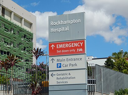
Directions to Rockhampton Hospital with public transportation
The following transport lines have routes that pass near Rockhampton Hospital
How to get to Rockhampton Hospital by bus?
Click on the bus route to see step by step directions with maps, line arrival times and updated time schedules.
Bus stations near Rockhampton Hospital
- Denham St Near West St Hail 'N' Ride, 6 min walk,
- Canning Street at Cq University Rockhampton City, 14 min walk,
- Murray St Near Denham St Hail 'N' Ride, 15 min walk,
Bus routes to Rockhampton Hospital
- 440, Rockhampton Airport,
- 404, Botanic Gardens,
- 407, Allentown State School,
- 403, Rockhampton State High,
What are the nearest stations to Rockhampton Hospital?
The nearest stations to Rockhampton Hospital are:
- Denham St Near West St Hail 'N' Ride is 440 meters away, 6 min walk.
- Canning Street at Cq University Rockhampton City is 984 meters away, 14 min walk.
- Murray St Near Denham St Hail 'N' Ride is 1135 meters away, 15 min walk.
Which bus lines stop near Rockhampton Hospital?
These bus lines stop near Rockhampton Hospital: 401, 403, 404, 407, 440.
What’s the nearest bus stop to Rockhampton Hospital?
The nearest bus stop to Rockhampton Hospital is Denham St Near West St Hail 'N' Ride. It’s a 6 min walk away.
See Rockhampton Hospital on the map
Public Transportation to Rockhampton Hospital
Wondering how to get to Rockhampton Hospital, Australia? Moovit helps you find the best way to get to Rockhampton Hospital with step-by-step directions from the nearest public transit station.
Moovit provides free maps and live directions to help you navigate through your city. View schedules, routes, timetables, and find out how long does it take to get to Rockhampton Hospital in real time.
Looking for the nearest stop or station to Rockhampton Hospital? Check out this list of stops closest to your destination: Denham St Near West St Hail 'N' Ride; Canning Street at Cq University Rockhampton City; Murray St Near Denham St Hail 'N' Ride.
Bus: 401, 403, 404, 407, 440.
Want to see if there’s another route that gets you there at an earlier time? Moovit helps you find alternative routes or times. Get directions from and directions to Rockhampton Hospital easily from the Moovit App or Website.
We make riding to Rockhampton Hospital easy, which is why over 1.5 million users, including users in Rockhampton, trust Moovit as the best app for public transit. You don’t need to download an individual bus app or train app, Moovit is your all-in-one transit app that helps you find the best bus time or train time available.
For information on prices of bus, costs and ride fares to Rockhampton Hospital, please check the Moovit app.
Use the app to navigate to popular places including to the airport, hospital, stadium, grocery store, mall, coffee shop, school, college, and university.
Location: Rockhampton
Attractions near Rockhampton Hospital
Prue Watson Occupational Therapist,CQ Mind Matters,Lre Lance Ryan Electrical,Tab,Recollections Scrapbooking,Kevin Castles centre,Kevin Castles Conference Centre,Howard Walmsley,Oates Cranny,Capricorn Educational Resources,World Class Products,Crains Trip,Voss Medical Centre,The Suite Boutique Coworking,Australian 4x4 Treks,Gracemere Ventures,Diabetes Dashboard,Ganden Engineers and Project Managers,Matthew J Doyle the World Changers Coach,Provider AcademyHow to get to popular attractions in Rockhampton with public transportation
Early Birds Cafe, Rockhampton,Gary William Pearce & Michelle Therese Pearce, Rockhampton,Mother Mcgregor Reef,Emmaus College, Rockhampton,Kele Park, Rockhampton,Capricorn Trading Co, Rockhampton,Capricornia Performing Arts Centre, Rockhampton,Jamaica Blue, Rockhampton,Oztel Hostel, Rockhampton,Aislinn Photo Art, Livingstone - Pt B,Bidgerdii Community Health Service Wellness Hub, Rockhampton,The Strand Hotel, Livingstone - Pt B,Glenmore High School, Rockhampton,Dobinsons Spring & Suspension-Rockhampton, Rockhampton,K & T Jennings & Sons Transport, Livingstone - Pt B,Brittany Lauga MP, Livingstone - Pt B,JM & MM Keily, Livingstone - Pt B,Peter Jephcott, Rockhampton,Stage 4 Consulting, Rockhampton,Duthie Park, RockhamptonGet around Rockhampton by public transport!
Travelling around Rockhampton has never been so easy. See step by step directions as you travel to any attraction, street or major public transport station. View bus and train timetables, arrival times, service alerts and detailed routes on a map, so you know exactly how to get to anywhere in Rockhampton.
When travelling to any destination around Rockhampton use Moovit's Live Directions with Get Off Notifications to know exactly where and how far to walk, how long to wait for your line , and how many stops are left. Moovit will alert you when it’s time to get off — no need to constantly re-check whether yours is the next stop.
Wondering how to use public transport in Rockhampton or how to pay for public transport in Rockhampton? Moovit public transport app can help you navigate your way with public transport easily, and at minimum cost. It includes public transport fees, ticket prices, and costs. Looking for a map of Rockhampton public transport lines? Moovit public transport app shows all public transport maps in Rockhampton with all bus routes and stops on an interactive map.
Rockhampton has 1 transport type(s), including: bus, operated by several transport agencies, including Translink