Directions to Rockingham Castle (Corby) with public transport
The following transport lines have routes that pass near Rockingham Castle
How to get to Rockingham Castle by bus?
Click on the bus route to see step by step directions with maps, line arrival times and updated time schedules.
Bus stations near Rockingham Castle in Corby
- Vian Way, Lodge Park, 20 min walk,
- Nene Crescent, Shire Lodge, 27 min walk,
Bus lines to Rockingham Castle in Corby
- 2C, Corby Village,
- 4, Earlstrees Industry,
- 3, Danesholme,
What are the nearest stations to Rockingham Castle?
The nearest stations to Rockingham Castle are:
- Vian Way, Lodge Park is 1521 meters away, 20 min walk.
- Nene Crescent, Shire Lodge is 2023 meters away, 27 min walk.
Which bus lines stop near Rockingham Castle?
These bus lines stop near Rockingham Castle: 3, X4.
What time is the first bus to Rockingham Castle in Corby?
The 3 is the first bus that goes to Rockingham Castle in Corby. It stops nearby at 09:45.
What time is the last bus to Rockingham Castle in Corby?
The 3 is the last bus that goes to Rockingham Castle in Corby. It stops nearby at 17:18.
See Rockingham Castle, Corby, on the map
Public Transit to Rockingham Castle in Corby
Wondering how to get to Rockingham Castle in Corby, United Kingdom? Moovit helps you find the best way to get to Rockingham Castle with step-by-step directions from the nearest public transit station.
Moovit provides free maps and live directions to help you navigate through your city. View schedules, routes, timetables, and find out how long does it take to get to Rockingham Castle in real time.
Looking for the nearest stop or station to Rockingham Castle? Check out this list of stops closest to your destination: Vian Way; Nene Crescent.
Bus: 3, X4, 2C, 4.
Want to see if there’s another route that gets you there at an earlier time? Moovit helps you find alternative routes or times. Get directions from and directions to Rockingham Castle easily from the Moovit App or Website.
We make riding to Rockingham Castle easy, which is why over 1.5 million users, including users in Corby, trust Moovit as the best app for public transit. You don’t need to download an individual bus app or train app, Moovit is your all-in-one transit app that helps you find the best bus time or train time available.
For information on prices of bus and train, costs and ride fares to Rockingham Castle, please check the Moovit app.
Use the app to navigate to popular places including to the airport, hospital, stadium, grocery store, mall, coffee shop, school, college, and university.
Location: Corby, East Midlands
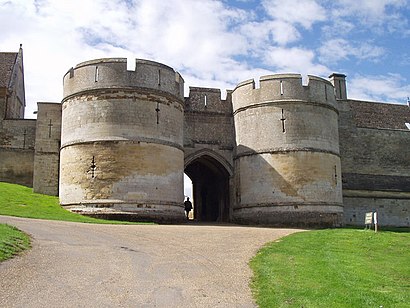
Rockingham Castle is a former royal castle and hunting lodge in Rockingham Forest, approximately two miles north from the town centre of Corby, Northamptonshire, England.Wiki
Attractions near Rockingham Castle
Berzes strazdi :),Corby Athletics Track,MCM Costruction,Rockingham Castle,Royce Engineering,Ice House,Lodge Park Academy,Best Western Rockingham Forest Hotel Corby,Best Western (Best W.ern Rockingham Forest Hotel),Rockingham Chimney Sweeps,KDMRL,Corby Town FC - Steel Park,Studio Amoureux,K Langrick Consulting,Chartwells at Lodge Park Academy,Lodge Park School, Corby,CH Plumbing and Heating,Hallie's Handyman,Gardner Fencing,Tjackson Electrical ServicesHow to get to popular attractions in Corby with public transportation
Melbourne Water Treatment Works, South Derbyshire,Planet Ice Peterborough, Peterborough,Queens Medical Centre, Nottingham,Meteor Centre Park-and-Ride, Derby,Matalan, Nottingham,Jubilee Campus (University Of Nottingham), Nottingham,University of Nottingham Tram Stop, Nottingham,Nottingham Rugby Club, Rushcliffe,Grimsby Diana Princess of Wales Hospital Pathology, North East Lincolnshire,Aston-On-Trent, South Derbyshire,Tesco, Chesterfield,Boston, uk, Boston,Southglade Leisure Centre, Nottingham,THORESBY PARK, Newark And Sherwood,NTU Brackenhurst Campus, Newark And Sherwood,Clifton Cornerstone, Nottingham,Twinlakes, Melton,Sneinton Market, Nottingham,Leicester Magistrates' Court, Leicester,Berrywood Hospital, NorthamptonGet around East Midlands by public transport!
Travelling around East Midlands has never been so easy. See step by step directions as you travel to any attraction, street or major public transport station. View bus and train timetables, arrival times, service alerts and detailed routes on a map, so you know exactly how to get to anywhere in East Midlands.
When travelling to any destination around East Midlands use Moovit's Live Directions with Get Off Notifications to know exactly where and how far to walk, how long to wait for your line , and how many stops are left. Moovit will alert you when it’s time to get off — no need to constantly re-check whether yours is the next stop.
Wondering how to use public transport in East Midlands or how to pay for public transport in East Midlands? Moovit public transport app can help you navigate your way with public transport easily, and at minimum cost. It includes public transport fees, ticket prices, and costs. Looking for a map of East Midlands public transport lines? Moovit public transport app shows all public transport maps in East Midlands with all Bus, Train and Light rail routes and stops on an interactive map.
East Midlands has 3 transport type(s), including: Bus, Train and Light rail, operated by several transport agencies, including National Rail, Ashbourne Community Transport, Delaine Buses, Arriva Midlands, Centrebus, Our Centre, Hulleys of Baslow, D & G Bus, Stagecoach East Midlands, North Lincolnshire Council, Roberts Coaches, Hawkes Coaches, Lawson's of Corby, East Yorkshire, Soar Valley Community Bus