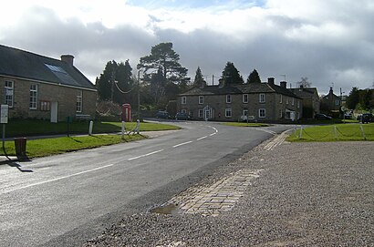
Directions to Romaldkirk (County Durham) with public transport
The following transport lines have routes that pass near Romaldkirk
How to get to Romaldkirk by bus?
Click on the bus route to see step by step directions with maps, line arrival times and updated time schedules.
Bus stations near Romaldkirk in County Durham
- Kirk Inn, Romaldkirk,2 min walk,
Bus lines to Romaldkirk in County Durham
- 95,Middleton In Teesdale,
- 96,Middleton In Teesdale,
What are the nearest stations to Romaldkirk?
The nearest stations to Romaldkirk are:
- Kirk Inn, Romaldkirk is 50 meters away, 2 min walk.
Which bus lines stop near Romaldkirk?
These bus lines stop near Romaldkirk: 95, 96.
What’s the nearest bus stop to Romaldkirk in County Durham?
The nearest bus stop to Romaldkirk in County Durham is Kirk Inn, Romaldkirk. It’s a 2 min walk away.
What time is the first bus to Romaldkirk in County Durham?
The 96 is the first bus that goes to Romaldkirk in County Durham. It stops nearby at 07:12.
What time is the last bus to Romaldkirk in County Durham?
The 95 is the last bus that goes to Romaldkirk in County Durham. It stops nearby at 19:10.
See Romaldkirk, County Durham, on the map
Public Transit to Romaldkirk in County Durham
Wondering how to get to Romaldkirk in County Durham, United Kingdom? Moovit helps you find the best way to get to Romaldkirk with step-by-step directions from the nearest public transit station.
Moovit provides free maps and live directions to help you navigate through your city. View schedules, routes, timetables, and find out how long does it take to get to Romaldkirk in real time.
Looking for the nearest stop or station to Romaldkirk? Check out this list of stops closest to your destination: Kirk Inn.
Bus:9596
Want to see if there’s another route that gets you there at an earlier time? Moovit helps you find alternative routes or times. Get directions from and directions to Romaldkirk easily from the Moovit App or Website.
We make riding to Romaldkirk easy, which is why over 1.5 million users, including users in County Durham, trust Moovit as the best app for public transit. You don’t need to download an individual bus app or train app, Moovit is your all-in-one transit app that helps you find the best bus time or train time available.
For information on prices of bus and train, costs and ride fares to Romaldkirk, please check the Moovit app.
Use the app to navigate to popular places including to the airport, hospital, stadium, grocery store, mall, coffee shop, school, college, and university.
Romaldkirk Address: Sennings Lane street in County Durham
Attractions near Romaldkirk
Teesdale Traditional Taverns,Kirk Inn,Hayberries Nature Reserve,Eggleston Hall,Gueswick Hills,Eggleston Hall Gardens,Eggleston,Holy Trinity Church,P Hobson,Thwaite Hall (car boot sale),T.E.J Parkin,Mickleton Post Office,Springwater View,Durham Dales Holiday Cottages,CA Gas Services Limited,Cobblers Barn,Pace,The Fox & Hounds Pub,Low Shipley,HyperdrugHow to get to popular attractions in County Durham with public transportation
ASDA Living, County Durham,Manor Walks Shopping Centre, Northumberland,Newcastle upon Tyne, Newcastle Upon Tyne,Hendon, Sunderland,Haggerton Castle Holiday Park - Haven, Northumberland,Rockliffe Hall Hotel, Darlington,CeX, Sunderland,Kenton, Newcastle Upon Tyne,Blue House Roundabout, Newcastle Upon Tyne,Tynemouth, North Tyneside,Preston Farm (Brewers Fayre), Stockton-On-Tees,Newcastle Racecourse, Newcastle Upon Tyne,Alnwick Castle, Northumberland,Testo's Roundabout, South Tyneside,Birtley High Street, Gateshead,The Electrical Wizard (Wetherspoon), Northumberland,Durham University, Queen's Campus, Stockton-On-Tees,No. 1 Bus, Newcastle Upon Tyne,Kingston Park Retail Park, Newcastle Upon Tyne,Whitley Bay Ice Rink, North TynesideGet around County Durham by public transport!
Travelling around County Durham has never been so easy. See step by step directions as you travel to any attraction, street or major public transport station. View bus and train timetables, arrival times, service alerts and detailed routes on a map, so you know exactly how to get to anywhere in County Durham.
When travelling to any destination around County Durham use Moovit's Live Directions with Get Off Notifications to know exactly where and how far to walk, how long to wait for your line , and how many stops are left. Moovit will alert you when it’s time to get off — no need to constantly re-check whether yours is the next stop.
Wondering how to use public transport in County Durham or how to pay for public transport in County Durham? Moovit public transport app can help you navigate your way with public transport easily, and at minimum cost. It includes public transport fees, ticket prices, and costs. Looking for a map of County Durham public transport lines? Moovit public transport app shows all public transport maps in County Durham with all bus or train routes and stops on an interactive map.
County Durham has 2 transport type(s), including: bus or train, operated by several transport agencies, including Go North East, Stagecoach North East, Stagecoach Cumbria and North Lancashire, Arriva North East, Gateshead Central Taxis, JH Coaches, Weardale Motor Services, Stanley Travel, Cumbria Classic Coaches, Peter Hogg of Jedburgh, Hodgsons, Tyne and Wear Metro, Ferryhill Village Travel, A-line Coaches and Upper Coquetdale Community Transport