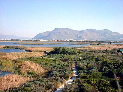
See Rondevlei, Wynberg, on the map
Directions to Rondevlei (Wynberg) with public transport
The following transport lines have routes that pass near Rondevlei
 Bus:
Bus: - Train:
How to get to Rondevlei by bus?
Click on the bus route to see step by step directions with maps, line arrival times and updated time schedules.
Train stations near Rondevlei in Wynberg
- Southfield,35 min walk,
- Retreat,62 min walk,
What are the nearest stations to Rondevlei?
The nearest stations to Rondevlei are:
- Southfield is 2655 meters away, 35 min walk.
- Retreat is 4596 meters away, 62 min walk.
Which bus line stops near Rondevlei?
BAYVIEW - CLAREMONT
What time is the first train to Rondevlei in Wynberg?
The CAPE FLATS is the first train that goes to Rondevlei in Wynberg. It stops nearby at 03:00.
What time is the last train to Rondevlei in Wynberg?
The CAPE FLATS is the last train that goes to Rondevlei in Wynberg. It stops nearby at 03:04.
See Rondevlei, Wynberg, on the map
Public Transit to Rondevlei in Wynberg
Wondering how to get to Rondevlei in Wynberg, South Africa? Moovit helps you find the best way to get to Rondevlei with step-by-step directions from the nearest public transit station.
Moovit provides free maps and live directions to help you navigate through your city. View schedules, routes, timetables, and find out how long does it take to get to Rondevlei in real time.
Looking for the nearest stop or station to Rondevlei? Check out this list of stops closest to your destination: Southfield; Retreat.
Bus:Train:
Want to see if there’s another route that gets you there at an earlier time? Moovit helps you find alternative routes or times. Get directions from and directions to Rondevlei easily from the Moovit App or Website.
We make riding to Rondevlei easy, which is why over 1.5 million users, including users in Wynberg, trust Moovit as the best app for public transit. You don’t need to download an individual bus app or train app, Moovit is your all-in-one transit app that helps you find the best bus time or train time available.
For information on prices of bus, costs and ride fares to Rondevlei, please check the Moovit app.
Use the app to navigate to popular places including to the airport, hospital, stadium, grocery store, mall, coffee shop, school, college, and university.
Location: Wynberg, Cape Town
Attractions near Rondevlei
rondevlei nature reserve,Rooikrans Sports Complex,CAFDA,Two Oceans Leadership Academy,Prince George Primary School,Lavender Hill High School,Zeekoevlei,Battswood Arts Centre,Grassy Park High School,Grassy Park,Zeekoevlei Kiteboarding,Lourier Primary School,Busy Corner Taxi Rank,Retreat Day Hospital,Sid G Rule Primary School,Zeekoevlei,Grassy Park EC Primary School,Retreat Library,Grassy Park,Grassy ParkHow to get to popular attractions in Wynberg with public transportation
Montagu, Paarl Mall, Paarl,Casa del Sol, Strand,Drama street, Somerset West,Klipfontein Rd., Mitchells Plain,Tong Lok Canal Walk, Cape,Eikenfontein Station, Kuils River,Happy R5 store, Simon Town,Eersterivier, Kuils River,Eskom Brackenfell, Kuils River,Table View, Cape,Green Point, Goodwood,Grassy Park, Wynberg,Kalk Bay, Simon Town,Sea Point Pavilion, Goodwood,Good Hope Christian Centre, Wynberg,Planning & Building Development, South Peninsula Municipality, Wynberg,Helderberg Village Walk, Somerset West,Camps bay high school, Goodwood,Sunbird Park, Kuils River,Arden Grove Business Park, CapeGet around Wynberg by public transport!
Travelling around Wynberg has never been so easy. See step by step directions as you travel to any attraction, street or major public transport station. View bus and train timetables, arrival times, service alerts and detailed routes on a map, so you know exactly how to get to anywhere in Wynberg.
When travelling to any destination around Wynberg use Moovit's Live Directions with Get Off Notifications to know exactly where and how far to walk, how long to wait for your line , and how many stops are left. Moovit will alert you when it’s time to get off — no need to constantly re-check whether yours is the next stop.
Wondering how to use public transport in Wynberg or how to pay for public transport in Wynberg? Moovit public transport app can help you navigate your way with public transport easily, and at minimum cost. It includes public transport fees, ticket prices, and costs. Looking for a map of Wynberg public transport lines? Moovit public transport app shows all public transport maps in Wynberg with all bus routes and stops on an interactive map.
Wynberg has 1 transport type(s), including: bus, operated by several transport agencies, including Golden Arrow, MyCiTi, Metrorail Western Cape, Intercape and City Sightseeing Cpt