Directions to Roundthorn Metrolink Station (Manchester) with public transport
The following transport lines have routes that pass near Roundthorn Metrolink Station
How to get to Roundthorn Metrolink Station by bus?
Click on the bus route to see step by step directions with maps, line arrival times and updated time schedules.
How to get to Roundthorn Metrolink Station by train?
Click on the train route to see step by step directions with maps, line arrival times and updated time schedules.
How to get to Roundthorn Metrolink Station by light rail?
Click on the light rail route to see step by step directions with maps, line arrival times and updated time schedules.
Light Rail stations near Roundthorn Metrolink Station in Manchester
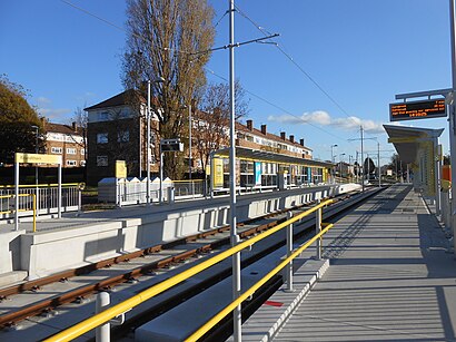
- Roundthorn (Manchester Metrolink),1 min walk,
Bus stations near Roundthorn Metrolink Station in Manchester
- Southmoor Road (Stop C),3 min walk,
- Ledson Road (Stop B),3 min walk,
- Roundthorn Way,3 min walk,
- Black Boy,4 min walk,
- The Red Rose,5 min walk,
Bus lines to Roundthorn Metrolink Station in Manchester
- 11,Stockport - Altrincham,
- 18,Manchester - Eccles,
- 19,Manchester - Altrincham,
- 44,Altrincham - Manchester,
- 368,Stockport - Manchester,
- 751,John Leigh Park,
- 752,Cheadle Heath,
- 101,Piccadilly Gardens,
- 774,Timperley,
- 769,Hale Barns,
What are the nearest stations to Roundthorn Metrolink Station?
The nearest stations to Roundthorn Metrolink Station are:
- Roundthorn (Manchester Metrolink) is 16 meters away, 1 min walk.
- Southmoor Road (Stop C) is 161 meters away, 3 min walk.
- Ledson Road (Stop B) is 173 meters away, 3 min walk.
- Roundthorn Way is 187 meters away, 3 min walk.
- Black Boy is 268 meters away, 4 min walk.
- The Red Rose is 373 meters away, 5 min walk.
Which bus line stops near Roundthorn Metrolink Station?
101
Which train line stops near Roundthorn Metrolink Station?
NORTHERN
Which light rail line stops near Roundthorn Metrolink Station?
NAVY LINE
What’s the nearest light rail station to Roundthorn Metrolink Station in Manchester?
The nearest light rail station to Roundthorn Metrolink Station in Manchester is Roundthorn (Manchester Metrolink). It’s a 1 min walk away.
What’s the nearest bus stop to Roundthorn Metrolink Station in Manchester?
The nearest bus stops to Roundthorn Metrolink Station in Manchester are Southmoor Road (Stop C), Ledson Road (Stop B) and Roundthorn Way. The closest one is a 3 min walk away.
What time is the first light rail to Roundthorn Metrolink Station in Manchester?
The NAVY LINE is the first light rail that goes to Roundthorn Metrolink Station in Manchester. It stops nearby at 05:22.
What time is the last light rail to Roundthorn Metrolink Station in Manchester?
The NAVY LINE is the last light rail that goes to Roundthorn Metrolink Station in Manchester. It stops nearby at 00:36.
What time is the first bus to Roundthorn Metrolink Station in Manchester?
The 101 is the first bus that goes to Roundthorn Metrolink Station in Manchester. It stops nearby at 04:35.
What time is the last bus to Roundthorn Metrolink Station in Manchester?
The 101 is the last bus that goes to Roundthorn Metrolink Station in Manchester. It stops nearby at 00:58.
See Roundthorn Metrolink Station, Manchester, on the map
Public Transit to Roundthorn Metrolink Station in Manchester
Wondering how to get to Roundthorn Metrolink Station in Manchester, United Kingdom? Moovit helps you find the best way to get to Roundthorn Metrolink Station with step-by-step directions from the nearest public transit station.
Moovit provides free maps and live directions to help you navigate through your city. View schedules, routes, timetables, and find out how long does it take to get to Roundthorn Metrolink Station in real time.
Looking for the nearest stop or station to Roundthorn Metrolink Station? Check out this list of stops closest to your destination: Roundthorn (Manchester Metrolink); Southmoor Road (Stop C); Ledson Road (Stop B); Roundthorn Way; Black Boy; The Red Rose.
Bus:10111181944368751752774769Train:NORTHERNLight rail:NAVY LINE
Want to see if there’s another route that gets you there at an earlier time? Moovit helps you find alternative routes or times. Get directions from and directions to Roundthorn Metrolink Station easily from the Moovit App or Website.
We make riding to Roundthorn Metrolink Station easy, which is why over 1.5 million users, including users in Manchester, trust Moovit as the best app for public transit. You don’t need to download an individual bus app or train app, Moovit is your all-in-one transit app that helps you find the best bus time or train time available.
For information on prices of light rail, bus and train, costs and ride fares to Roundthorn Metrolink Station, please check the Moovit app.
Use the app to navigate to popular places including to the airport, hospital, stadium, grocery store, mall, coffee shop, school, college, and university.
Roundthorn Metrolink Station Address: Southmoor Rd street in Manchester
Attractions near Roundthorn Metrolink Station
Carol Kendrick Unit,The Carol Kendrick Centre,Roundthorn tram stop,STERIS IMS (Pegasus House),Opal House,Bowland Medical Practice,Nightingale Centre,Howdens Joinery - Wythenshawe,Virgin Media,International House,M23 9qz,Wythenshawe Hospital Pharmacy,M23 9nx,Wythenshawe Hospital Bus Stop,Wilson Ward,Southmoor Road,Beers Timber & Building Supplies,JD Gym Wythenshawe,Wythenshawe Hospital,Wythenshawe HospitalHow to get to popular attractions in Manchester with public transportation
Pear Mill, Bredbury,Doubletree by Hilton Manchester Airport, Manchester,Salford Royal Nhs Foundation Trust, Salford,Clatterbridge Hospital, Bromborough,Central Pier, Blackpool,Cineworld Ashton, Ashton Under Lyne,O2 Apollo Manchester, Manchester,Whitworth Park, Manchester,Alder Hey Children's Hospital (Abandoned), Liverpool,Sapporo Teppanyaki, Manchester,The Printworks, Manchester,University Hospital Aintree, Fazakerley,Newton Heath, Manchester,Goodison Park, Liverpool,Lowry Outlet Shopping, Salford,Prestwich Hospital (Edenfield Centre), Prestwich,Monton, Worsley,The Blackpool Sixth Form College, Blackpool,Moston, Manchester,Halewood Park Environmental Centre, HalewoodGet around Manchester by public transport!
Travelling around Manchester has never been so easy. See step by step directions as you travel to any attraction, street or major public transport station. View bus and train timetables, arrival times, service alerts and detailed routes on a map, so you know exactly how to get to anywhere in Manchester.
When travelling to any destination around Manchester use Moovit's Live Directions with Get Off Notifications to know exactly where and how far to walk, how long to wait for your line , and how many stops are left. Moovit will alert you when it’s time to get off — no need to constantly re-check whether yours is the next stop.
Wondering how to use public transport in Manchester or how to pay for public transport in Manchester? Moovit public transport app can help you navigate your way with public transport easily, and at minimum cost. It includes public transport fees, ticket prices, and costs. Looking for a map of Manchester public transport lines? Moovit public transport app shows all public transport maps in Manchester with all light rail, bus or train routes and stops on an interactive map.
Manchester has 3 transport type(s), including: light rail, bus or train, operated by several transport agencies, including Stagecoach Manchester, Arriva North West, Diamond Bus North West, Stagecoach Merseyside and South Lancashire, Stagecoach Cumbria and North Lancashire, First Greater Manchester, First Halifax, National Express, Warrington's Own Buses, First Potteries, Rosso, Blackpool Transport, Blackpool Transport, The Blackburn Bus Company and The Burnley Bus Company