Rowley Regis Station stop - Monday schedule
| Line | Direction | Time |
|---|---|---|
| 231 | Halesowen | 07:38 |
| 231 | Halesowen | 08:38 |
| 231 | Halesowen | 09:38 |
| 231 | Halesowen | 10:38 |
| 231 | Halesowen | 11:38 |
| 231 | Halesowen | 12:38 |
| 231 | Halesowen | 13:38 |
| 231 | Halesowen | 14:38 |
| 231 | Halesowen | 15:38 |
| 231 | Halesowen | 16:38 |
| 231 | Halesowen | 17:38 |
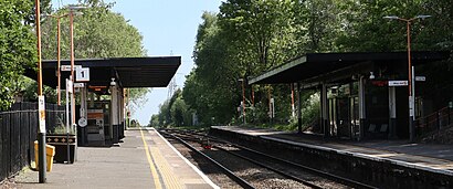
See Rowley Regis Station, Blackheath, on the map
Directions to Rowley Regis Station (Blackheath) with public transport
The following transport lines have routes that pass near Rowley Regis Station
 Bus:
Bus: - Train:
How to get to Rowley Regis Station by bus?
Click on the bus route to see step by step directions with maps, line arrival times and updated time schedules.
How to get to Rowley Regis Station by train?
Click on the train route to see step by step directions with maps, line arrival times and updated time schedules.
Bus stations near Rowley Regis Station in Blackheath
- Rowley Regis Station,1 min walk,
- Houston Way (Stop Bn),4 min walk,
- Station Rd,6 min walk,
- Blackheath Market,8 min walk,
Train stations near Rowley Regis Station in Blackheath
- Cradley Heath,20 min walk,
- Sandwell & Dudley,31 min walk,
Bus lines to Rowley Regis Station in Blackheath
- 231,Blackheath,
- 13A,Blackheath,
- 4,Blackheath,
- 4H,Hayley Green,
- 4H,Walsall,
- 4M,Merry Hill,
- X8,Birmingham,
- 14,Swan Village,
- 14A,Dudley,
What are the nearest stations to Rowley Regis Station?
The nearest stations to Rowley Regis Station are:
- Rowley Regis Station is 61 meters away, 1 min walk.
- Houston Way (Stop Bn) is 251 meters away, 4 min walk.
- Station Rd is 386 meters away, 6 min walk.
- Blackheath Market is 605 meters away, 8 min walk.
- Cradley Heath is 1553 meters away, 20 min walk.
- Sandwell & Dudley is 2353 meters away, 31 min walk.
Which bus lines stop near Rowley Regis Station?
These bus lines stop near Rowley Regis Station: 4, 4M, X8
Which train lines stop near Rowley Regis Station?
These train lines stop near Rowley Regis Station: WEST MIDLANDS RAILWAY
What’s the nearest train station to Rowley Regis Station in Blackheath?
The nearest train station to Rowley Regis Station in Blackheath is Cradley Heath. It’s a 20 min walk away.
What’s the nearest bus stop to Rowley Regis Station in Blackheath?
The nearest bus stop to Rowley Regis Station in Blackheath is Rowley Regis Station. It’s a 1 min walk away.
What time is the first train to Rowley Regis Station in Blackheath?
The AVANTI WEST COAST is the first train that goes to Rowley Regis Station in Blackheath. It stops nearby at 08:12.
What time is the last train to Rowley Regis Station in Blackheath?
The WEST MIDLANDS RAILWAY is the last train that goes to Rowley Regis Station in Blackheath. It stops nearby at 23:55.
What time is the first bus to Rowley Regis Station in Blackheath?
The X8 is the first bus that goes to Rowley Regis Station in Blackheath. It stops nearby at 06:37.
What time is the last bus to Rowley Regis Station in Blackheath?
The 13A is the last bus that goes to Rowley Regis Station in Blackheath. It stops nearby at 00:03.
How much is the train fare to Rowley Regis Station?
The train fare to Rowley Regis Station costs about £3.00 - £7.80.
How much is the bus fare to Rowley Regis Station?
The bus fare to Rowley Regis Station costs about £2.40.
How much is the light rail fare to Rowley Regis Station?
The light rail fare to Rowley Regis Station costs about £1.90 - £4.50.
See Rowley Regis Station, Blackheath, on the map
Public transport to Rowley Regis Station stop (ID: nwmtdmda) in Blackheath
Looking for directions to Rowley Regis Station in Blackheath, United Kingdom?
Download the Moovit App to find the current schedule and step-by-step directions for Bus, Train or Light rail routes that pass through Rowley Regis Station.
Looking for the nearest stops closest to Rowley Regis Station ? Check out this list of closest stops to your destination: Rowley Regis Station; Houston Way (Stop Bn); Station Rd; Blackheath Market; Cradley Heath; Sandwell & Dudley.
Bus:Train:
We make riding on public transit to Rowley Regis Station easy, which is why over 1.5 million users, including users in Blackheath trust Moovit as the best app for public transit.
Use the app to navigate to popular places including to the airport, hospital, stadium, grocery store, mall, coffee shop, school, college, and university.
Rowley Regis Station stop’s code is nwmtdmda
The first line to this stop is 231, at 07:38, and the last line is 231 at 17:38.
Great Western Road, Birmingham/Wolverhampton/Walsall/Dudley, England, United Kingdom
This stop serves Diamond Bus’s lines
Bus stops near Rowley Regis Station
Rowley Regis Station,Houston Way (Stop Bn),Station Rd,Blackheath MarketPopular public transport stations in Blackheath
Steelhouse Lane (Stop Sq7),D & G Bus Depot,Badgers Bank Rd,Smithfield Shopping Centre,Union Rd,Black Country Museum,Magistrates Court,St Nicolas Park Drive,Newtown Police Station,Dove Valley Business Park,Salop Leisure,Tunnel St,University North Gate,Queens Rd,Bacons End Island,Senneleys Park,The Learning Hub,Embassy Drive (Stop Fl),Sandwell & Dudley Station,Packington AvenueGet around Blackheath by public transport!
Travelling around Blackheath has never been so easy. See step by step directions as you travel to any attraction, street or major public transport station. View bus and train timetables, arrival times, service alerts and detailed routes on a map, so you know exactly how to get to anywhere in Blackheath.
When travelling to any destination around Blackheath use Moovit's Live Directions with Get Off Notifications to know exactly where and how far to walk, how long to wait for your line , and how many stops are left. Moovit will alert you when it’s time to get off — no need to constantly re-check whether yours is the next stop.
Wondering how to use public transport in Blackheath or how to pay for public transport in Blackheath? Moovit public transport app can help you navigate your way with public transport easily, and at minimum cost. It includes public transport fees, ticket prices, and costs. Looking for a map of Blackheath public transport lines? Moovit public transport app shows all public transport maps in Blackheath with all bus, train or light rail routes and stops on an interactive map.
Blackheath has 3 transport type(s), including: bus, train or light rail, operated by several transport agencies, including National Express West Midlands, National Express Coventry, National Express, Diamond Bus, Arriva Midlands, Stagecoach Midlands, West Midlands Metro, Stagecoach West, Stagecoach South Wales, First Potteries, First Worcestershire, LandFlight, trentbarton, Flexibus and Lakeside Coaches