Directions to Royal Manchester Children’S Hospital with public transportation
The following transport lines have routes that pass near Royal Manchester Children’S Hospital
How to get to Royal Manchester Children’S Hospital by bus?
Click on the bus route to see step by step directions with maps, line arrival times and updated time schedules.
How to get to Royal Manchester Children’S Hospital by train?
Click on the train route to see step by step directions with maps, line arrival times and updated time schedules.
How to get to Royal Manchester Children’S Hospital by light rail?
Click on the light rail route to see step by step directions with maps, line arrival times and updated time schedules.
Bus stations near Royal Manchester Children’S Hospital
- St Mary's (Stop R),3 min walk,
- Hathersage Road (Stop N),4 min walk,
- Manchester Royal Infirmary (Stop S),5 min walk,
- St Mary's (Stop B),5 min walk,
- St Mary's (Stop T),5 min walk,
- Manchester Royal Infirmary (Stop E),6 min walk,
- Manchester Royal Infirmary (Stop C),7 min walk,
Train stations near Royal Manchester Children’S Hospital
- Manchester Oxford Road,28 min walk,
- Manchester Piccadilly,33 min walk,
Light Rail stations near Royal Manchester Children’S Hospital
- Piccadilly (Manchester Metrolink),32 min walk,
Bus routes to Royal Manchester Children’S Hospital
- 41,Sale,
- 42,Stockport,
- 42B,Woodford,
- 43,Manchester Airport,
- 142,East Didsbury,
- 143,Piccadilly Gardens,
- 742,Hulme,
- 749,Burnage,
- 50,East Didsbury,
- 53,Cheetham Hill,
- 751,Piccadilly Gardens,
- V1,Manchester Royal Infirmary,
- V2,Atherton,
- V4,Ellenbrook,
- 18,Langley,
- 15,Manchester - Urmston,
- 42A,Manchester -,
- 42C,Manchester - Handforth,
- 111,Manchester,
- 147,Manchester Royal Infirmary,
What are the nearest stations to Royal Manchester Children’S Hospital?
The nearest stations to Royal Manchester Children’S Hospital are:
- St Mary's (Stop R) is 174 meters away, 3 min walk.
- Hathersage Road (Stop N) is 254 meters away, 4 min walk.
- Manchester Royal Infirmary (Stop S) is 300 meters away, 5 min walk.
- St Mary's (Stop B) is 301 meters away, 5 min walk.
- St Mary's (Stop T) is 333 meters away, 5 min walk.
- Manchester Royal Infirmary (Stop E) is 416 meters away, 6 min walk.
- Manchester Royal Infirmary (Stop C) is 438 meters away, 7 min walk.
- Manchester Oxford Road is 2100 meters away, 28 min walk.
- Piccadilly (Manchester Metrolink) is 2421 meters away, 32 min walk.
- Manchester Piccadilly is 2449 meters away, 33 min walk.
Which bus lines stop near Royal Manchester Children’S Hospital?
These bus lines stop near Royal Manchester Children’S Hospital: 15, 18, 192, 41, 42, 42B, 43, 50, V1.
Which train lines stop near Royal Manchester Children’S Hospital?
These train lines stop near Royal Manchester Children’S Hospital: NORTHERN, TRANSPENNINE EXPRESS.
Which light rail lines stop near Royal Manchester Children’S Hospital?
These light rail lines stop near Royal Manchester Children’S Hospital: BLUE LINE, NAVY LINE, PINK LINE.
What’s the nearest train station to Royal Manchester Children’S Hospital?
The nearest train station to Royal Manchester Children’S Hospital is Manchester Oxford Road. It’s a 28 min walk away.
What’s the nearest bus stop to Royal Manchester Children’S Hospital?
The nearest bus stop to Royal Manchester Children’S Hospital is St Mary's (Stop R). It’s a 3 min walk away.
What time is the first light rail to Royal Manchester Children’S Hospital?
The BLUE LINE is the first light rail that goes to Royal Manchester Children’S Hospital. It stops nearby at 06:18.
What time is the last light rail to Royal Manchester Children’S Hospital?
The BLUE LINE is the last light rail that goes to Royal Manchester Children’S Hospital. It stops nearby at 00:24.
What time is the first train to Royal Manchester Children’S Hospital?
The NORTHERN is the first train that goes to Royal Manchester Children’S Hospital. It stops nearby at 07:35.
What time is the last train to Royal Manchester Children’S Hospital?
The TRANSPENNINE EXPRESS is the last train that goes to Royal Manchester Children’S Hospital. It stops nearby at 04:59.
What time is the first bus to Royal Manchester Children’S Hospital?
The 43 is the first bus that goes to Royal Manchester Children’S Hospital. It stops nearby at 03:04.
What time is the last bus to Royal Manchester Children’S Hospital?
The 43 is the last bus that goes to Royal Manchester Children’S Hospital. It stops nearby at 03:35.
See Royal Manchester Children’S Hospital on the map
Public Transportation to Royal Manchester Children’S Hospital
Wondering how to get to Royal Manchester Children’S Hospital, United Kingdom? Moovit helps you find the best way to get to Royal Manchester Children’S Hospital with step-by-step directions from the nearest public transit station.
Moovit provides free maps and live directions to help you navigate through your city. View schedules, routes, timetables, and find out how long does it take to get to Royal Manchester Children’S Hospital in real time.
Looking for the nearest stop or station to Royal Manchester Children’S Hospital? Check out this list of stops closest to your destination: St Mary's (Stop R); Hathersage Road (Stop N); Manchester Royal Infirmary (Stop S); St Mary's (Stop B); St Mary's (Stop T); Manchester Royal Infirmary (Stop E); Manchester Royal Infirmary (Stop C); Manchester Oxford Road; Piccadilly (Manchester Metrolink); Manchester Piccadilly.
Bus:1518192414242B4350V11425375142A42C111V2V4Train:NORTHERNTRANSPENNINE EXPRESSEAST MIDLANDS RAILWAYTRANSPORT FOR WALESAVANTI WEST COASTCROSSCOUNTRYLight rail:BLUE LINENAVY LINEPINK LINE
Want to see if there’s another route that gets you there at an earlier time? Moovit helps you find alternative routes or times. Get directions from and directions to Royal Manchester Children’S Hospital easily from the Moovit App or Website.
We make riding to Royal Manchester Children’S Hospital easy, which is why over 1.5 million users, including users in Manchester, trust Moovit as the best app for public transit. You don’t need to download an individual bus app or train app, Moovit is your all-in-one transit app that helps you find the best bus time or train time available.
For information on prices of bus, light rail and train, costs and ride fares to Royal Manchester Children’S Hospital, please check the Moovit app.
Use the app to navigate to popular places including to the airport, hospital, stadium, grocery store, mall, coffee shop, school, college, and university.
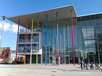
Royal Manchester Children’S Hospital Address: North Road street in Manchester
Popular routes to Royal Manchester Children’S Hospital
Attractions near Royal Manchester Children’S Hospital
Costa Coffee,RMCH Boardroom,M13 0je,Harrington Building,Central Manchester Childrens Hospital A&E,Ronald McDonald House Manchester,Rawnsley Building,Saint Mary’S Hospital,St. Mary's Hospital,Tommy’s Maternal and Fetal Health Research Centre,Saint Mary s Hospital,Peter Mount Building,M13 9WL,Mark and Spencer,Central Manchester University Hospitals NHS Foundation Trust,Andrology Laboratory Within Old St Marys Hospital,The Boulevard,Manchester Royal Eye Hospital,Clinical Sciences Building 2,CMFT the ConservatoryHow to get to popular attractions in Manchester with public transportation
Bowlers Exhibition Centre, Trafford Park,Amazon MAN1 fulfillment center, Manchester,Robin Retail Park, Wigan,Stepping Hill Hospital, Stockport,New Royal Liverpool University Hospital, Liverpool,Rail Replacement bus, Manchester,Manchester Piccadilly Railway Station (MAN), Manchester,Runway Visitor Park, Manchester,Gemini Retail Park, Warrington,M53 Junction 5 / A41, Bromborough,Loreto College, Manchester, Manchester,Aviation Viewing Park, Manchester, Manchester,Royal Bolton Hospital, Bolton,Quay Street, Manchester,378 Bus to Wilmslow, Stockport,Withington Community Hospital, Manchester,The Walton Centre, Fazakerley,Alder Hey Children's Hospital, Liverpool,Royal Liverpool University Hospital, Liverpool,Broadgreen Hospital, LiverpoolGet around Manchester by public transport!
Travelling around Manchester has never been so easy. See step by step directions as you travel to any attraction, street or major public transport station. View bus and train timetables, arrival times, service alerts and detailed routes on a map, so you know exactly how to get to anywhere in Manchester.
When travelling to any destination around Manchester use Moovit's Live Directions with Get Off Notifications to know exactly where and how far to walk, how long to wait for your line , and how many stops are left. Moovit will alert you when it’s time to get off — no need to constantly re-check whether yours is the next stop.
Wondering how to use public transport in Manchester or how to pay for public transport in Manchester? Moovit public transport app can help you navigate your way with public transport easily, and at minimum cost. It includes public transport fees, ticket prices, and costs. Looking for a map of Manchester public transport lines? Moovit public transport app shows all public transport maps in Manchester with all bus, light rail or train routes and stops on an interactive map.
Manchester has 3 transport type(s), including: bus, light rail or train, operated by several transport agencies, including Stagecoach Manchester, Arriva North West, Diamond Bus North West, Stagecoach Merseyside and South Lancashire, Stagecoach Cumbria and North Lancashire, First Greater Manchester, First Halifax, National Express, Warrington's Own Buses, First Potteries, Rosso, Blackpool Transport, Blackpool Transport, The Blackburn Bus Company and The Burnley Bus Company