Directions to Royal Worlington And Newmarket Golf Club (Forest Heath) with public transport
The following transport lines have routes that pass near Royal Worlington And Newmarket Golf Club
How to get to Royal Worlington And Newmarket Golf Club by bus?
Click on the bus route to see step by step directions with maps, line arrival times and updated time schedules.
Bus stops near Royal Worlington And Newmarket Golf Club in Forest Heath
- Walnut Tree, Worlington, 10 min walk,
Bus lines to Royal Worlington And Newmarket Golf Club in Forest Heath
- 16, Bury St Edmunds,
- 16A, Newmarket,
- 357, Bury St Edmunds - Red Lodge - Mildenhall,
- 956, Lakenheath - Mildenhall - Bury St Edmunds,
What are the nearest stations to Royal Worlington And Newmarket Golf Club?
The nearest stations to Royal Worlington And Newmarket Golf Club are:
- Walnut Tree, Worlington is 657 meters away, 10 min walk.
Which bus lines stop near Royal Worlington And Newmarket Golf Club?
These bus lines stop near Royal Worlington And Newmarket Golf Club: 16, 200.
What’s the nearest bus stop to Royal Worlington And Newmarket Golf Club in Forest Heath?
The nearest bus stop to Royal Worlington And Newmarket Golf Club in Forest Heath is Walnut Tree, Worlington. It’s a 10 min walk away.
See Royal Worlington And Newmarket Golf Club, Forest Heath, on the map
Public Transit to Royal Worlington And Newmarket Golf Club in Forest Heath
Wondering how to get to Royal Worlington And Newmarket Golf Club in Forest Heath, United Kingdom? Moovit helps you find the best way to get to Royal Worlington And Newmarket Golf Club with step-by-step directions from the nearest public transit station.
Moovit provides free maps and live directions to help you navigate through your city. View schedules, routes, timetables, and find out how long does it take to get to Royal Worlington And Newmarket Golf Club in real time.
Looking for the nearest stop or station to Royal Worlington And Newmarket Golf Club? Check out this list of stops closest to your destination: Walnut Tree.
Bus: 16, 200, 16A, 357, 956.
Want to see if there’s another route that gets you there at an earlier time? Moovit helps you find alternative routes or times. Get directions from and directions to Royal Worlington And Newmarket Golf Club easily from the Moovit App or Website.
We make riding to Royal Worlington And Newmarket Golf Club easy, which is why over 1.5 million users, including users in Forest Heath, trust Moovit as the best app for public transit. You don’t need to download an individual bus app or train app, Moovit is your all-in-one transit app that helps you find the best bus time or train time available.
For information on prices of bus and train, costs and ride fares to Royal Worlington And Newmarket Golf Club, please check the Moovit app.
Use the app to navigate to popular places including to the airport, hospital, stadium, grocery store, mall, coffee shop, school, college, and university.
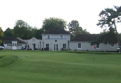
Royal Worlington And Newmarket Golf Club Address: Golf Links Road street in Forest Heath
Attractions near Royal Worlington And Newmarket Golf Club
Cambridge University Golf Club,G & E Redhead Limited,Worlington,Worlington Hall,Walnut Tree,Worlington Village Hall,Worlington,Worlington Cricket Club,Moat,Worlington,Louis James-Parker,T S R Tuning,Joanna Samuel,All Saints,Grange Farm,Quantum Engineering Disciplines,MNM Care Limited,Drivewise Suffolk,Jake Smith,Mildenhall Jobcentre PlusHow to get to popular attractions in Forest Heath with public transportation
Cambridge Judge Business School, Cambridge,Scudamore's Boatyard Punt Station, Cambridge,UEA LCR, Norwich,Madingley Road Park & Ride, Cambridge,Cambourne, South Cambridgeshire,Whittlesford Parkway Railway Station (WLF), South Cambridgeshire,Roys Of Wroxham, North Norfolk,Addenbrooke's Hospital (Outpatients Block), Cambridge,Stilton, Huntingdonshire,Norfolk and Norwich University Hospital, South Norfolk,Bell School Of Cambridge, Cambridge,Cambridge University Sports Centre, Cambridge,Sainsbury's, Ipswich,Christchurch Park, Ipswich,Wymondham, South Norfolk,Attleborough Railway Station (ATL), Breckland,Crown Point Maintenance Depot, Norwich,Hellesdon, Norwich,Kings Lynn Railway Station (KLN), King'S Lynn And West Norfolk,Needham Lake, Mid SuffolkGet around East Anglia by public transport!
Travelling around East Anglia has never been so easy. See step by step directions as you travel to any attraction, street or major public transport station. View bus and train timetables, arrival times, service alerts and detailed routes on a map, so you know exactly how to get to anywhere in East Anglia.
When travelling to any destination around East Anglia use Moovit's Live Directions with Get Off Notifications to know exactly where and how far to walk, how long to wait for your line , and how many stops are left. Moovit will alert you when it’s time to get off — no need to constantly re-check whether yours is the next stop.
Wondering how to use public transport in East Anglia or how to pay for public transport in East Anglia? Moovit public transport app can help you navigate your way with public transport easily, and at minimum cost. It includes public transport fees, ticket prices, and costs. Looking for a map of East Anglia public transport lines? Moovit public transport app shows all public transport maps in East Anglia with all Bus, Train and Ferry routes and stops on an interactive map.
East Anglia has 3 transport type(s), including: Bus, Train and Ferry, operated by several transport agencies, including National Rail, Ambassador Travel, Harwich Harbour Ferry, Stephensons of Essex, Villager Minibus Sharnbrook, The Voluntary Network, Dews Coaches, Lord's Travel, Felixstowe Ferry Boat Yard, Hadleigh Community Transport, Beestons, Fenland Association for Community Transport, First Norfolk & Suffolk, Mulleys Motorways, Halesworth Area Community Transport