See Rushcutters, Darlinghurst, on the map
Directions to Rushcutters (Darlinghurst) with public transport
The following transport lines have routes that pass near Rushcutters
 Bus:
Bus: - Train:
How to get to Rushcutters by bus?
Click on the bus route to see step by step directions with maps, line arrival times and updated time schedules.
How to get to Rushcutters by train?
Click on the train route to see step by step directions with maps, line arrival times and updated time schedules.
Bus stations near Rushcutters in Darlinghurst
- Craigend St After Neild Av,3 min walk,
- Bayswater Rd After Waratah St,4 min walk,
- Lawson St At Vialoux Ave,4 min walk,
- Bayswater Rd Before New Beach Rd,5 min walk,
Bus lines to Rushcutters in Darlinghurst
- 324,Vaucluse Heights,
- 325,Walsh Bay,
- 602E,Kings Cross,
- 613E,Edgecliff,
- 725E,Watsons Bay,
- 388,Bondi Junction,
- 687E,Bondi Junction,
What are the nearest stations to Rushcutters?
The nearest stations to Rushcutters are:
- Craigend St After Neild Av is 197 meters away, 3 min walk.
- Bayswater Rd After Waratah St is 258 meters away, 4 min walk.
- Lawson St At Vialoux Ave is 294 meters away, 4 min walk.
- Bayswater Rd Before New Beach Rd is 325 meters away, 5 min walk.
Which bus lines stop near Rushcutters?
These bus lines stop near Rushcutters: 311, 324, 325.
Which train line stops near Rushcutters?
T4
What’s the nearest bus stop to Rushcutters in Darlinghurst?
The nearest bus stop to Rushcutters in Darlinghurst is Craigend St After Neild Av. It’s a 3 min walk away.
See Rushcutters, Darlinghurst, on the map
Public Transit to Rushcutters in Darlinghurst
Wondering how to get to Rushcutters in Darlinghurst, Australia? Moovit helps you find the best way to get to Rushcutters with step-by-step directions from the nearest public transit station.
Moovit provides free maps and live directions to help you navigate through your city. View schedules, routes, timetables, and find out how long does it take to get to Rushcutters in real time.
Looking for the nearest stop or station to Rushcutters? Check out this list of stops closest to your destination: Craigend St After Neild Av; Bayswater Rd After Waratah St; Lawson St At Vialoux Ave; Bayswater Rd Before New Beach Rd.
Bus:Train:
Want to see if there’s another route that gets you there at an earlier time? Moovit helps you find alternative routes or times. Get directions from and directions to Rushcutters easily from the Moovit App or Website.
We make riding to Rushcutters easy, which is why over 1.5 million users, including users in Darlinghurst, trust Moovit as the best app for public transit. You don’t need to download an individual bus app or train app, Moovit is your all-in-one transit app that helps you find the best bus time or train time available.
For information on prices of bus, train and ferry, costs and ride fares to Rushcutters, please check the Moovit app.
Use the app to navigate to popular places including to the airport, hospital, stadium, grocery store, mall, coffee shop, school, college, and university.
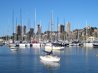
Rushcutters Address: map 10 Neild Avenue street in Darlinghurst
Attractions near Rushcutters
Sourceress The Store,Bar Machiavelli,POPteno,12 Neild Avenue,Advanx,Yellow Bistro,Marta Osteria,Verve Studio,Cafe Maybe,BMW Service Centre,Mapen, Japanese Restaurant,Rushcutters Bay,Crown Lane,The Bayswater,Green Bay Cafe,BMW Sydney,Weigall Sports Ground,Sydney City Lexus,Sandersons Rushcutters Bay - Mercedes-Benz,panorama pizzeriaHow to get to popular attractions in Darlinghurst with public transportation
King Street Brewhouse, Sydney,Marquee, Pyrmont,Coogee, Coogee (NSW),Artarmon Station (Platform 2), Artarmon,Circular Quay, No. 3 Wharf, Sydney,Strathfield Station (Main Concourse), Strathfield (NSW),Sydney Airport (SYD), Mascot,Goulburn, Goulburn,Toongabbie Station, Toongabbie (NSW),The M5/M7 Pyramid, Prestons,Bar Reggio, Darlinghurst,Westfield Miranda, Miranda (NSW),Munich Brauhaus, The Rocks (Sydney - NSW),The Star Casino, Pyrmont,Watsons Bay, Watsons Bay,Panania Station, Panania,The Grounds of Alexandria, Alexandria,St Marys Station, St Marys (NSW),Lewisham Station, Lewisham (NSW),Quakers Hill Station, Quakers HillGet around Darlinghurst by public transport!
Travelling around Darlinghurst has never been so easy. See step by step directions as you travel to any attraction, street or major public transport station. View bus and train timetables, arrival times, service alerts and detailed routes on a map, so you know exactly how to get to anywhere in Darlinghurst.
When travelling to any destination around Darlinghurst use Moovit's Live Directions with Get Off Notifications to know exactly where and how far to walk, how long to wait for your line , and how many stops are left. Moovit will alert you when it’s time to get off — no need to constantly re-check whether yours is the next stop.
Wondering how to use public transport in Darlinghurst or how to pay for public transport in Darlinghurst? Moovit public transport app can help you navigate your way with public transport easily, and at minimum cost. It includes public transport fees, ticket prices, and costs. Looking for a map of Darlinghurst public transport lines? Moovit public transport app shows all public transport maps in Darlinghurst with all bus, train or ferry routes and stops on an interactive map.
Darlinghurst has 3 transport type(s), including: bus, train or ferry, operated by several transport agencies, including Sydney Metro, Sydney Trains, Sydney Light Rail, Sydney Ferries, Intercity Trains, Intercity Train, NSW TrainLink, CDC NSW R14, U-Go Mobility, Keolis Downer Northern Beaches, Manly Fast Ferry, Transdev John Holland Buses, Busways, Busways North West and Dysons Buslines