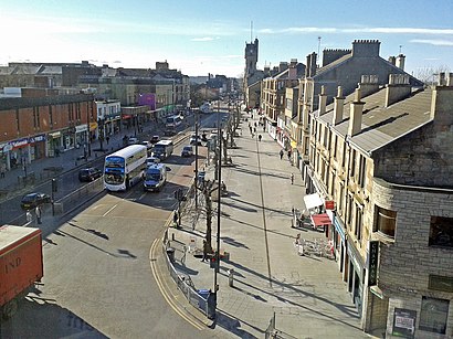
Directions to Rutherglen with public transportation
The following transport lines have routes that pass near Rutherglen
How to get to Rutherglen by bus?
Click on the bus route to see step by step directions with maps, line arrival times and updated time schedules.
How to get to Rutherglen by train?
Click on the train route to see step by step directions with maps, line arrival times and updated time schedules.
Bus stations near Rutherglen
- Kirkwood Street, Rutherglen, 6 min walk,
- Dryburgh Avenue, Rutherglen, 9 min walk,
- Rutherglen, 10 min walk,
- Farme Cross, Rutherglen, 10 min walk,
Bus routes to Rutherglen
- M2, Toryglen - Castlemilk,
- 7, Rutherglen, Caledonia Ave - Summerston,
- 7A, Westburn - Summerston,
- 90, Partick Bus Station - QEUH, Arrivals Sq,
- 190, Govan - Inner Circle,
- 18, Glasgow,
- SCOTRAIL, Cumbernauld,
- 46, Easterhouse,
- 46, Shettleston,
- 65, Glasgow,
- 189, Govan Bus Interchange,
What are the nearest stations to Rutherglen?
The nearest stations to Rutherglen are:
- Kirkwood Street, Rutherglen is 410 meters away, 6 min walk.
- Dryburgh Avenue, Rutherglen is 591 meters away, 9 min walk.
- Rutherglen is 702 meters away, 10 min walk.
- Farme Cross, Rutherglen is 731 meters away, 10 min walk.
Which bus lines stop near Rutherglen?
These bus lines stop near Rutherglen: 267, 7, 90.
Which train line stops near Rutherglen?
SCOTRAIL
What’s the nearest bus stop to Rutherglen?
The nearest bus stop to Rutherglen is Kirkwood Street, Rutherglen. It’s a 6 min walk away.
See Rutherglen on the map
Public Transportation to Rutherglen
Wondering how to get to Rutherglen, United Kingdom? Moovit helps you find the best way to get to Rutherglen with step-by-step directions from the nearest public transit station.
Moovit provides free maps and live directions to help you navigate through your city. View schedules, routes, timetables, and find out how long does it take to get to Rutherglen in real time.
Looking for the nearest stop or station to Rutherglen? Check out this list of stops closest to your destination: Kirkwood Street; Dryburgh Avenue; Rutherglen; Farme Cross.
Bus: 267, 7, 90, M2, 7A, 190, 18, SCOTRAIL, 46, 46, 65, 189.Train: SCOTRAIL.
Want to see if there’s another route that gets you there at an earlier time? Moovit helps you find alternative routes or times. Get directions from and directions to Rutherglen easily from the Moovit App or Website.
We make riding to Rutherglen easy, which is why over 1.5 million users, including users in Rutherglen, trust Moovit as the best app for public transit. You don’t need to download an individual bus app or train app, Moovit is your all-in-one transit app that helps you find the best bus time or train time available.
For information on prices of bus and train, costs and ride fares to Rutherglen, please check the Moovit app.
Use the app to navigate to popular places including to the airport, hospital, stadium, grocery store, mall, coffee shop, school, college, and university.
Rutherglen Address: South Lanarkshire street in Rutherglen
Attractions near Rutherglen
5 Reid Street,Stonelaw High School,The Glitter Garden,James Gorman Statute,Bello Beauty,Mccutcheons Delicatessens,40 Hamilton Road,Prince & Princess of Wales Hospice Shops,Ming's,Smoky Grill,Chesné Hair Rutherglen,Spectrum Financial Services,Fort Hamilton,The Bistro Rutherglen,264 Main Street,The Party Hut,Scott Asia,Le Bouchon,Desi Divers,Belleza BoutiqueHow to get to popular attractions in Rutherglen with public transportation
Bearsden, Bearsden,Newton Mearns, Newton Mearns,Vue Cinema, Edinburgh,Shawlands, Glasgow,Inverness Railway Station (INV), Inverness,St Andrews University Library, St Andrews,Soar at intu Braehead, Renfrew,Sauchiehall Street, Glasgow,Kilmarnock Bus Station, Kilmarnock,Annandale Water Motorway Services (RoadChef), Dumfries And Galloway,Asda, Edinburgh,Dundee Bus Station, Dundee,Aberdeen International Airport (ABZ), Dyce,John Lewis, Glasgow,The Three Sisters, Edinburgh,Tesco, Aberdeen,Paisley, Paisley,Overgate Centre, Dundee,Marks & Spencer, Edinburgh,Airlink Bus Stop | Edinburgh Airport, Ratho StationGet around Scotland by public transport!
Travelling around Scotland has never been so easy. See step by step directions as you travel to any attraction, street or major public transport station. View bus and train timetables, arrival times, service alerts and detailed routes on a map, so you know exactly how to get to anywhere in Scotland.
When travelling to any destination around Scotland use Moovit's Live Directions with Get Off Notifications to know exactly where and how far to walk, how long to wait for your line , and how many stops are left. Moovit will alert you when it’s time to get off — no need to constantly re-check whether yours is the next stop.
Wondering how to use public transport in Scotland or how to pay for public transport in Scotland? Moovit public transport app can help you navigate your way with public transport easily, and at minimum cost. It includes public transport fees, ticket prices, and costs. Looking for a map of Scotland public transport lines? Moovit public transport app shows all public transport maps in Scotland with all Bus, Train, Light rail and Ferry routes and stops on an interactive map.
Scotland has 4 transport type(s), including: Bus, Train, Light rail and Ferry, operated by several transport agencies, including First Greater Glasgow, First Aberdeen, Lothian Buses, McGill's Bus Service, Stagecoach East Scotland, Stagecoach Bluebird, Xplore Dundee, Community Transport Glasgow, Prentice Westwood, McCall's Coaches, J P Minibus, National Rail, R Robertson & Son, Burnbrae Garage, Ember