Directions to SUTD (Southeast) with public transport
The following transport lines have routes that pass near SUTD
How to get to SUTD by bus?
Click on the bus route to see step by step directions with maps, line arrival times and updated time schedules.
How to get to SUTD by metro?
Click on the metro route to see step by step directions with maps, line arrival times and updated time schedules.
Bus stops near SUTD in Southeast
- Somapah Rd - Sutd (96449), 2 min walk,
- Upp Changi Rd East - Upp Changi Stn/Sutd (96049), 4 min walk,
- Upp Changi Rd East - Aft Somapah Rd (95909), 6 min walk,
- Simei Rd - Opp Simei Green Condo (96209), 7 min walk,
- Changi Sth Ave 1 - Changi Business Pk Ter (97009), 8 min walk,
Metro stations near SUTD in Southeast
- Tanah Merah (EW4), 14 min walk,
- Tampines East (DT33), 22 min walk,
Bus lines to SUTD in Southeast
- 20, Tampines Int,
- 728, Sengkang West Ave (Bef Fernvale Lane),
- 742, Ang Mo Kio Ave 3 (Blk 101),
- 20A, Changi Sth Ave 1 (Expo Stn Exit B),
- 2, Kg Bahru Ter,
- 5, Bt Merah Int,
- 24, Ang Mo Kio Int,
- 593, Punggol Way (Soo Teck Stn),
- 740, Sembawang Dr (Blk 478),
- 776, Sembawang Rd,
- 5A, Upp Changi Rd East (Upp Changi Stn/Sutd),
- 2B, New Upp Changi Rd (Bedok Stn Exit A),
- 12, Kg Bahru Ter,
- 38, Bedok Int,
- 5B, Mariam Way (Bef Mariam Wk),
- 12E, Kg Bahru Ter,
- 47, Changi Business Park Ter,
- 118, Punggol Temp Int,
What are the nearest stations to SUTD?
The nearest stations to SUTD are:
- Somapah Rd - Sutd (96449) is 132 meters away, 2 min walk.
- Upp Changi Rd East - Upp Changi Stn/Sutd (96049) is 248 meters away, 4 min walk.
- Upp Changi Rd East - Aft Somapah Rd (95909) is 420 meters away, 6 min walk.
- Simei Rd - Opp Simei Green Condo (96209) is 472 meters away, 7 min walk.
- Changi Sth Ave 1 - Changi Business Pk Ter (97009) is 608 meters away, 8 min walk.
- Tanah Merah (EW4) is 1021 meters away, 14 min walk.
- Tampines East (DT33) is 1635 meters away, 22 min walk.
Which bus lines stop near SUTD?
These bus lines stop near SUTD: 118, 12, 2, 38, 5.
Which metro line stops near SUTD?
DOWNTOWN LINE (to ⑫ Expo)
What’s the nearest metro station to SUTD in Southeast?
The nearest metro station to SUTD in Southeast is Tanah Merah (EW4). It’s a 14 min walk away.
What’s the nearest bus station to SUTD in Southeast?
The nearest bus station to SUTD in Southeast is Somapah Rd - Sutd (96449). It’s a 2 min walk away.
What time is the first metro to SUTD in Southeast?
The EAST WEST LINE is the first metro that goes to SUTD in Southeast. It stops nearby at 05:47.
What time is the last metro to SUTD in Southeast?
The EAST WEST LINE is the last metro that goes to SUTD in Southeast. It stops nearby at 00:56.
What time is the first bus to SUTD in Southeast?
The 38 is the first bus that goes to SUTD in Southeast. It stops nearby at 05:27.
What time is the last bus to SUTD in Southeast?
The 2 is the last bus that goes to SUTD in Southeast. It stops nearby at 00:55.
See SUTD, Southeast, on the map
Public Transit to SUTD in Southeast
Wondering how to get to SUTD in Southeast, Singapore? Moovit helps you find the best way to get to SUTD with step-by-step directions from the nearest public transit station.
Moovit provides free maps and live directions to help you navigate through your city. View schedules, routes, timetables, and find out how long does it take to get to SUTD in real time.
Looking for the nearest stop or station to SUTD? Check out this list of stops closest to your destination: Somapah Rd - Sutd (96449); Upp Changi Rd East - Upp Changi Stn/Sutd (96049); Upp Changi Rd East - Aft Somapah Rd (95909); Simei Rd - Opp Simei Green Condo (96209); Changi Sth Ave 1 - Changi Business Pk Ter (97009); Tanah Merah (EW4); Tampines East (DT33).
Bus: 118, 12, 2, 38, 5, 20, 728, 742, 20A, 24, 593, 740, 5B, 12E.Metro: DOWNTOWN LINE, EAST WEST LINE.
Want to see if there’s another route that gets you there at an earlier time? Moovit helps you find alternative routes or times. Get directions from and directions to SUTD easily from the Moovit App or Website.
We make riding to SUTD easy, which is why over 1.5 million users, including users in Southeast, trust Moovit as the best app for public transit. You don’t need to download an individual bus app or train app, Moovit is your all-in-one transit app that helps you find the best bus time or train time available.
For information on prices of bus, metro and MRT & LRT, costs and ride fares to SUTD, please check the Moovit app.
Use the app to navigate to popular places including to the airport, hospital, stadium, grocery store, mall, coffee shop, school, college, and university.
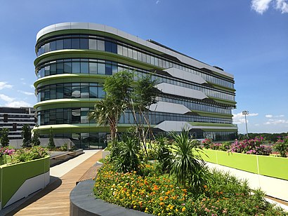
SUTD Address: 8 Somapah Rd street in Southeast
The Singapore University of Technology and Design (SUTD) is a public autonomous university in Singapore.Wiki
Places Near SUTD (Southeast)
How to get to popular places in Singapore with public transport
Get around Southeast by public transport!
Travelling around Southeast has never been so easy. See step by step directions as you travel to any attraction, street or major public transport station. View bus and train timetables, arrival times, service alerts and detailed routes on a map, so you know exactly how to get to anywhere in Southeast.
When travelling to any destination around Southeast use Moovit's Live Directions with Get Off Notifications to know exactly where and how far to walk, how long to wait for your line , and how many stops are left. Moovit will alert you when it’s time to get off — no need to constantly re-check whether yours is the next stop.
Wondering how to use public transport in Southeast or how to pay for public transport in Southeast? Moovit public transport app can help you navigate your way with public transport easily, and at minimum cost. It includes public transport fees, ticket prices, and costs. Looking for a map of Southeast public transport lines? Moovit public transport app shows all public transport maps in Southeast with all Bus, Train, Metro, MRT & LRT, Ferry and Cable Car routes and stops on an interactive map.
Singapore has 6 transport type(s), including: Bus, Train, Metro, MRT & LRT, Ferry and Cable Car, operated by several transport agencies, including SMRT, SBS Transit, Tower Transit, Go-Ahead Singapore, Premium Bus, City Direct Bus, Changi Airport, Sentosa Development Corporation, Cross Border Bus, Singapore Cable Car Network, NUS Shuttle (ComfortDelGro), NTU Shuttle (ComfortDelGro), JTC Corp, Shuttle Bus (Appx. Schedule) and Tourist Bus (Book in Advance)