See Sacred Heart Church, St Ives, Huntingdonshire, on the map
Directions to Sacred Heart Church, St Ives (Huntingdonshire) with public transport
The following transport lines have routes that pass near Sacred Heart Church, St Ives
 Bus:
Bus:
How to get to Sacred Heart Church, St Ives by bus?
Click on the bus route to see step by step directions with maps, line arrival times and updated time schedules.
Bus stations near Sacred Heart Church, St Ives in Huntingdonshire
- Needingworth Road, St Ives,3 min walk,
- Little Farthing Close, St Ives,6 min walk,
- St John's Road, St Ives,8 min walk,
- East Street, St Ives,13 min walk,
- Bus Station, St Ives,14 min walk,
Bus lines to Sacred Heart Church, St Ives in Huntingdonshire
- 302,March,
- 22,St Ives - Pidley - Warboys,
- 22A,St Ives - Somersham - Woodhurst,
- 22X,St Ives - Pidley,
- 300,St Ives Town Circular,
- 301,St Ives - Somersham - Ramsey,
- A,Trumpington,
- B,Hinchingbrooke Park,
- 1A,St Ives - Bar Hill,
- V4,St Ives - Fenstanton - Boxworth,
- 9,St Ives - Hilton,
- 21,St Ives - Somersham - Ramsey,
- VL14,St Ives,
- F,Fenstanton,
What are the nearest stations to Sacred Heart Church, St Ives?
The nearest stations to Sacred Heart Church, St Ives are:
- Needingworth Road, St Ives is 210 meters away, 3 min walk.
- Little Farthing Close, St Ives is 416 meters away, 6 min walk.
- St John's Road, St Ives is 535 meters away, 8 min walk.
- East Street, St Ives is 969 meters away, 13 min walk.
- Bus Station, St Ives is 1045 meters away, 14 min walk.
Which bus lines stop near Sacred Heart Church, St Ives?
These bus lines stop near Sacred Heart Church, St Ives: 22, 66, 9.
What’s the nearest bus stop to Sacred Heart Church, St Ives in Huntingdonshire?
The nearest bus stop to Sacred Heart Church, St Ives in Huntingdonshire is Needingworth Road, St Ives. It’s a 3 min walk away.
What time is the first bus to Sacred Heart Church, St Ives in Huntingdonshire?
The 9 is the first bus that goes to Sacred Heart Church, St Ives in Huntingdonshire. It stops nearby at 09:18.
What time is the last bus to Sacred Heart Church, St Ives in Huntingdonshire?
The 9 is the last bus that goes to Sacred Heart Church, St Ives in Huntingdonshire. It stops nearby at 17:10.
See Sacred Heart Church, St Ives, Huntingdonshire, on the map
Public Transit to Sacred Heart Church, St Ives in Huntingdonshire
Wondering how to get to Sacred Heart Church, St Ives in Huntingdonshire, United Kingdom? Moovit helps you find the best way to get to Sacred Heart Church, St Ives with step-by-step directions from the nearest public transit station.
Moovit provides free maps and live directions to help you navigate through your city. View schedules, routes, timetables, and find out how long does it take to get to Sacred Heart Church, St Ives in real time.
Looking for the nearest stop or station to Sacred Heart Church, St Ives? Check out this list of stops closest to your destination: Needingworth Road; Little Farthing Close; St John's Road; East Street; Bus Station.
Bus:
Want to see if there’s another route that gets you there at an earlier time? Moovit helps you find alternative routes or times. Get directions from and directions to Sacred Heart Church, St Ives easily from the Moovit App or Website.
We make riding to Sacred Heart Church, St Ives easy, which is why over 1.5 million users, including users in Huntingdonshire, trust Moovit as the best app for public transit. You don’t need to download an individual bus app or train app, Moovit is your all-in-one transit app that helps you find the best bus time or train time available.
For information on prices of bus, costs and ride fares to Sacred Heart Church, St Ives, please check the Moovit app.
Use the app to navigate to popular places including to the airport, hospital, stadium, grocery store, mall, coffee shop, school, college, and university.
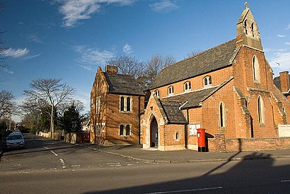
Sacred Heart Church, St Ives Address: Park Road St Ives St Ives PE27 5 street in Huntingdonshire
Attractions near Sacred Heart Church, St Ives
G C Landscapes,Anglia Tax Help,Acw Bathrooms,Oliver&,Sunflower Heights,Packaging Re-Source,Rileys Coffee Shop,The Riverport Cafe and Bar,Natural Shy Limited,Warners Park,Jamia Masjid St Ives Mosque,Faizan E Madina Masjid,Alexanders,Aviation Support Consultants,Spiderfolder Limited,Alison Whateley,The Hearing Company,Darwood Pond Car Park,Jeremy Liesner Advisory Services Limited,Hideaway CottageHow to get to popular attractions in Huntingdonshire with public transportation
Lammas Land, Cambridge,Holiday Inn Ipswich - Orwell, Ipswich,Cringleford, South Norfolk,Felixstowe Beach, Suffolk Coastal,Chemistry and Pharmacy Building UEA, Norwich,The Punter, Cambridge,The Waterman, Cambridge,Potters Leisure Resort, Great Yarmouth,Sutton Hoo, Suffolk Coastal,Thickthorn Park and Ride, South Norfolk,Banham, Breckland,Farlingaye High School, Suffolk Coastal,Holiday Inn Norwich, Norwich,Castle Rising Castle, King'S Lynn And West Norfolk,UEA Congregation Hall, Norwich,The Cellar House, Norwich,Notcutts Garden Centre, Norwich,Thickthorn Sevices A11 / A47 Interchange, South Norfolk,Chesterton Community College, Cambridge,Seckford Hall, Suffolk CoastalGet around Huntingdonshire by public transport!
Travelling around Huntingdonshire has never been so easy. See step by step directions as you travel to any attraction, street or major public transport station. View bus and train timetables, arrival times, service alerts and detailed routes on a map, so you know exactly how to get to anywhere in Huntingdonshire.
When travelling to any destination around Huntingdonshire use Moovit's Live Directions with Get Off Notifications to know exactly where and how far to walk, how long to wait for your line , and how many stops are left. Moovit will alert you when it’s time to get off — no need to constantly re-check whether yours is the next stop.
Wondering how to use public transport in Huntingdonshire or how to pay for public transport in Huntingdonshire? Moovit public transport app can help you navigate your way with public transport easily, and at minimum cost. It includes public transport fees, ticket prices, and costs. Looking for a map of Huntingdonshire public transport lines? Moovit public transport app shows all public transport maps in Huntingdonshire with all bus routes and stops on an interactive map.
Huntingdonshire has 1 transport type(s), including: bus, operated by several transport agencies, including National Rail, Ambassador Travel, Harwich Harbour Ferry, Stephensons of Essex, Villager Minibus Sharnbrook, The Voluntary Network, Dews Coaches, Felixstowe Ferry Boat Yard, Lord's Travel, Hadleigh Community Transport, Beestons, Fenland Association for Community Transport, First Norfolk & Suffolk, National Rail and Mulleys Motorways