See Salford Quays tram stop on the map
Directions to Salford Quays tram stop with public transportation
The following transport lines have routes that pass near Salford Quays tram stop
 Bus:
Bus: - Train:
- Light rail:
How to get to Salford Quays tram stop by bus?
Click on the bus route to see step by step directions with maps, line arrival times and updated time schedules.
How to get to Salford Quays tram stop by train?
Click on the train route to see step by step directions with maps, line arrival times and updated time schedules.
How to get to Salford Quays tram stop by light rail?
Click on the light rail route to see step by step directions with maps, line arrival times and updated time schedules.
Light Rail stations near Salford Quays tram stop
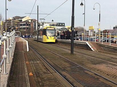
- Salford Quays (Manchester Metrolink),1 min walk,
Bus stations near Salford Quays tram stop
- Dock Office (Stop A),3 min walk,
- Merchants Quay (Stop C),3 min walk,
- Sir Alex Ferguson Way,6 min walk,
- Harbour City Metrolink (Stop A),8 min walk,
- Primrose Hill Primary School,8 min walk,
Bus routes to Salford Quays tram stop
- 745,Roe Green,
- 53,Cheetham Hill,
- 79,Pendleton,
- X50,Worsley,
- 29,Swinton,
- 50,East Didsbury,
- 998,Ordsall,
What are the nearest stations to Salford Quays tram stop?
The nearest stations to Salford Quays tram stop are:
- Salford Quays (Manchester Metrolink) is 6 meters away, 1 min walk.
- Dock Office (Stop A) is 208 meters away, 3 min walk.
- Merchants Quay (Stop C) is 219 meters away, 3 min walk.
- Sir Alex Ferguson Way is 454 meters away, 6 min walk.
- Harbour City Metrolink (Stop A) is 585 meters away, 8 min walk.
- Primrose Hill Primary School is 602 meters away, 8 min walk.
Which bus line stops near Salford Quays tram stop?
53
Which train line stops near Salford Quays tram stop?
NORTHERN
Which light rail line stops near Salford Quays tram stop?
BLUE LINE
What’s the nearest light rail station to Salford Quays tram stop?
The nearest light rail station to Salford Quays tram stop is Salford Quays (Manchester Metrolink). It’s a 1 min walk away.
What’s the nearest bus stop to Salford Quays tram stop?
The nearest bus stops to Salford Quays tram stop are Dock Office (Stop A) and Merchants Quay (Stop C). The closest one is a 3 min walk away.
What time is the first light rail to Salford Quays tram stop?
The BLUE LINE is the first light rail that goes to Salford Quays tram stop. It stops nearby at 05:35.
What time is the last light rail to Salford Quays tram stop?
The BLUE LINE is the last light rail that goes to Salford Quays tram stop. It stops nearby at 00:31.
What time is the first bus to Salford Quays tram stop?
The 53 is the first bus that goes to Salford Quays tram stop. It stops nearby at 04:52.
What time is the last bus to Salford Quays tram stop?
The 53 is the last bus that goes to Salford Quays tram stop. It stops nearby at 00:14.
How much is the train fare to Salford Quays tram stop?
The train fare to Salford Quays tram stop costs about £3.40.
See Salford Quays tram stop on the map
Public Transportation to Salford Quays tram stop
Wondering how to get to Salford Quays tram stop, United Kingdom? Moovit helps you find the best way to get to Salford Quays tram stop with step-by-step directions from the nearest public transit station.
Moovit provides free maps and live directions to help you navigate through your city. View schedules, routes, timetables, and find out how long does it take to get to Salford Quays tram stop in real time.
Looking for the nearest stop or station to Salford Quays tram stop? Check out this list of stops closest to your destination: Salford Quays (Manchester Metrolink); Dock Office (Stop A); Merchants Quay (Stop C); Sir Alex Ferguson Way; Harbour City Metrolink (Stop A); Primrose Hill Primary School.
Bus:Train:Light rail:
Want to see if there’s another route that gets you there at an earlier time? Moovit helps you find alternative routes or times. Get directions from and directions to Salford Quays tram stop easily from the Moovit App or Website.
We make riding to Salford Quays tram stop easy, which is why over 1.5 million users, including users in Salford, trust Moovit as the best app for public transit. You don’t need to download an individual bus app or train app, Moovit is your all-in-one transit app that helps you find the best bus time or train time available.
For information on prices of light rail, bus and train, costs and ride fares to Salford Quays tram stop, please check the Moovit app.
Use the app to navigate to popular places including to the airport, hospital, stadium, grocery store, mall, coffee shop, school, college, and university.
Location: Salford, North West
Attractions near Salford Quays tram stop
Salford Quays,Salford Quays Metrolink Station,Capital Quay,Matchstick Man (Hungry Horse),The Matchstick Man,M5 2wl,AC Hotel by Marriott Manchester Salford Quays,Shahi Masala,AC Hotel Manchester Salford Quays,M5 3aw,M5 3AW,Ibis Budget Salford Quays,X1 the Gateway,19 Trafford Road,Ibis Budget Hotel,M50 3sg,M50 3sr,Tlscontact (Uk),ibis budget Manchester Salford Quays,Unite The Union / T&G OfficeHow to get to popular attractions in Salford with public transportation
Warrington, Warrington,James Parsons Building, Liverpool,Northenden, Manchester,Whalley, Whalley,Chorlton Street, Manchester,Piccadilly, Manchester,Parrs Wood High School, Manchester,Longsight Market, Manchester,Eccles College (Salford City College), Swinton,Partington, Partington,Longsight, Manchester,Darwin Building, UCLan, Preston,Haughton Green, Denton,Burnage Academy For Boys, Manchester,Anchorage Metrolink Station, Salford,Uppermill, Saddleworth,Alder Hey Children's Hospital (Abandoned), Liverpool,Salford Shopping Centre, Salford,Ormskirk Hospital, Ormskirk,Stopford Building, ManchesterGet around Salford by public transport!
Travelling around Salford has never been so easy. See step by step directions as you travel to any attraction, street or major public transport station. View bus and train timetables, arrival times, service alerts and detailed routes on a map, so you know exactly how to get to anywhere in Salford.
When travelling to any destination around Salford use Moovit's Live Directions with Get Off Notifications to know exactly where and how far to walk, how long to wait for your line , and how many stops are left. Moovit will alert you when it’s time to get off — no need to constantly re-check whether yours is the next stop.
Wondering how to use public transport in Salford or how to pay for public transport in Salford? Moovit public transport app can help you navigate your way with public transport easily, and at minimum cost. It includes public transport fees, ticket prices, and costs. Looking for a map of Salford public transport lines? Moovit public transport app shows all public transport maps in Salford with all light rail, bus or train routes and stops on an interactive map.
Salford has 3 transport type(s), including: light rail, bus or train, operated by several transport agencies, including Stagecoach Manchester, Arriva North West, Diamond Bus North West, Stagecoach Merseyside and South Lancashire, Stagecoach Cumbria and North Lancashire, First Greater Manchester, First Halifax, National Express, Warrington's Own Buses, First Potteries, Rosso, Blackpool Transport, The Blackburn Bus Company, The Burnley Bus Company and Vision Bus