See Salford Shopping Centre on the map
Directions to Salford Shopping Centre with public transportation
The following transport lines have routes that pass near Salford Shopping Centre
 Bus:
Bus: - Train:
- Light rail:
How to get to Salford Shopping Centre by bus?
Click on the bus route to see step by step directions with maps, line arrival times and updated time schedules.
How to get to Salford Shopping Centre by train?
Click on the train route to see step by step directions with maps, line arrival times and updated time schedules.
How to get to Salford Shopping Centre by light rail?
Click on the light rail route to see step by step directions with maps, line arrival times and updated time schedules.
Bus stations near Salford Shopping Centre
- Salford Shopping Centre (Stop H),1 min walk,
- Salford Shopping Centre (Stop E),3 min walk,
- Salford Shopping Centre (Stop F),3 min walk,
- Tesco,5 min walk,
- Paddington Close,6 min walk,
- Salford Shopping Centre (Stop K),7 min walk,
- Salford Shopping Centre (Stop A),7 min walk,
- Pendleton Church (Stop U),7 min walk,
- Salford Shopping Centre (Stop C),7 min walk,
Light Rail stations near Salford Shopping Centre
- Langworthy (Manchester Metrolink),13 min walk,
Train stations near Salford Shopping Centre
- Salford Crescent,17 min walk,
Bus routes to Salford Shopping Centre
- 36,Piccadilly Gardens,
- 37,Bolton,
- 38,Piccadilly Gardens,
- 8,Shudehill,
- 10,Brookhouse Estate,
- 35,Piccadilly Gardens,
- 52,The Trafford Centre,
- 70,Pendleton,
- 53,Manchester - Salford,
- 67,Manchester - Cadishead,
- 67A,Cadishead - Manchester,
- 100,Manchester - Trafford Park,
- 50,East Didsbury,
- 74,Agecroft,
- 75,Agecroft,
- 79,Pendleton,
- V1,Leigh - Manchester,
- V2,Atherton - Manchester,
- V4,Boothstown - Manchester,
- 95,Whitefield,
What are the nearest stations to Salford Shopping Centre?
The nearest stations to Salford Shopping Centre are:
- Salford Shopping Centre (Stop H) is 48 meters away, 1 min walk.
- Salford Shopping Centre (Stop E) is 186 meters away, 3 min walk.
- Salford Shopping Centre (Stop F) is 200 meters away, 3 min walk.
- Tesco is 363 meters away, 5 min walk.
- Paddington Close is 399 meters away, 6 min walk.
- Salford Shopping Centre (Stop K) is 468 meters away, 7 min walk.
- Salford Shopping Centre (Stop A) is 468 meters away, 7 min walk.
- Pendleton Church (Stop U) is 504 meters away, 7 min walk.
- Salford Shopping Centre (Stop C) is 523 meters away, 7 min walk.
- Langworthy (Manchester Metrolink) is 964 meters away, 13 min walk.
- Salford Crescent is 1252 meters away, 17 min walk.
Which bus lines stop near Salford Shopping Centre?
These bus lines stop near Salford Shopping Centre: 35, 36, 37, 50, 53, 67, 95.
Which train line stops near Salford Shopping Centre?
NORTHERN
Which light rail line stops near Salford Shopping Centre?
BLUE LINE
What’s the nearest light rail station to Salford Shopping Centre?
The nearest light rail station to Salford Shopping Centre is Langworthy (Manchester Metrolink). It’s a 13 min walk away.
What’s the nearest train station to Salford Shopping Centre?
The nearest train station to Salford Shopping Centre is Salford Crescent. It’s a 17 min walk away.
What’s the nearest bus stop to Salford Shopping Centre?
The nearest bus stop to Salford Shopping Centre is Salford Shopping Centre (Stop H). It’s a 1 min walk away.
What time is the first light rail to Salford Shopping Centre?
The BLUE LINE is the first light rail that goes to Salford Shopping Centre. It stops nearby at 05:44.
What time is the last light rail to Salford Shopping Centre?
The BLUE LINE is the last light rail that goes to Salford Shopping Centre. It stops nearby at 00:22.
What time is the first train to Salford Shopping Centre?
The NORTHERN is the first train that goes to Salford Shopping Centre. It stops nearby at 05:13.
What time is the last train to Salford Shopping Centre?
The NORTHERN is the last train that goes to Salford Shopping Centre. It stops nearby at 23:47.
What time is the first bus to Salford Shopping Centre?
The V1 is the first bus that goes to Salford Shopping Centre. It stops nearby at 04:30.
What time is the last bus to Salford Shopping Centre?
The NORTHERN is the last bus that goes to Salford Shopping Centre. It stops nearby at 01:13.
See Salford Shopping Centre on the map
Public Transportation to Salford Shopping Centre
Wondering how to get to Salford Shopping Centre, United Kingdom? Moovit helps you find the best way to get to Salford Shopping Centre with step-by-step directions from the nearest public transit station.
Moovit provides free maps and live directions to help you navigate through your city. View schedules, routes, timetables, and find out how long does it take to get to Salford Shopping Centre in real time.
Looking for the nearest stop or station to Salford Shopping Centre? Check out this list of stops closest to your destination: Salford Shopping Centre (Stop H); Salford Shopping Centre (Stop E); Salford Shopping Centre (Stop F); Tesco; Paddington Close; Salford Shopping Centre (Stop K); Salford Shopping Centre (Stop A); Pendleton Church (Stop U); Salford Shopping Centre (Stop C); Langworthy (Manchester Metrolink); Salford Crescent.
Bus:Train:Light rail:
Want to see if there’s another route that gets you there at an earlier time? Moovit helps you find alternative routes or times. Get directions from and directions to Salford Shopping Centre easily from the Moovit App or Website.
We make riding to Salford Shopping Centre easy, which is why over 1.5 million users, including users in Salford, trust Moovit as the best app for public transit. You don’t need to download an individual bus app or train app, Moovit is your all-in-one transit app that helps you find the best bus time or train time available.
For information on prices of bus, light rail and train, costs and ride fares to Salford Shopping Centre, please check the Moovit app.
Use the app to navigate to popular places including to the airport, hospital, stadium, grocery store, mall, coffee shop, school, college, and university.
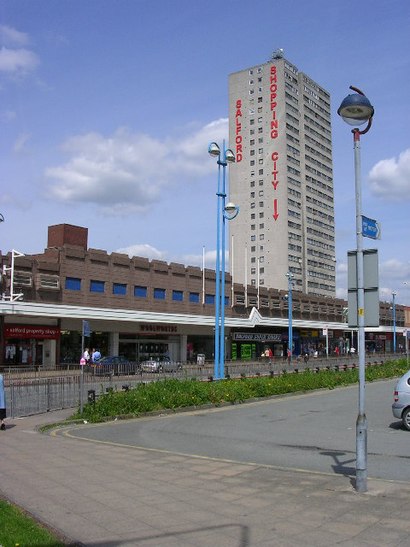
Salford Shopping Centre Address: Hankinson Way street in Salford
Attractions near Salford Shopping Centre
Hankinson Way (Stop J), Salford,Citizens Advice Bureau,M6 5JA,Salford Library (Pendleton Gateway),Pendleton Gateway,M6 5fx,Pendleton Police Station,Salford Shopping Centre,Bronze Boutique,Puregym,Iceland,Rossall Way (Stop E), Salford,Poundland,Olympus Bathrooms and Tiling,M6 5DS,Salford Post Office,Paypoint,M6 5fw,Salford Shopping Centre Car Park,Pendleton Police StationHow to get to popular attractions in Salford with public transportation
Haughton Green, Denton,Sale Moor, Sale,The Blackpool Sixth Form College, Blackpool,HMRC Trinity Bridge House, Manchester,St Ann Square, Manchester,Broadgreen Hospital, Liverpool,Reflexion Lounge, Salford,Doubletree by Hilton Manchester Airport, Manchester,Murdishaw, Runcorn,Royal Preston Hospital, Preston,Bury, Bury,Shudehill Interchange, Manchester,Central Pier, Blackpool,Withington Library, Manchester,Halewood Park Environmental Centre, Halewood,Boots, Trafford Park,Wythenshawe Hospital, Manchester,The Trafford Centre, Trafford Park,James Parsons Building, Liverpool,Prescot, St HelensGet around Salford by public transport!
Travelling around Salford has never been so easy. See step by step directions as you travel to any attraction, street or major public transport station. View bus and train timetables, arrival times, service alerts and detailed routes on a map, so you know exactly how to get to anywhere in Salford.
When travelling to any destination around Salford use Moovit's Live Directions with Get Off Notifications to know exactly where and how far to walk, how long to wait for your line , and how many stops are left. Moovit will alert you when it’s time to get off — no need to constantly re-check whether yours is the next stop.
Wondering how to use public transport in Salford or how to pay for public transport in Salford? Moovit public transport app can help you navigate your way with public transport easily, and at minimum cost. It includes public transport fees, ticket prices, and costs. Looking for a map of Salford public transport lines? Moovit public transport app shows all public transport maps in Salford with all bus, light rail or train routes and stops on an interactive map.
Salford has 3 transport type(s), including: bus, light rail or train, operated by several transport agencies, including Stagecoach Manchester, Arriva North West, Diamond Bus North West, Stagecoach Merseyside and South Lancashire, Stagecoach Cumbria and North Lancashire, First Greater Manchester, First Halifax, National Express, Warrington's Own Buses, First Potteries, Rosso, Blackpool Transport, Blackpool Transport, The Blackburn Bus Company and The Burnley Bus Company