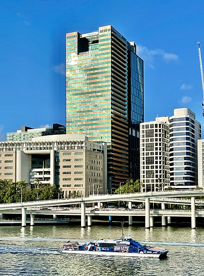
See Santos Place, City, on the map
Directions to Santos Place (City) with public transport
The following transport lines have routes that pass near Santos Place
 Bus:
Bus: - Train:
- Ferry:
How to get to Santos Place by bus?
Click on the bus route to see step by step directions with maps, line arrival times and updated time schedules.
How to get to Santos Place by train?
Click on the train route to see step by step directions with maps, line arrival times and updated time schedules.
Bus stations near Santos Place in City
- George Street Stop 118 Near Turbot St,1 min walk,
- George Street Stop 117 Near Turbot St,2 min walk,
- George St at Magistrates Court,2 min walk,
- Turbot St Stop 130 at Magistrates Court,2 min walk,
- Roma Street Stop 138 Near Ann St,4 min walk,
- Ann Street Stop 12 at City Hall,4 min walk,
- Adelaide Street Stop 47 Near George St,5 min walk,
- Adelaide Street Stop 46 Near City Plaza,5 min walk,
- North Quay Stop 106 Near Herschel St,5 min walk,
- King George Square, 1b,8 min walk,
Train stations near Santos Place in City
- South Brisbane Station,10 min walk,
- Roma Street Station,25 min walk,
Ferry stations near Santos Place in City
- South Bank Ferry Terminal,17 min walk,
Bus lines to Santos Place in City
- 470,Toowong Village,
- 475,Rainworth, Leworthy St,
- 476,Bardon, Warburton St,
- 61,Ashgrove Shops - Coorparoo Via City,
- 370,City - Chermside,
- 375,Bardon - Stafford Via City/valley,
- 379,Grange/ashgrove - City,
- 380,The Gap - City Via Hilder Road,
- 381,The Gap - City Via Payne Road,
- 444,Moggill, Moggill Rd,
- P343,Aspley - City Pre-paid Rocket,
- 363,Herston - City,
- 376,Stafford - City Express,
- 382,The Gap - City Rocket Via Settlement Road,
- 383,The Gap - City Rocket Via Payne Road,
- 390,Mitchelton - City,
- P455,Riverhills - City Pre-paid Rocket,
- P456,Mt Ommaney - City Pre-paid Rocket,
- 412,City, Roma St,
- 302,City, City Hall,
What are the nearest stations to Santos Place?
The nearest stations to Santos Place are:
- George Street Stop 118 Near Turbot St is 51 meters away, 1 min walk.
- George Street Stop 117 Near Turbot St is 72 meters away, 2 min walk.
- George St at Magistrates Court is 105 meters away, 2 min walk.
- Turbot St Stop 130 at Magistrates Court is 131 meters away, 2 min walk.
- Roma Street Stop 138 Near Ann St is 256 meters away, 4 min walk.
- Ann Street Stop 12 at City Hall is 268 meters away, 4 min walk.
- Adelaide Street Stop 47 Near George St is 294 meters away, 5 min walk.
- Adelaide Street Stop 46 Near City Plaza is 325 meters away, 5 min walk.
- North Quay Stop 106 Near Herschel St is 361 meters away, 5 min walk.
- King George Square, 1b is 549 meters away, 8 min walk.
- South Brisbane Station is 699 meters away, 10 min walk.
- South Bank Ferry Terminal is 1250 meters away, 17 min walk.
- Roma Street Station is 1885 meters away, 25 min walk.
Which bus lines stop near Santos Place?
These bus lines stop near Santos Place: 131, 155, 186, 340, 381, 382, 445, P221, P456.
Which train lines stop near Santos Place?
These train lines stop near Santos Place: IPSW, REDC.
What’s the nearest train station to Santos Place in City?
The nearest train station to Santos Place in City is South Brisbane Station. It’s a 10 min walk away.
What’s the nearest bus stop to Santos Place in City?
The nearest bus stop to Santos Place in City is George Street Stop 118 Near Turbot St. It’s a 1 min walk away.
What’s the nearest ferry station to Santos Place in City?
The nearest ferry station to Santos Place in City is South Bank Ferry Terminal. It’s a 17 min walk away.
What time is the first train to Santos Place in City?
The BEEN is the first train that goes to Santos Place in City. It stops nearby at 04:04.
What time is the last train to Santos Place in City?
The GOLD is the last train that goes to Santos Place in City. It stops nearby at 01:01.
What time is the first bus to Santos Place in City?
The 111 is the first bus that goes to Santos Place in City. It stops nearby at 05:09.
What time is the last bus to Santos Place in City?
The 412 is the last bus that goes to Santos Place in City. It stops nearby at 00:03.
What time is the first ferry to Santos Place in City?
The CITY HOPPER - NORTH QUAY is the first ferry that goes to Santos Place in City. It stops nearby at 05:46.
What time is the last ferry to Santos Place in City?
The CITY HOPPER - NORTH QUAY is the last ferry that goes to Santos Place in City. It stops nearby at 00:27.
How much is the train fare to Santos Place?
The train fare to Santos Place costs about $2.84 - $6.98.
How much is the bus fare to Santos Place?
The bus fare to Santos Place costs about $2.84 - $4.34.
See Santos Place, City, on the map
Public Transit to Santos Place in City
Wondering how to get to Santos Place in City, Australia? Moovit helps you find the best way to get to Santos Place with step-by-step directions from the nearest public transit station.
Moovit provides free maps and live directions to help you navigate through your city. View schedules, routes, timetables, and find out how long does it take to get to Santos Place in real time.
Looking for the nearest stop or station to Santos Place? Check out this list of stops closest to your destination: George Street Stop 118 Near Turbot St; George Street Stop 117 Near Turbot St; George St at Magistrates Court; Turbot St Stop 130 at Magistrates Court; Roma Street Stop 138 Near Ann St; Ann Street Stop 12 at City Hall; Adelaide Street Stop 47 Near George St; Adelaide Street Stop 46 Near City Plaza; North Quay Stop 106 Near Herschel St; King George Square; South Brisbane Station; South Bank Ferry Terminal; Roma Street Station.
Bus:Train:Ferry:
Want to see if there’s another route that gets you there at an earlier time? Moovit helps you find alternative routes or times. Get directions from and directions to Santos Place easily from the Moovit App or Website.
We make riding to Santos Place easy, which is why over 1.5 million users, including users in City, trust Moovit as the best app for public transit. You don’t need to download an individual bus app or train app, Moovit is your all-in-one transit app that helps you find the best bus time or train time available.
For information on prices of bus and train, costs and ride fares to Santos Place, please check the Moovit app.
Use the app to navigate to popular places including to the airport, hospital, stadium, grocery store, mall, coffee shop, school, college, and university.
Santos Place Address: 32 Turbot Street street in City
Attractions near Santos Place
400 George,32 Turbot Street,Doyle Family Law,400 George Street,Inns Of Court,Ibis Brisbane,Commonwealth Bank,George Williams Hotel,George Williams Hotel Brisbane,317-325 George Street,Commonwealth Law Courts,Mercure,Tank Street,W Hotel Brisbane,Harry Gibbs Commonwealth Law Courts,Newcrest Mining,Queensland Supreme And District Court,Brisbane Magistrates Court,Linger Longer Cafe,Sir Harry Gibbs Legal Heritage CentreHow to get to popular attractions in City with public transportation
Cultural Centre Platform 1, South Brisbane,Cultural Centre Platform 2, South Brisbane,Rbw Hospital, Herston,Warner Bros. Movie World, Oxenford,Capalaba Central Shopping Centre, Capalaba,South Bank Parklands, South Brisbane,UQ Lakes Stop C, St Lucia,Inala Plaza, Inala,Mooloolaba, Mooloolaba,Sea World, Main Beach,Stafford City, Stafford,Pick'N Pay Hypermarket, Aspley,Browns Plains, Browns Plains,Capalaba Park Shopping Centre, Capalaba,Princess Alexandra Hospital, Woolloongabba,Bulimba,Griffith University Gold Coast, Southport,Kelvin Grove, Kelvin Grove,RACQ, Eight Mile Plains,Gold CoastGet around City by public transport!
Travelling around City has never been so easy. See step by step directions as you travel to any attraction, street or major public transport station. View bus and train timetables, arrival times, service alerts and detailed routes on a map, so you know exactly how to get to anywhere in City.
When travelling to any destination around City use Moovit's Live Directions with Get Off Notifications to know exactly where and how far to walk, how long to wait for your line , and how many stops are left. Moovit will alert you when it’s time to get off — no need to constantly re-check whether yours is the next stop.
Wondering how to use public transport in City or how to pay for public transport in City? Moovit public transport app can help you navigate your way with public transport easily, and at minimum cost. It includes public transport fees, ticket prices, and costs. Looking for a map of City public transport lines? Moovit public transport app shows all public transport maps in City with all bus or train routes and stops on an interactive map.
City has 2 transport type(s), including: bus or train, operated by several transport agencies, including TransLink SEQ, TransLink, TransLink, TransLink, Christensens Bus and Coach, North Stradbroke Island Buses and Griffith Uni Intercampus bus