See Satrosphere, Aberdeen, on the map
Directions to Satrosphere (Aberdeen) with public transport
The following transport lines have routes that pass near Satrosphere
 Bus:
Bus: - Train:
How to get to Satrosphere by bus?
Click on the bus route to see step by step directions with maps, line arrival times and updated time schedules.
How to get to Satrosphere by train?
Click on the train route to see step by step directions with maps, line arrival times and updated time schedules.
Bus stations near Satrosphere in Aberdeen
- Constitution Street, Sea Beach,3 min walk,
Bus lines to Satrosphere in Aberdeen
- 13,Seaton,
What are the nearest stations to Satrosphere?
The nearest stations to Satrosphere are:
- Constitution Street, Sea Beach is 209 meters away, 3 min walk.
Which bus lines stop near Satrosphere?
These bus lines stop near Satrosphere: 091, 61, 727, M9.
Which train line stops near Satrosphere?
SCOTRAIL
What’s the nearest bus stop to Satrosphere in Aberdeen?
The nearest bus stop to Satrosphere in Aberdeen is Constitution Street, Sea Beach. It’s a 3 min walk away.
How much is the bus fare to Satrosphere?
The bus fare to Satrosphere costs about £5.60 - £18.50.
See Satrosphere, Aberdeen, on the map
Public Transit to Satrosphere in Aberdeen
Wondering how to get to Satrosphere in Aberdeen, United Kingdom? Moovit helps you find the best way to get to Satrosphere with step-by-step directions from the nearest public transit station.
Moovit provides free maps and live directions to help you navigate through your city. View schedules, routes, timetables, and find out how long does it take to get to Satrosphere in real time.
Looking for the nearest stop or station to Satrosphere? Check out this list of stops closest to your destination: Constitution Street.
Bus:Train:
Want to see if there’s another route that gets you there at an earlier time? Moovit helps you find alternative routes or times. Get directions from and directions to Satrosphere easily from the Moovit App or Website.
We make riding to Satrosphere easy, which is why over 1.5 million users, including users in Aberdeen, trust Moovit as the best app for public transit. You don’t need to download an individual bus app or train app, Moovit is your all-in-one transit app that helps you find the best bus time or train time available.
For information on prices of bus and train, costs and ride fares to Satrosphere, please check the Moovit app.
Use the app to navigate to popular places including to the airport, hospital, stadium, grocery store, mall, coffee shop, school, college, and university.
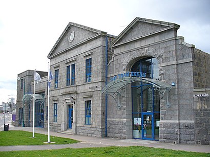
Satrosphere Address: Constitution Street Aberdeen Aberdeen AB24 5 street in Aberdeen
Attractions near Satrosphere
Aberdeen Science Centre,Aberdeen Science Centre,Hudsons,ALDI,Constitution street,Town & Country - Bothwell Road,Remax Property Centre Aberdeen,Matalan,Bannermill Place,Maiya Uk,Codona's,Bon Accord Care,Hanover Community Centre,Property Management Co,Sandcastle Adventure Land,Beach Ballroom Aberdeen,Tec Spray Aberdeen,Imber Distribution,Asco,Strathclyde FansHow to get to popular attractions in Aberdeen with public transportation
The Justice Mill (Wetherspoon), Aberdeen,Ocean Terminal, Edinburgh,Fort William, Fort William,Ninewells Hospital & Medical School, Dundee,Altens Industrial Estate, Aberdeen,Perth Railway Station (PTH), Perth,Cathcart Railway Station (CCT), Glasgow,The Crystal Palace (Wetherspoon), Glasgow,Marks & Spencer, Edinburgh,The Alexander Graham Bell (Wetherspoon), Edinburgh,Buchanan Street Bus Station, Glasgow,Fir Park Stadium, Motherwell,River Clyde, Glasgow City,Soar at intu Braehead, Renfrew,Nuffield Health Glasgow Central Fitness & Wellbeing Gym, Glasgow,Langside, Glasgow,Dunfermline Bus Station, Dunfermline,Tynecastle Park, Edinburgh,Drumgelloch Railway Station (DRU), Airdrie,Costco Wholesale, GlasgowGet around Aberdeen by public transport!
Travelling around Aberdeen has never been so easy. See step by step directions as you travel to any attraction, street or major public transport station. View bus and train timetables, arrival times, service alerts and detailed routes on a map, so you know exactly how to get to anywhere in Aberdeen.
When travelling to any destination around Aberdeen use Moovit's Live Directions with Get Off Notifications to know exactly where and how far to walk, how long to wait for your line , and how many stops are left. Moovit will alert you when it’s time to get off — no need to constantly re-check whether yours is the next stop.
Wondering how to use public transport in Aberdeen or how to pay for public transport in Aberdeen? Moovit public transport app can help you navigate your way with public transport easily, and at minimum cost. It includes public transport fees, ticket prices, and costs. Looking for a map of Aberdeen public transport lines? Moovit public transport app shows all public transport maps in Aberdeen with all bus or train routes and stops on an interactive map.
Aberdeen has 2 transport type(s), including: bus or train, operated by several transport agencies, including First Greater Glasgow, First Aberdeen, Lothian Buses, McGill's Bus Service, Stagecoach East Scotland, Stagecoach Bluebird, Xplore Dundee, Community Transport Glasgow, Prentice Westwood, McCall's Coaches, J P Minibus, National Rail, R Robertson & Son, Burnbrae Garage and Ember