Directions to Scarborough Castle with public transportation
The following transport lines have routes that pass near Scarborough Castle
How to get to Scarborough Castle by bus?
Click on the bus route to see step by step directions with maps, line arrival times and updated time schedules.
How to get to Scarborough Castle by train?
Click on the train route to see step by step directions with maps, line arrival times and updated time schedules.
Bus stops near Scarborough Castle
- Sandside, 11 min walk,
- Castle Road Stop A, 12 min walk,
- Queen Street Stop B, 14 min walk,
- Trafalgar Sq, 14 min walk,
- St Thomas Street Stop C, 15 min walk,
Train station near Scarborough Castle
- Scarborough, 22 min walk,
Bus routes to Scarborough Castle
- 99, The Sands,
- 109, North Bay the Sands,
- 109 SEAFRONT SERVICE, The Spa,
- 2, St Thomas Street Stop D,
- 5, Sea Life Centre,
- 8, Briercliffe,
- 11, Sea Life Centre,
- 20, Queen Street,
- S115, Ravenscar (Station Square),
- 777-GRAHAM-SCHOOL, Byward Drive,
- 3, St Thomas Street,
- 353S, Queen Street Stop B,
- 112, Trafalgar Sq,
- 64, Seamer Road Park And Ride Site,
- 165, Filey Road Park And Ride Site,
What are the nearest stations to Scarborough Castle?
The nearest stations to Scarborough Castle are:
- Sandside is 761 meters away, 11 min walk.
- Castle Road Stop A is 841 meters away, 12 min walk.
- Queen Street Stop B is 1023 meters away, 14 min walk.
- Trafalgar Sq is 1058 meters away, 14 min walk.
- St Thomas Street Stop C is 1123 meters away, 15 min walk.
- Scarborough is 1666 meters away, 22 min walk.
Which bus lines stop near Scarborough Castle?
These bus lines stop near Scarborough Castle: 10, 20, 7, 7A.
Which train lines stop near Scarborough Castle?
These train lines stop near Scarborough Castle: NORTHERN, TRANSPENNINE EXPRESS.
What’s the nearest train station to Scarborough Castle?
The nearest train station to Scarborough Castle is Scarborough. It’s a 22 min walk away.
What’s the nearest bus station to Scarborough Castle?
The nearest bus station to Scarborough Castle is Sandside. It’s a 11 min walk away.
What time is the first train to Scarborough Castle?
The TRANSPENNINE EXPRESS is the first train that goes to Scarborough Castle. It stops nearby at 05:48.
What time is the last train to Scarborough Castle?
The TRANSPENNINE EXPRESS is the last train that goes to Scarborough Castle. It stops nearby at 23:54.
What time is the first bus to Scarborough Castle?
The 7A is the first bus that goes to Scarborough Castle. It stops nearby at 05:40.
What time is the last bus to Scarborough Castle?
The 10 is the last bus that goes to Scarborough Castle. It stops nearby at 19:33.
See Scarborough Castle on the map
Public Transportation to Scarborough Castle
Wondering how to get to Scarborough Castle, United Kingdom? Moovit helps you find the best way to get to Scarborough Castle with step-by-step directions from the nearest public transit station.
Moovit provides free maps and live directions to help you navigate through your city. View schedules, routes, timetables, and find out how long does it take to get to Scarborough Castle in real time.
Looking for the nearest stop or station to Scarborough Castle? Check out this list of stops closest to your destination: Sandside; Castle Road Stop A; Queen Street Stop B; Trafalgar Sq; St Thomas Street Stop C; Scarborough.
Bus: 10, 20, 7, 7A, 99, 109, 109 SEAFRONT SERVICE, 2, 5, 8, 11, S115, 3, 353S, 112.Train: NORTHERN, TRANSPENNINE EXPRESS.
Want to see if there’s another route that gets you there at an earlier time? Moovit helps you find alternative routes or times. Get directions from and directions to Scarborough Castle easily from the Moovit App or Website.
We make riding to Scarborough Castle easy, which is why over 1.5 million users, including users in Scarborough, trust Moovit as the best app for public transit. You don’t need to download an individual bus app or train app, Moovit is your all-in-one transit app that helps you find the best bus time or train time available.
For information on prices of bus and train, costs and ride fares to Scarborough Castle, please check the Moovit app.
Use the app to navigate to popular places including to the airport, hospital, stadium, grocery store, mall, coffee shop, school, college, and university.
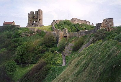
Scarborough Castle Address: Marine Drive, Scarborough, North Yorkshire YO11, UK street in Scarborough
Places Near Scarborough Castle
How to get to popular places in Yorkshire with public transport
Get around Scarborough by public transport!
Travelling around Scarborough has never been so easy. See step by step directions as you travel to any attraction, street or major public transport station. View bus and train timetables, arrival times, service alerts and detailed routes on a map, so you know exactly how to get to anywhere in Scarborough.
When travelling to any destination around Scarborough use Moovit's Live Directions with Get Off Notifications to know exactly where and how far to walk, how long to wait for your line , and how many stops are left. Moovit will alert you when it’s time to get off — no need to constantly re-check whether yours is the next stop.
Wondering how to use public transport in Scarborough or how to pay for public transport in Scarborough? Moovit public transport app can help you navigate your way with public transport easily, and at minimum cost. It includes public transport fees, ticket prices, and costs. Looking for a map of Scarborough public transport lines? Moovit public transport app shows all public transport maps in Scarborough with all Bus, Train and Light rail routes and stops on an interactive map.
Yorkshire has 3 transport type(s), including: Bus, Train and Light rail, operated by several transport agencies, including First Leeds, First South Yorkshire, First York, First West Yorkshire Ltd, Arriva Yorkshire, Stagecoach Yorkshire, National Rail, First Bradford, First Halifax, Calder Valley & Huddersfield, East Yorkshire, The Keighley Bus Company, South Yorkshire Future Tram, The Harrogate Bus Company, TM Travel and Coastliner