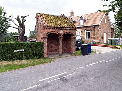
See Searby cum Owmby, West Lindsey, on the map
Directions to Searby cum Owmby (West Lindsey) with public transport
The following transport lines have routes that pass near Searby cum Owmby
Bus:
Train:
How to get to Searby cum Owmby by Bus?
Click on the Bus route to see step by step directions with maps, line arrival times and updated time schedules.
Bus stations near Searby cum Owmby in West Lindsey
- Demand Responsive Area, Owmby,13 min walk,
- Village Hall, Grasby,21 min walk,
Bus lines to Searby cum Owmby in West Lindsey
- 53C,Caistor,
- 161,Market Rasen,
What are the nearest stations to Searby cum Owmby?
The nearest stations to Searby cum Owmby are:
- Demand Responsive Area, Owmby is 969 meters away, 13 min walk.
- Village Hall, Grasby is 1565 meters away, 21 min walk.
Which Bus lines stop near Searby cum Owmby?
These Bus lines stop near Searby cum Owmby: 1501, 68
Which Train lines stop near Searby cum Owmby?
These Train lines stop near Searby cum Owmby: TRANSPENNINE EXPRESS
What’s the nearest bus stop to Searby cum Owmby in West Lindsey?
The nearest bus stop to Searby cum Owmby in West Lindsey is Demand Responsive Area, Owmby. It’s a 13 min walk away.
See Searby cum Owmby, West Lindsey, on the map

Public Transit to Searby cum Owmby in West Lindsey
Wondering how to get to Searby cum Owmby in West Lindsey, United Kingdom? Moovit helps you find the best way to get to Searby cum Owmby with step-by-step directions from the nearest public transit station.
Moovit provides free maps and live directions to help you navigate through your city. View schedules, routes, timetables, and find out how long does it take to get to Searby cum Owmby in real time.
Looking for the nearest stop or station to Searby cum Owmby? Check out this list of stops closest to your destination: Demand Responsive Area; Village Hall.
Bus:Train:
Want to see if there’s another route that gets you there at an earlier time? Moovit helps you find alternative routes or times. Get directions from and directions to Searby cum Owmby easily from the Moovit App or Website.
We make riding to Searby cum Owmby easy, which is why over 1.5 million users, including users in West Lindsey, trust Moovit as the best app for public transit. You don’t need to download an individual bus app or train app, Moovit is your all-in-one transit app that helps you find the best bus time or train time available.
For information on prices of Bus and Train, costs and ride fares to Searby cum Owmby, please check the Moovit app.
Use the app to navigate to popular places including to the airport, hospital, stadium, grocery store, mall, coffee shop, school, college, and university.
Location: West Lindsey, East Midlands

Attractions near Searby cum Owmby
How to get to popular attractions in West Lindsey with public transportation
- James France Building, Charnwood
- Riverside Retail Park, Northampton
- Kingsway Hospital, Derby
- De Montfort University, Leicester
- University Of Nottingham, Nottingham
- Leicester Royal Infirmary, Leicester
- Harry French Halls, Charnwood
- Gedling, Gedling
- Westwood Centre, Peterborough
- E.ON (Bilborough), Nottingham
- The Picturedrome, Northampton
- Soar Valley Way, Leicester
- Outwood Academy Newbold, Chesterfield
- Western Park, Leicester
- Lidl, Peterborough
- Kettering General Hospital, Kettering
- Bilborough College, Nottingham
- Market Warsop, Mansfield
- Nottingham Station, Nottingham
- Bradlaugh Fields, Northampton