See Semaphore Ink on the map
Directions to Semaphore Ink with public transportation
The following transport lines have routes that pass near Semaphore Ink
 Bus:
Bus:
How to get to Semaphore Ink by bus?
Click on the bus route to see step by step directions with maps, line arrival times and updated time schedules.
Bus stations near Semaphore Ink
- Stop 44f Semaphore Rd - North Side,3 min walk,
- Stop 44 Military Rd - East Side,6 min walk,
- Stop 44 Military Rd - West Side,6 min walk,
Bus routes to Semaphore Ink
- N254,City,
- AO17,Adelaide Oval,
- 157,City,
- 157X,Largs Bay,
- 333,Port Adelaide,
- 652,St Michael's Primary Campus (School Bus),
- 655,St Michael's College Primary Campus to Port Adelaide,
- 658,St Michael's College Secondary Campus to Largs Bay,
- 664,Nazareth Catholic College to Alberton,
- 668,Henley High School to Port Adelaide,
- 672,Le Fevre High School to Taperoo,
What are the nearest stations to Semaphore Ink?
The nearest stations to Semaphore Ink are:
- Stop 44f Semaphore Rd - North Side is 188 meters away, 3 min walk.
- Stop 44 Military Rd - East Side is 457 meters away, 6 min walk.
- Stop 44 Military Rd - West Side is 457 meters away, 6 min walk.
Which bus lines stop near Semaphore Ink?
These bus lines stop near Semaphore Ink: 150B, H1.
What’s the nearest bus stop to Semaphore Ink?
The nearest bus stop to Semaphore Ink is Stop 44f Semaphore Rd - North Side. It’s a 3 min walk away.
See Semaphore Ink on the map
Public Transportation to Semaphore Ink
Wondering how to get to Semaphore Ink, Australia? Moovit helps you find the best way to get to Semaphore Ink with step-by-step directions from the nearest public transit station.
Moovit provides free maps and live directions to help you navigate through your city. View schedules, routes, timetables, and find out how long does it take to get to Semaphore Ink in real time.
Looking for the nearest stop or station to Semaphore Ink? Check out this list of stops closest to your destination: Stop 44f Semaphore Rd - North Side; Stop 44 Military Rd - East Side; Stop 44 Military Rd - West Side.
Bus:
Want to see if there’s another route that gets you there at an earlier time? Moovit helps you find alternative routes or times. Get directions from and directions to Semaphore Ink easily from the Moovit App or Website.
We make riding to Semaphore Ink easy, which is why over 1.5 million users, including users in Semaphore, trust Moovit as the best app for public transit. You don’t need to download an individual bus app or train app, Moovit is your all-in-one transit app that helps you find the best bus time or train time available.
For information on prices of bus, costs and ride fares to Semaphore Ink, please check the Moovit app.
Use the app to navigate to popular places including to the airport, hospital, stadium, grocery store, mall, coffee shop, school, college, and university.
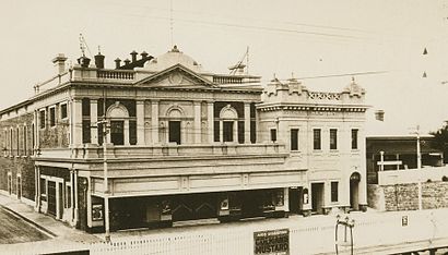
Semaphore Ink Address: 118 Semaphore Rd street in Semaphore
Attractions near Semaphore Ink
The Red Ass Curry & Noodle Cafe,Semaphore Laundrette,Eagle Boys,Sully's on Semaphore,Tab,Red Ass,Hot Tonto,Pets On Semaphore,Coastal Ink FX,Beau Thai,Sarah's Cafe,Hottonto,V Music,Sarah'S,Semaphore Vet,Eagle Boys Pizza,Sarah's Sisters Sustainable Cafe,CBA ATM,Semaphore Pets And Garden,Semaphore Wine Cellars (Thirsty Camel)How to get to popular attractions in Semaphore with public transportation
Marryatville High School, Marryatville,Flinders Medical Centre Interchange, Bedford Park,Sacred Heart College, Somerton Park,Hoyts Norwood, Norwood,Blackwood, Blackwood,Central Markets, Adelaide,Welland Plaza Shopping Centre, Welland,University of Adelaide, Adelaide,Happy Valley, Happy Valley,Emu Hotel, Morphett Vale,Wayville Pavilion, Goodwood,Henley Square, Henley Beach,Hallett Cove Shopping Centre, Hallett Cove,Light Square, Adelaide,Salisbury, Salisbury,Aberfoyle Park, Aberfoyle Park,Aberfoyle Park Hub Shopping Centre, Aberfoyle Park,Gepps Cross, Gepps Cross,Moseley Square, Glenelg,Klemzig, KlemzigGet around Semaphore by public transport!
Travelling around Semaphore has never been so easy. See step by step directions as you travel to any attraction, street or major public transport station. View bus and train timetables, arrival times, service alerts and detailed routes on a map, so you know exactly how to get to anywhere in Semaphore.
When travelling to any destination around Semaphore use Moovit's Live Directions with Get Off Notifications to know exactly where and how far to walk, how long to wait for your line , and how many stops are left. Moovit will alert you when it’s time to get off — no need to constantly re-check whether yours is the next stop.
Wondering how to use public transport in Semaphore or how to pay for public transport in Semaphore? Moovit public transport app can help you navigate your way with public transport easily, and at minimum cost. It includes public transport fees, ticket prices, and costs. Looking for a map of Semaphore public transport lines? Moovit public transport app shows all public transport maps in Semaphore with all bus routes and stops on an interactive map.
Semaphore has 1 transport type(s), including: bus, operated by several transport agencies, including Adelaide Metro (Busways), SouthLink, Torrens Transit, Adelaide Metro Train, Adelaide Metro (Torrens Connect), Adelaide Metro (Industrial Service - Torrens Transit), Adelaide Metro (School Service - SouthLink), Adelaide Metro (School Service - Torrens Transit) and Adelaide Metro (School Service - Busways)