See Sentosa, Singapore, on the map
Directions to Sentosa (Singapore) with public transport
The following transport lines have routes that pass near Sentosa
 Bus:
Bus: - Metro:
How to get to Sentosa by bus?
Click on the bus route to see step by step directions with maps, line arrival times and updated time schedules.
How to get to Sentosa by metro?
Click on the metro route to see step by step directions with maps, line arrival times and updated time schedules.
Bus stations near Sentosa in Singapore
- Gogreen Segway Eco Adventure,1 min walk,
Mrt & lrt stations near Sentosa in Singapore
- Beach Station,5 min walk,
Bus lines to Sentosa in Singapore
- BEACH SHUTTLE,Beach Stn,
What are the nearest stations to Sentosa?
The nearest stations to Sentosa are:
- Gogreen Segway Eco Adventure is 8 meters away, 1 min walk.
- Beach Station is 310 meters away, 5 min walk.
Which bus lines stop near Sentosa?
These bus lines stop near Sentosa: 123, BEACH TRAM.
Which metro line stops near Sentosa?
NORTH EAST LINE
What’s the nearest MRT & LRT station to Sentosa in Singapore?
The nearest MRT & LRT station to Sentosa in Singapore is Beach Station. It’s a 5 min walk away.
What’s the nearest bus stop to Sentosa in Singapore?
The nearest bus stop to Sentosa in Singapore is Gogreen Segway Eco Adventure. It’s a 1 min walk away.
See Sentosa, Singapore, on the map
Public Transit to Sentosa in Singapore
Wondering how to get to Sentosa in Singapore, Singapore? Moovit helps you find the best way to get to Sentosa with step-by-step directions from the nearest public transit station.
Moovit provides free maps and live directions to help you navigate through your city. View schedules, routes, timetables, and find out how long does it take to get to Sentosa in real time.
Looking for the nearest stop or station to Sentosa? Check out this list of stops closest to your destination: Gogreen Segway Eco Adventure; Beach Station.
Bus:Metro:
Want to see if there’s another route that gets you there at an earlier time? Moovit helps you find alternative routes or times. Get directions from and directions to Sentosa easily from the Moovit App or Website.
We make riding to Sentosa easy, which is why over 1.5 million users, including users in Singapore, trust Moovit as the best app for public transit. You don’t need to download an individual bus app or train app, Moovit is your all-in-one transit app that helps you find the best bus time or train time available.
For information on prices of bus and metro, costs and ride fares to Sentosa, please check the Moovit app.
Use the app to navigate to popular places including to the airport, hospital, stadium, grocery store, mall, coffee shop, school, college, and university.
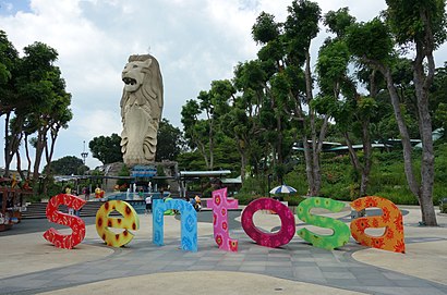
Sentosa Address: Singapore 099000 street in Singapore
Attractions near Sentosa
Islandlife @ Siloso East,Chinatown Coffee Shop,Bikini Bar,Gogreen Segway Eco Adventure,C-Side,New Zealand Natural,Siloso Beach,New Zealand Natural Ice Cream,Sakae sushi Sentosa,Ammesia Ibiza Party,Bikini Bar,kurry corner,Gogreen Cycle & Island Explorer,Sakae Tepannyaki @ Sentosa,Sakae Izakaya,Coaste's,50 Siloso Beach Walk,Pancious,The White Room Labs,Billabong SentosaHow to get to popular attractions in Singapore with public transportation
POSB Woodlands West Branch, Northwest,Bagus Cafe, Southwest,West Coast Park Playground, Southwest,PSA VISTA, Southwest,Setsco, Southwest,Ananas Cafe, Northwest,Sanofi Aventis, Southwest,That Aquarium (Y618), Northwest,UNIQLO, Singapore,313@Somerset, Singapore,Causeway Point, Northwest,HP - Harbour Link Building, Southwest,Jelutung Harbour Park, Northwest,Hillview Camp, Southwest,NUS FASS AS1, Southwest,AbbVie, Southwest,SAF.eMart, Southwest,Al-Firdaus Mosque, Southwest,HarbourFront Departure Hall, Singapore,MINDEF, NorthwestGet around Singapore by public transport!
Travelling around Singapore has never been so easy. See step by step directions as you travel to any attraction, street or major public transport station. View bus and train timetables, arrival times, service alerts and detailed routes on a map, so you know exactly how to get to anywhere in Singapore.
When travelling to any destination around Singapore use Moovit's Live Directions with Get Off Notifications to know exactly where and how far to walk, how long to wait for your line , and how many stops are left. Moovit will alert you when it’s time to get off — no need to constantly re-check whether yours is the next stop.
Wondering how to use public transport in Singapore or how to pay for public transport in Singapore? Moovit public transport app can help you navigate your way with public transport easily, and at minimum cost. It includes public transport fees, ticket prices, and costs. Looking for a map of Singapore public transport lines? Moovit public transport app shows all public transport maps in Singapore with all bus or metro routes and stops on an interactive map.
Singapore has 2 transport type(s), including: bus or metro, operated by several transport agencies, including SMRT, SBS Transit, SMRT, MRT/LRT Replacement Services, SBS Transit, SBS Transit, SMRT, Tower Transit, Go-Ahead Singapore, Premium Bus, City Direct Bus, Changi Airport, Sentosa Development Corporation, Sentosa Development Corporation and Cross Border Bus