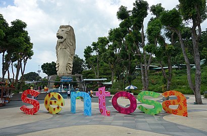
See Sentosa, Singapore, on the map
Directions to Sentosa (Singapore) with public transport
The following transport lines have routes that pass near Sentosa
 Bus:
Bus:
How to get to Sentosa by bus?
Click on the bus route to see step by step directions with maps, line arrival times and updated time schedules.
Bus stations near Sentosa in Singapore
- The Oceanfront @ Sentosa Cove,13 min walk,
- W Hotel / Quayside Isle,17 min walk,
Bus lines to Sentosa in Singapore
- SENTOSA COVE SHUTTLE,Harbourfront Int,
- BUS B,Beach Stn,
What are the nearest stations to Sentosa?
The nearest stations to Sentosa are:
- The Oceanfront @ Sentosa Cove is 976 meters away, 13 min walk.
- W Hotel / Quayside Isle is 1259 meters away, 17 min walk.
Which bus line stops near Sentosa?
SENTOSA COVE SHUTTLE
What’s the nearest bus stop to Sentosa in Singapore?
The nearest bus stop to Sentosa in Singapore is The Oceanfront @ Sentosa Cove. It’s a 13 min walk away.
See Sentosa, Singapore, on the map
Public Transit to Sentosa in Singapore
Wondering how to get to Sentosa in Singapore, Singapore? Moovit helps you find the best way to get to Sentosa with step-by-step directions from the nearest public transit station.
Moovit provides free maps and live directions to help you navigate through your city. View schedules, routes, timetables, and find out how long does it take to get to Sentosa in real time.
Looking for the nearest stop or station to Sentosa? Check out this list of stops closest to your destination: The Oceanfront @ Sentosa Cove; W Hotel / Quayside Isle.
Bus:
Want to see if there’s another route that gets you there at an earlier time? Moovit helps you find alternative routes or times. Get directions from and directions to Sentosa easily from the Moovit App or Website.
We make riding to Sentosa easy, which is why over 1.5 million users, including users in Singapore, trust Moovit as the best app for public transit. You don’t need to download an individual bus app or train app, Moovit is your all-in-one transit app that helps you find the best bus time or train time available.
For information on prices of bus, costs and ride fares to Sentosa, please check the Moovit app.
Use the app to navigate to popular places including to the airport, hospital, stadium, grocery store, mall, coffee shop, school, college, and university.
Sentosa Address: Singapore 098536 street in Singapore
Attractions near Sentosa
Ocean Dr,098584,The Azure,17 Coral Is,Gym @ The Berth By E Cove,The Azure Ocean Dr,212 Ocean Drive,Young Administration Services,098622,THE BERTH BY THE COVE Ocean Dr,River Road, Sentosa Island,The Berth By The Cove,Coral Island,098550,Coral Is,THE BERTH BY THE COVE,Coral Bridge,Swimming Pool At The Bearth,Treasure Island,The Open Space CommunicationsHow to get to popular attractions in Singapore with public transportation
Queensway Shopping Centre, Singapore,NTUC Foodfare, Northwest,AbbVie, Southwest,NTUC FairPrice, Southwest,Overhead Bridge Across Kranji Expressway (KJE), Southwest,Al-Firdaus Mosque, Southwest,Blue Riverview, Northwest,Admiralty Drive, Northwest,Blk 18 @ TradeHub 21, Southwest,KFC, Singapore,Blk 864 Jurong West Street 81, Southwest,SAF.eMart, Southwest,West Coast Park Playground, Southwest,Xin Wang Hong Kong Café, Southwest,Beach Pool, Southwest,Bus Stop 23491 (Joo Koon Stn), Southwest,SAP Asia, Southwest,Tan Tock Seng Hospital, Singapore,Stamford Tyres, Southwest,Manhill Restaurant, SouthwestGet around Singapore by public transport!
Travelling around Singapore has never been so easy. See step by step directions as you travel to any attraction, street or major public transport station. View bus and train timetables, arrival times, service alerts and detailed routes on a map, so you know exactly how to get to anywhere in Singapore.
When travelling to any destination around Singapore use Moovit's Live Directions with Get Off Notifications to know exactly where and how far to walk, how long to wait for your line , and how many stops are left. Moovit will alert you when it’s time to get off — no need to constantly re-check whether yours is the next stop.
Wondering how to use public transport in Singapore or how to pay for public transport in Singapore? Moovit public transport app can help you navigate your way with public transport easily, and at minimum cost. It includes public transport fees, ticket prices, and costs. Looking for a map of Singapore public transport lines? Moovit public transport app shows all public transport maps in Singapore with all bus routes and stops on an interactive map.
Singapore has 1 transport type(s), including: bus, operated by several transport agencies, including SMRT, SBS Transit, SMRT, MRT/LRT Replacement Services, SBS Transit, SBS Transit, SMRT, Tower Transit, Go-Ahead Singapore, Premium Bus, City Direct Bus, Changi Airport, Sentosa Development Corporation, Sentosa Development Corporation and Cross Border Bus