See Shacklewell Lane Mosque, Dalston, on the map
Directions to Shacklewell Lane Mosque (Dalston) with public transport
The following transport lines have routes that pass near Shacklewell Lane Mosque
 Bus:
Bus: - Train:
- Tube:
How to get to Shacklewell Lane Mosque by bus?
Click on the bus route to see step by step directions with maps, line arrival times and updated time schedules.
How to get to Shacklewell Lane Mosque by train?
Click on the train route to see step by step directions with maps, line arrival times and updated time schedules.
How to get to Shacklewell Lane Mosque by Tube?
Click on the Tube route to see step by step directions with maps, line arrival times and updated time schedules.
Bus stations near Shacklewell Lane Mosque in Dalston
- Shacklewell Lane (V),2 min walk,
- Rio Cinema (S),2 min walk,
- Crossway / Kingsland High Street (U),3 min walk,
Train stations near Shacklewell Lane Mosque in Dalston
- Essex Road,3 min walk,
- Highbury & Islington,11 min walk,
- Hackney Downs,29 min walk,
Tube stations near Shacklewell Lane Mosque in Dalston
- Arsenal,21 min walk,
Bus lines to Shacklewell Lane Mosque in Dalston
- 67,Wood Green,
- 76,Waterloo, County Hall,
- 149,London Bridge,
- 243,Waterloo,
- 488,Bromley-By-Bow, Tesco,
- 236,Hackney Wick,
What are the nearest stations to Shacklewell Lane Mosque?
The nearest stations to Shacklewell Lane Mosque are:
- Shacklewell Lane (V) is 89 meters away, 2 min walk.
- Rio Cinema (S) is 96 meters away, 2 min walk.
- Crossway / Kingsland High Street (U) is 115 meters away, 3 min walk.
- Essex Road is 219 meters away, 3 min walk.
- Highbury & Islington is 788 meters away, 11 min walk.
- Arsenal is 1641 meters away, 21 min walk.
- Hackney Downs is 2245 meters away, 29 min walk.
Which bus lines stop near Shacklewell Lane Mosque?
These bus lines stop near Shacklewell Lane Mosque: 149, 236, 243, 67.
Which train line stops near Shacklewell Lane Mosque?
OVERGROUND
Which Tube line stops near Shacklewell Lane Mosque?
VICTORIA
What’s the nearest Tube station to Shacklewell Lane Mosque in Dalston?
The nearest Tube station to Shacklewell Lane Mosque in Dalston is Arsenal. It’s a 21 min walk away.
What’s the nearest train station to Shacklewell Lane Mosque in Dalston?
The nearest train station to Shacklewell Lane Mosque in Dalston is Essex Road. It’s a 3 min walk away.
What’s the nearest bus stop to Shacklewell Lane Mosque in Dalston?
The nearest bus stops to Shacklewell Lane Mosque in Dalston are Shacklewell Lane (V) and Rio Cinema (S). The closest one is a 2 min walk away.
What time is the first Tube to Shacklewell Lane Mosque in Dalston?
The VICTORIA is the first Tube that goes to Shacklewell Lane Mosque in Dalston. It stops nearby at 05:27.
What time is the last Tube to Shacklewell Lane Mosque in Dalston?
The PICCADILLY is the last Tube that goes to Shacklewell Lane Mosque in Dalston. It stops nearby at 00:48.
What time is the first train to Shacklewell Lane Mosque in Dalston?
The OVERGROUND is the first train that goes to Shacklewell Lane Mosque in Dalston. It stops nearby at 05:28.
What time is the last train to Shacklewell Lane Mosque in Dalston?
The OVERGROUND is the last train that goes to Shacklewell Lane Mosque in Dalston. It stops nearby at 01:10.
What time is the first bus to Shacklewell Lane Mosque in Dalston?
The 243 is the first bus that goes to Shacklewell Lane Mosque in Dalston. It stops nearby at 03:00.
What time is the last bus to Shacklewell Lane Mosque in Dalston?
The 243 is the last bus that goes to Shacklewell Lane Mosque in Dalston. It stops nearby at 03:32.
See Shacklewell Lane Mosque, Dalston, on the map
Public Transit to Shacklewell Lane Mosque in Dalston
Wondering how to get to Shacklewell Lane Mosque in Dalston, United Kingdom? Moovit helps you find the best way to get to Shacklewell Lane Mosque with step-by-step directions from the nearest public transit station.
Moovit provides free maps and live directions to help you navigate through your city. View schedules, routes, timetables, and find out how long does it take to get to Shacklewell Lane Mosque in real time.
Looking for the nearest stop or station to Shacklewell Lane Mosque? Check out this list of stops closest to your destination: Shacklewell Lane (V); Rio Cinema (S); Crossway / Kingsland High Street (U); Essex Road; Highbury & Islington; Arsenal; Hackney Downs.
Bus:Train:Tube:
Want to see if there’s another route that gets you there at an earlier time? Moovit helps you find alternative routes or times. Get directions from and directions to Shacklewell Lane Mosque easily from the Moovit App or Website.
We make riding to Shacklewell Lane Mosque easy, which is why over 1.5 million users, including users in Dalston, trust Moovit as the best app for public transit. You don’t need to download an individual bus app or train app, Moovit is your all-in-one transit app that helps you find the best bus time or train time available.
For information on prices of bus, Tube and train, costs and ride fares to Shacklewell Lane Mosque, please check the Moovit app.
Use the app to navigate to popular places including to the airport, hospital, stadium, grocery store, mall, coffee shop, school, college, and university.
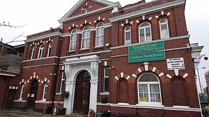
Shacklewell Lane Mosque Address: Shacklewell Lane street in Dalston
Attractions near Shacklewell Lane Mosque
E8 2da,Shacklewell Lane et Drysdale,Mangal II,Shacklewell Lane Dalston (Stop V), London,Escudo de Cuba,MANGAL 2 RESTAURANT,E8 2ez,The Cauldron Pub,Nando's - Dalston,The Old Dalston Market,Earth (Evolutionary Arts Hackney),N16 8bh,E8 2DJ,Istanbul Restaurant,EartH (Hackney Arts Centre),Turkish Bath Hamam,N16 8BJ,Arcola Street,Jones & Sons,ArgosHow to get to popular attractions in Dalston with public transportation
Queen's Club, West Kensington,Redbridge Roundabout, Clayhall,Crouch End, Crouch End,Royal Observatory Greenwich, Greenwich,Asda, Park Royal,Romford, Romford,Oxford Brookes University Gipsy Lane Site, Oxford,Warner Bros. Studio Tour London - the Making Of Harry Potter, Three Rivers,Acton, Acton,Gatwick Airport, Crawley,The Whittington Hospital, Upper Holloway,Issigonis House, Acton,Central Middlesex Hospital, Park Royal,Covent Garden Station, Covent Garden,Sainsbury's, Guildford,Nuffield Health Newbury Fitness & Wellbeing Gym, Newbury (W Berks),Hamleys, Soho,Brixton, Brixton,Southall Police Station, Southall,Beaconsfield Old Town, BeaconsfieldGet around Dalston by public transport!
Travelling around Dalston has never been so easy. See step by step directions as you travel to any attraction, street or major public transport station. View bus and train timetables, arrival times, service alerts and detailed routes on a map, so you know exactly how to get to anywhere in Dalston.
When travelling to any destination around Dalston use Moovit's Live Directions with Get Off Notifications to know exactly where and how far to walk, how long to wait for your line , and how many stops are left. Moovit will alert you when it’s time to get off — no need to constantly re-check whether yours is the next stop.
Wondering how to use public transport in Dalston or how to pay for public transport in Dalston? Moovit public transport app can help you navigate your way with public transport easily, and at minimum cost. It includes public transport fees, ticket prices, and costs. Looking for a map of Dalston public transport lines? Moovit public transport app shows all public transport maps in Dalston with all bus, Tube or train routes and stops on an interactive map.
Dalston has 3 transport type(s), including: bus, Tube or train, operated by several transport agencies, including London Underground, London Buses, Transport for London, London Tramlink, Transport for London, National Rail, Bluestar, Berry's Coaches, Oxford Bus Company, Stagecoach West, Community First Wessex, Cresta Coaches, D & P Boat Hire, First Portsmouth, Fareham & Gosport and FYTbus