Directions to Shenton Park with public transportation
The following transport lines have routes that pass near Shenton Park
How to get to Shenton Park by bus?
Click on the bus route to see step by step directions with maps, line arrival times and updated time schedules.
How to get to Shenton Park by train?
Click on the train route to see step by step directions with maps, line arrival times and updated time schedules.
Bus stations near Shenton Park
- Railway Rd After Gloster St, 6 min walk,
- Derby Rd Before Onslow Rd, 9 min walk,
Bus routes to Shenton Park
- 27, Claremont Stn,
- 24, Perth Childrens Hospital,
- 97, Crawley,
What are the nearest stations to Shenton Park?
The nearest stations to Shenton Park are:
- Railway Rd After Gloster St is 451 meters away, 6 min walk.
- Derby Rd Before Onslow Rd is 637 meters away, 9 min walk.
Which bus lines stop near Shenton Park?
These bus lines stop near Shenton Park: 24, 27, 998, 999.
Which train line stops near Shenton Park?
FREMANTLE LINE
What’s the nearest bus stop to Shenton Park?
The nearest bus stop to Shenton Park is Railway Rd After Gloster St. It’s a 6 min walk away.
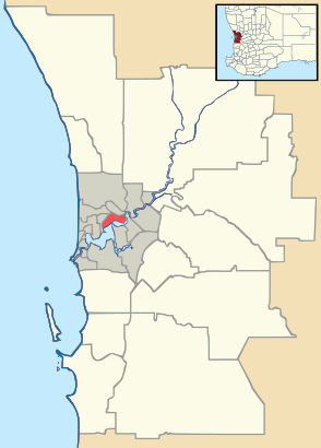
See Shenton Park on the map
Public Transportation to Shenton Park
Wondering how to get to Shenton Park, Australia? Moovit helps you find the best way to get to Shenton Park with step-by-step directions from the nearest public transit station.
Moovit provides free maps and live directions to help you navigate through your city. View schedules, routes, timetables, and find out how long does it take to get to Shenton Park in real time.
Looking for the nearest stop or station to Shenton Park? Check out this list of stops closest to your destination: Railway Rd After Gloster St; Derby Rd Before Onslow Rd.
Bus: 24, 27, 998, 999, 97.Train: FREMANTLE LINE.
Want to see if there’s another route that gets you there at an earlier time? Moovit helps you find alternative routes or times. Get directions from and directions to Shenton Park easily from the Moovit App or Website.
We make riding to Shenton Park easy, which is why over 1.5 million users, including users in Shenton Park, trust Moovit as the best app for public transit. You don’t need to download an individual bus app or train app, Moovit is your all-in-one transit app that helps you find the best bus time or train time available.
For information on prices of bus and train, costs and ride fares to Shenton Park, please check the Moovit app.
Use the app to navigate to popular places including to the airport, hospital, stadium, grocery store, mall, coffee shop, school, college, and university.
Location: Shenton Park, Perth
Attractions near Shenton Park
Jualbup Lake,Tao Acupuncture,249B Nicholson Road,Tasi,Shenton Park Toy Library,266 Onslow Road,Bloomsbury Antiques,Shenton Park Community Center,Star Anise,The Warehouse Cafe,Shenton Park Playground,Warehouse Cafe,Petit Mort,Uca Subiaco Parish,Grantham St. Cafe,The Window Cleaner,The Secret Closet,Secondo Mondo,Galileo Buona Cucina,GalileoHow to get to popular attractions in Shenton Park with public transportation
Perth Convention Exhibition Centre, Perth,City Garden Chinese Restaurant, Northbridge,Duende, Leederville,Treendale Shopping Centre, Australind,Woolworths, Inglewood,Jb O'Reilly's, West Leederville,Dome, East Victoria Park,Booragoon Bus Station, Booragoon,Stockland Shopping Centre Baldivis, Baldivis,Wellington St Telephone Exchange, Perth,Ace Cinemas, Rockingham,Eaton Community College, Eaton,Spencer Village Food Court, Thornlie,Mandurah Forum, Mandurah,Grosvenor Hotel, Perth,Westfield Carousel, Cannington,Crawley, Crawley,Myaree Megaplex, Myaree,ECU Library, Joondalup,The Wembley Hotel, WembleyGet around Perth by public transport!
Travelling around Perth has never been so easy. See step by step directions as you travel to any attraction, street or major public transport station. View bus and train timetables, arrival times, service alerts and detailed routes on a map, so you know exactly how to get to anywhere in Perth.
When travelling to any destination around Perth use Moovit's Live Directions with Get Off Notifications to know exactly where and how far to walk, how long to wait for your line , and how many stops are left. Moovit will alert you when it’s time to get off — no need to constantly re-check whether yours is the next stop.
Wondering how to use public transport in Perth or how to pay for public transport in Perth? Moovit public transport app can help you navigate your way with public transport easily, and at minimum cost. It includes public transport fees, ticket prices, and costs. Looking for a map of Perth public transport lines? Moovit public transport app shows all public transport maps in Perth with all Bus, Train and Ferry routes and stops on an interactive map.
Perth has 3 transport type(s), including: Bus, Train and Ferry, operated by several transport agencies, including Transperth Rail, Transwa, Transperth Ferry, Transperth, TransBusselton, TransAlbany, TransGoldfields, TransEsperance, TransGeraldton, TransCarnarvon, TransHedland, TransKarratha, TransBunbury, Mandurah Bus Charter