See Shepreth Railway Station, East Anglia, on the map
Directions to Shepreth Railway Station (East Anglia) with public transport
The following transport lines have routes that pass near Shepreth Railway Station
 Bus:
Bus: - Train:
How to get to Shepreth Railway Station by bus?
Click on the bus route to see step by step directions with maps, line arrival times and updated time schedules.
How to get to Shepreth Railway Station by train?
Click on the train route to see step by step directions with maps, line arrival times and updated time schedules.
Bus stations near Shepreth Railway Station in East Anglia
- Shepreth,1 min walk,
- High Street, Shepreth,4 min walk,
Bus lines to Shepreth Railway Station in East Anglia
- GREAT NORTHERN,Cambridge,
- THAMESLINK,Bus Replacement: Royston,
- 26,Royston,
What are the nearest stations to Shepreth Railway Station?
The nearest stations to Shepreth Railway Station are:
- Shepreth is 36 meters away, 1 min walk.
- High Street, Shepreth is 258 meters away, 4 min walk.
Which bus lines stop near Shepreth Railway Station?
These bus lines stop near Shepreth Railway Station: 26, 75.
Which train line stops near Shepreth Railway Station?
GREAT NORTHERN
What’s the nearest bus stop to Shepreth Railway Station in East Anglia?
The nearest bus stop to Shepreth Railway Station in East Anglia is Shepreth. It’s a 1 min walk away.
What time is the first train to Shepreth Railway Station in East Anglia?
The GREAT NORTHERN is the first train that goes to Shepreth Railway Station in East Anglia. It stops nearby at 05:38.
What time is the last train to Shepreth Railway Station in East Anglia?
The GREAT NORTHERN is the last train that goes to Shepreth Railway Station in East Anglia. It stops nearby at 01:00.
What time is the first bus to Shepreth Railway Station in East Anglia?
The 26 is the first bus that goes to Shepreth Railway Station in East Anglia. It stops nearby at 11:22.
What time is the last bus to Shepreth Railway Station in East Anglia?
The 26 is the last bus that goes to Shepreth Railway Station in East Anglia. It stops nearby at 15:22.
See Shepreth Railway Station, East Anglia, on the map
Public Transit to Shepreth Railway Station in East Anglia
Wondering how to get to Shepreth Railway Station in East Anglia, United Kingdom? Moovit helps you find the best way to get to Shepreth Railway Station with step-by-step directions from the nearest public transit station.
Moovit provides free maps and live directions to help you navigate through your city. View schedules, routes, timetables, and find out how long does it take to get to Shepreth Railway Station in real time.
Looking for the nearest stop or station to Shepreth Railway Station? Check out this list of stops closest to your destination: Shepreth; High Street.
Bus:Train:
Want to see if there’s another route that gets you there at an earlier time? Moovit helps you find alternative routes or times. Get directions from and directions to Shepreth Railway Station easily from the Moovit App or Website.
We make riding to Shepreth Railway Station easy, which is why over 1.5 million users, including users in East Anglia, trust Moovit as the best app for public transit. You don’t need to download an individual bus app or train app, Moovit is your all-in-one transit app that helps you find the best bus time or train time available.
For information on prices of bus and train, costs and ride fares to Shepreth Railway Station, please check the Moovit app.
Use the app to navigate to popular places including to the airport, hospital, stadium, grocery store, mall, coffee shop, school, college, and university.
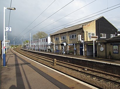
Shepreth Railway Station Address: Station Road Shepreth Royston SG8 6 street in East Anglia
Shepreth railway station serves the village of Shepreth in Cambridgeshire, England. The station is on the Cambridge Line, 49 miles 67 chains (49.84 miles, 80.21 km) from London King's Cross.Wiki
Attractions near Shepreth Railway Station
Esd Uk Limited,Life Line Screening, Shepreth Village Hall, Station Rd Shepreth, Royston,Amazon Locker-Konya,Shepreth,P R Blackwell,BH Aviation,Gpa Global Uk,Homestuff with History,Shepreth,Imcyte,Shepreth Wildlife Park,Frog End,PJ Fencing Contractors,The Windmill Driving School,West Barns Design,Supreme Carpet Cleaning,Squash GB,Originita,Pelvihealth,Barrington Store And Post OfficeHow to get to popular attractions in East Anglia with public transportation
Chesterton Community College, Cambridge,Wensum Lodge - Norfolk County Council Adult Education, Norwich,The Brickmakers, Norwich,Haslingfield, South Cambridgeshire,Banham, Breckland,Hunstanton,Cringleford, South Norfolk,Capel St Mary, Babergh,ipl whitlesey, Fenland,Caister Holiday Park - Haven, Great Yarmouth,Mulbarton, South Norfolk,Wickham Market, Suffolk Coastal,Better Jesus Green Lido, Cambridge,Thickthorn Sevices A11 / A47 Interchange, South Norfolk,Farlingaye High School, Suffolk Coastal,Whittlesey, Fenland,Hunstanton Beach, King'S Lynn And West Norfolk,The Punter, Cambridge,Milsoms, Kesgrave Hall, Suffolk Coastal,RAF Mildenhall Child Development Programs (CDC), Forest HeathGet around East Anglia by public transport!
Travelling around East Anglia has never been so easy. See step by step directions as you travel to any attraction, street or major public transport station. View bus and train timetables, arrival times, service alerts and detailed routes on a map, so you know exactly how to get to anywhere in East Anglia.
When travelling to any destination around East Anglia use Moovit's Live Directions with Get Off Notifications to know exactly where and how far to walk, how long to wait for your line , and how many stops are left. Moovit will alert you when it’s time to get off — no need to constantly re-check whether yours is the next stop.
Wondering how to use public transport in East Anglia or how to pay for public transport in East Anglia? Moovit public transport app can help you navigate your way with public transport easily, and at minimum cost. It includes public transport fees, ticket prices, and costs. Looking for a map of East Anglia public transport lines? Moovit public transport app shows all public transport maps in East Anglia with all bus or train routes and stops on an interactive map.
East Anglia has 2 transport type(s), including: bus or train, operated by several transport agencies, including National Rail, Ambassador Travel, Harwich Harbour Ferry, Stephensons of Essex, Villager Minibus Sharnbrook, The Voluntary Network, Dews Coaches, Felixstowe Ferry Boat Yard, Lord's Travel, Hadleigh Community Transport, Beestons, Fenland Association for Community Transport, First Norfolk & Suffolk, National Rail and Mulleys Motorways