Skegness stop - Thursday schedule
| Line | Direction | Time |
|---|---|---|
| EAST MIDLANDS RAILWAY | Skegness | 06:55 |
| EAST MIDLANDS RAILWAY | Nottingham | 07:06 |
| EAST MIDLANDS RAILWAY | Skegness | 07:59 |
| EAST MIDLANDS RAILWAY | Nottingham | 08:18 |
| EAST MIDLANDS RAILWAY | Skegness | 08:56 |
| EAST MIDLANDS RAILWAY | Nottingham | 09:20 |
| EAST MIDLANDS RAILWAY | Skegness | 09:56 |
| EAST MIDLANDS RAILWAY | Nottingham | 10:15 |
| EAST MIDLANDS RAILWAY | Skegness | 10:57 |
| EAST MIDLANDS RAILWAY | Nottingham | 11:14 |
| EAST MIDLANDS RAILWAY | Skegness | 11:53 |
| EAST MIDLANDS RAILWAY | Nottingham | 12:12 |
| EAST MIDLANDS RAILWAY | Skegness | 12:53 |
| EAST MIDLANDS RAILWAY | Nottingham | 13:15 |
| EAST MIDLANDS RAILWAY | Skegness | 13:49 |
| EAST MIDLANDS RAILWAY | Nottingham | 14:16 |
| EAST MIDLANDS RAILWAY | Skegness | 14:53 |
| EAST MIDLANDS RAILWAY | Nottingham | 15:12 |
| EAST MIDLANDS RAILWAY | Skegness | 15:53 |
| EAST MIDLANDS RAILWAY | Nottingham | 16:14 |
| EAST MIDLANDS RAILWAY | Skegness | 16:57 |
| EAST MIDLANDS RAILWAY | Nottingham | 17:23 |
| EAST MIDLANDS RAILWAY | Skegness | 17:58 |
| EAST MIDLANDS RAILWAY | Nottingham | 18:15 |
| EAST MIDLANDS RAILWAY | Skegness | 19:03 |
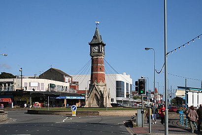
See Skegness, East Lindsey, on the map
Directions to Skegness (East Lindsey) with public transport
The following transport lines have routes that pass near Skegness
 Bus:
Bus: - Train:
How to get to Skegness by bus?
Click on the bus route to see step by step directions with maps, line arrival times and updated time schedules.
How to get to Skegness by train?
Click on the train route to see step by step directions with maps, line arrival times and updated time schedules.
Bus stations near Skegness in East Lindsey
- Bus Station, Skegness,1 min walk,
- Railway Station, Skegness,3 min walk,
- Lincolnshire Imp Cafe, Skegness,4 min walk,
Bus lines to Skegness in East Lindsey
- 1,Ingoldmells,
- M3,Skegness - Boston,
- 57,Skegness Interchange - Boston,
- X57,Skegness Interchange - Boston,
- 59,Skegness Interchange - Mablethorpe,
- 56,Skegness,
- 2,Skegness Interchange - South View,
- 2A,Skegness Interchange - South View,
- B7,Boston - Skegness,
- 12,Mablethorpe - Skegness,
- X12,Skegness - Boston,
- 96,Skegness - Spilsby High School,
- E81S,Spilsby,
- 7,Skegness,
- 59S,Anderby Creek,
- E86S,Alford,
What are the nearest stations to Skegness?
The nearest stations to Skegness are:
- Bus Station, Skegness is 0 meters away, 1 min walk.
- Railway Station, Skegness is 171 meters away, 3 min walk.
- Lincolnshire Imp Cafe, Skegness is 271 meters away, 4 min walk.
Which bus lines stop near Skegness?
These bus lines stop near Skegness: 56, 57, X12.
Which train line stops near Skegness?
EAST MIDLANDS RAILWAY
What’s the nearest bus stop to Skegness in East Lindsey?
The nearest bus stop to Skegness in East Lindsey is Bus Station, Skegness. It’s a 1 min walk away.
What time is the first bus to Skegness in East Lindsey?
The M3 is the first bus that goes to Skegness in East Lindsey. It stops nearby at 04:00.
What time is the last bus to Skegness in East Lindsey?
The 1 is the last bus that goes to Skegness in East Lindsey. It stops nearby at 00:41.
See Skegness, East Lindsey, on the map
Public transport to Skegness stop in East Lindsey
Looking for directions to Skegness in East Lindsey, United Kingdom?
Download the Moovit App to find the current schedule and step-by-step directions for Bus or Train routes that pass through Skegness.
Looking for the nearest stops closest to Skegness ? Check out this list of closest stops to your destination: Bus Station; Railway Station; Lincolnshire Imp Cafe.
Bus:Train:
We make riding on public transit to Skegness easy, which is why over 1.5 million users, including users in East Lindsey trust Moovit as the best app for public transit.
Use the app to navigate to popular places including to the airport, hospital, stadium, grocery store, mall, coffee shop, school, college, and university.
The stop has the following entrances: Richmond Dr
The first line to this stop is EAST MIDLANDS RAILWAY, at 06:55, and the last line is EAST MIDLANDS RAILWAY at 21:20.
This stop serves National Rail’s lines
Popular routes from Skegness, East Lindsey
Bus stops near Skegness
Bus Station, Skegness,Railway Station, Skegness,Lincolnshire Imp Cafe, SkegnessPopular public transport stations in East Lindsey
Magna Charta, Lowdham,Cow Lane, Beeston,Hope (Derbyshire),Henry Fanshawe School Bus Park, Dronfield,Rufford Park, Rufford Country Park,Nottingham Business Park, Strelley (Af08),Radcliffe Road, Gamston,Nottingham Road, Gotham,Link Road, Anstey,North Entrance, Nottingham University Main Campus (Un15),Heapham Road, Gainsborough,New Beetwell Street, Chesterfield (B11),John Coupland Hospital, Gainsborough,The Common, Hugglescote,Sitwell Arms, Renishaw,Firs Avenue, Alfreton,Reservoir Road, Surfleet Seas End,Leycroft Road, Beaumont Leys,Chetwynd Road, Chilwell,Carlton Centre, LincolnGet around East Lindsey by public transport!
Travelling around East Lindsey has never been so easy. See step by step directions as you travel to any attraction, street or major public transport station. View bus and train timetables, arrival times, service alerts and detailed routes on a map, so you know exactly how to get to anywhere in East Lindsey.
When travelling to any destination around East Lindsey use Moovit's Live Directions with Get Off Notifications to know exactly where and how far to walk, how long to wait for your line , and how many stops are left. Moovit will alert you when it’s time to get off — no need to constantly re-check whether yours is the next stop.
Wondering how to use public transport in East Lindsey or how to pay for public transport in East Lindsey? Moovit public transport app can help you navigate your way with public transport easily, and at minimum cost. It includes public transport fees, ticket prices, and costs. Looking for a map of East Lindsey public transport lines? Moovit public transport app shows all public transport maps in East Lindsey with all bus or train routes and stops on an interactive map.
East Lindsey has 2 transport type(s), including: bus or train, operated by several transport agencies, including National Rail, Ashbourne Community Transport, Delaine Buses, Arriva Midlands, Centrebus, Our Centre, Hulleys of Baslow, D & G Bus, Stagecoach East Midlands, North Lincolnshire Council, National Rail, Roberts Coaches, Lawson's of Corby, Hawkes Coaches and East Yorkshire