Directions to Soho Square with public transportation
The following transport lines have routes that pass near Soho Square
How to get to Soho Square by bus?
Click on the bus route to see step by step directions with maps, line arrival times and updated time schedules.
How to get to Soho Square by train?
Click on the train route to see step by step directions with maps, line arrival times and updated time schedules.
How to get to Soho Square by Tube?
Click on the Tube route to see step by step directions with maps, line arrival times and updated time schedules.
Bus stops near Soho Square
- Tottenham Court Road Station (V), 2 min walk,
- Gerrard Place / Chinatown (P), 4 min walk,
- Tottenham Court Road (T), 4 min walk,
- Tottenham Court Road Station (S), 5 min walk,
- Cambridge Circus (D), 5 min walk,
- Tottenham Court Road Station (C), 5 min walk,
- New Oxford Street (Z), 5 min walk,
Tube stations near Soho Square
- Leicester Square, 6 min walk,
- Piccadilly Circus, 9 min walk,
- Tottenham Court Road, 11 min walk,
Train station near Soho Square
- Tottenham Court Road, 11 min walk,
Bus routes to Soho Square
- N8, Oxford Circus - Hainault, The Lowe,
- N25, Ilford - Oxford Circus,
- 55, Oxford Circus - Walthamstow Central,
- N55, Oxford Circus - Woodford Wells,
- 73, Stoke Newington - Oxford Circus,
- N73, Walthamstow Central - Oxford Circus,
- 98, Holborn - Willesden, Bus Garage,
- N98, Holborn - Stanmore Station,
- N207, Holborn - Uxbridge,
- 390, Victoria - Archway,
- 14, Russell Square,
- 19, Battersea Bridge, South Side,
- N19, Clapham Junction,
- 38, Clapton Pond,
- N38, Walthamstow Central,
- N1, Thamesmead,
- N171, Hither Green Station,
- 188, North Greenwich,
- 176, Penge,
- N5, Trafalgar Square - Edgware,
What are the nearest stations to Soho Square?
The nearest stations to Soho Square are:
- Tottenham Court Road Station (V) is 141 meters away, 2 min walk.
- Gerrard Place / Chinatown (P) is 260 meters away, 4 min walk.
- Tottenham Court Road (T) is 298 meters away, 4 min walk.
- Tottenham Court Road Station (S) is 318 meters away, 5 min walk.
- Cambridge Circus (D) is 321 meters away, 5 min walk.
- Tottenham Court Road Station (C) is 337 meters away, 5 min walk.
- New Oxford Street (Z) is 379 meters away, 5 min walk.
- Leicester Square is 457 meters away, 6 min walk.
- Piccadilly Circus is 619 meters away, 9 min walk.
- Tottenham Court Road is 770 meters away, 11 min walk.
Which bus lines stop near Soho Square?
These bus lines stop near Soho Square: 12, 14, 188, 29, 390, 55.
Which train lines stop near Soho Square?
These train lines stop near Soho Square: ELIZABETH, SOUTHEASTERN.
Which Tube lines stop near Soho Square?
These Tube lines stop near Soho Square: NORTHERN, PICCADILLY.
What’s the nearest Tube station to Soho Square?
The nearest Tube station to Soho Square is Leicester Square. It’s a 6 min walk away.
What’s the nearest train station to Soho Square?
The nearest train station to Soho Square is Tottenham Court Road. It’s a 11 min walk away.
What’s the nearest bus station to Soho Square?
The nearest bus station to Soho Square is Tottenham Court Road Station (V). It’s a 2 min walk away.
What time is the first Tube to Soho Square?
The NORTHERN is the first Tube that goes to Soho Square. It stops nearby at 03:28.
What time is the last Tube to Soho Square?
The NORTHERN is the last Tube that goes to Soho Square. It stops nearby at 00:42.
What time is the first train to Soho Square?
The ELIZABETH is the first train that goes to Soho Square. It stops nearby at 07:22.
What time is the last train to Soho Square?
The ELIZABETH is the last train that goes to Soho Square. It stops nearby at 22:52.
What time is the first bus to Soho Square?
The 24 is the first bus that goes to Soho Square. It stops nearby at 03:00.
What time is the last bus to Soho Square?
The N8 is the last bus that goes to Soho Square. It stops nearby at 04:12.
See Soho Square on the map
Public Transportation to Soho Square
How to get to Soho Square in Soho, United Kingdom?
It’s easy with Moovit. Type in your street address and Moovit’s route finder will locate the fastest way to get you there! Not sure where to get off on the street? Download the Moovit App to find live directions (including where to get off on Soho Square), see timetables and get the estimated arrival times for your favourite bus, Tube, train or DLR lines.
Looking for the nearest stop or station to Soho Square? Check out this list of closest stops available to your destination: Tottenham Court Road Station (V); Gerrard Place / Chinatown (P); Tottenham Court Road (T); Tottenham Court Road Station (S); Cambridge Circus (D); Tottenham Court Road Station (C); New Oxford Street (Z); Leicester Square; Piccadilly Circus; Tottenham Court Road.
Bus: 12, 14, 188, 29, 390, 55, N8, N25, N55, 73, 19, N19, 38, N38.Train: ELIZABETH, SOUTHEASTERN.Tube: NORTHERN, PICCADILLY, BAKERLOO, CENTRAL.
Download the Moovit App to see the current schedule and routes available for Soho. No need to install a special bus app to check the bus time or a train app to get train time. Moovit is the only all-in-one transport app that helps you get where you need to go.
We make riding on public transit to Soho Square easy, which is why over 1.5 million users, including users in Soho trust Moovit as the best app for public transport.
Use the app to navigate to popular places including to the airport, hospital, stadium, grocery store, mall, coffee shop, school, college, and university.
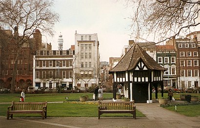
Location: Soho, London
Streets near Soho Square, Soho
Get around Soho by public transport!
Travelling around Soho has never been so easy. See step by step directions as you travel to any attraction, street or major public transport station. View bus and train timetables, arrival times, service alerts and detailed routes on a map, so you know exactly how to get to anywhere in Soho.
When travelling to any destination around Soho use Moovit's Live Directions with Get Off Notifications to know exactly where and how far to walk, how long to wait for your line , and how many stops are left. Moovit will alert you when it’s time to get off — no need to constantly re-check whether yours is the next stop.
Wondering how to use public transport in Soho or how to pay for public transport in Soho? Moovit public transport app can help you navigate your way with public transport easily, and at minimum cost. It includes public transport fees, ticket prices, and costs. Looking for a map of Soho public transport lines? Moovit public transport app shows all public transport maps in Soho with all Bus, Train, Tube, Tramlink, River Bus and DLR routes and stops on an interactive map.
London has 6 transport type(s), including: Bus, Train, Tube, Tramlink, River Bus and DLR, operated by several transport agencies, including London Underground, London Buses, Transport for London, London Tramlink, National Rail, Bluestar, Berry's Coaches, Oxford Bus Company, Stagecoach West, Community First Wessex, Cresta Coaches, First Portsmouth, Fareham & Gosport, IFS Cloud Cable Car, FYTbus and Gosport-Portsmouth Ferry