South Ealing station - Wednesday schedule
| Line | Direction | Time |
|---|---|---|
| DLR | Northbound | 05:05 |
| METROPOLITAN | Watford - Aldgate | 05:21 |
| DLR | Southbound | 05:29 |
| DLR | Westbound | 05:31 |
| METROPOLITAN | Watford - Aldgate | 05:38 |
| DLR | Northbound | 05:39 |
| METROPOLITAN | Watford - Aldgate | 05:45 |
| DLR | Northbound | 05:49 |
| DLR | Westbound | 05:55 |
| DLR | Northbound | 06:01 |
| METROPOLITAN | Watford - Aldgate | 06:08 |
| DLR | Westbound | 06:12 |
| DLR | Northbound | 06:13 |
| DLR | Southbound | 06:20 |
| METROPOLITAN | Watford - Aldgate | 06:23 |
| DLR | Northbound | 06:24 |
| DLR | Westbound | 06:28 |
| DLR | Southbound | 06:29 |
| METROPOLITAN | Watford - Aldgate | 06:34 |
| DLR | Northbound | 06:35 |
| DLR | Southbound | 06:39 |
| DLR | Westbound | 06:42 |
| DLR | Northbound | 06:44 |
| METROPOLITAN | Watford - Aldgate | 06:46 |
| DLR | Southbound | 06:49 |
See South Ealing on the map
Directions to South Ealing with public transportation
The following transport lines have routes that pass near South Ealing
 Bus:
Bus: - Train:
- Tube:
How to get to South Ealing by bus?
Click on the bus route to see step by step directions with maps, line arrival times and updated time schedules.
How to get to South Ealing by train?
Click on the train route to see step by step directions with maps, line arrival times and updated time schedules.
How to get to South Ealing by Tube?
Click on the Tube route to see step by step directions with maps, line arrival times and updated time schedules.
Bus stations near South Ealing
- South Ealing Station (D),1 min walk,
- South Ealing Road (N),6 min walk,
- South Ealing Road, Ealing,6 min walk,
- Julien Road (C),10 min walk,
Tube stations near South Ealing
- Ealing Broadway,22 min walk,
- Ealing Common,25 min walk,
Train stations near South Ealing
- West Ealing,34 min walk,
Bus routes to South Ealing
- 65,Kingston,
- N65,Chessington,
- E3,Greenford Broadway,
- N11,Ealing Broadway,
- A30,Heathrow Airport,
- E2,Greenford Broadway,
What are the nearest stations to South Ealing?
The nearest stations to South Ealing are:
- South Ealing Station (D) is 27 meters away, 1 min walk.
- South Ealing Road (N) is 387 meters away, 6 min walk.
- South Ealing Road, Ealing is 400 meters away, 6 min walk.
- Julien Road (C) is 721 meters away, 10 min walk.
- Ealing Broadway is 1692 meters away, 22 min walk.
- Ealing Common is 1950 meters away, 25 min walk.
- West Ealing is 2603 meters away, 34 min walk.
Which bus lines stop near South Ealing?
These bus lines stop near South Ealing: 288, 81, B12, N91.
Which train lines stop near South Ealing?
These train lines stop near South Ealing: ELIZABETH, SOUTH WESTERN RAILWAY.
Which Tube line stops near South Ealing?
PICCADILLY
What’s the nearest Tube station to South Ealing?
The nearest Tube station to South Ealing is Ealing Broadway. It’s a 22 min walk away.
What’s the nearest bus stop to South Ealing?
The nearest bus stop to South Ealing is South Ealing Station (D). It’s a 1 min walk away.
What time is the first Tube to South Ealing?
The DISTRICT is the first Tube that goes to South Ealing. It stops nearby at 04:42.
What time is the last Tube to South Ealing?
The DISTRICT is the last Tube that goes to South Ealing. It stops nearby at 01:16.
What time is the first train to South Ealing?
The GREAT WESTERN RAILWAY is the first train that goes to South Ealing. It stops nearby at 03:02.
What time is the last train to South Ealing?
The GREAT WESTERN RAILWAY is the last train that goes to South Ealing. It stops nearby at 03:02.
What time is the first bus to South Ealing?
The N65 is the first bus that goes to South Ealing. It stops nearby at 03:03.
What time is the last bus to South Ealing?
The N11 is the last bus that goes to South Ealing. It stops nearby at 03:46.
See South Ealing on the map
Public transport to South Ealing station
Looking for directions to South Ealing in South Ealing, United Kingdom?
Download the Moovit App to find the current schedule and step-by-step directions for Bus, Tube or Train routes that pass through South Ealing.
Looking for the nearest stops closest to South Ealing ? Check out this list of closest stops to your destination: South Ealing Station (D); South Ealing Road (N); South Ealing Road; Julien Road (C); Ealing Broadway; Ealing Common; West Ealing.
Bus:Train:Tube:
We make riding on public transit to South Ealing easy, which is why over 1.5 million users, including users in South Ealing trust Moovit as the best app for public transit.
Use the app to navigate to popular places including to the airport, hospital, stadium, grocery store, mall, coffee shop, school, college, and university.
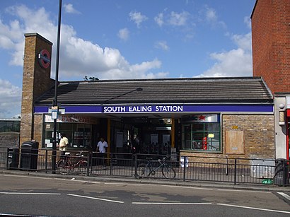
The station has the following entrances: South Ealing Road
The first line to this station is DLR, at 05:05, and the last line is DLR at 01:00.
82 South Ealing Road, London, England, United Kingdom
This station serves Transport for London and London Underground’s lines
Popular routes from South Ealing
Bus stops near South Ealing
South Ealing Station (D),South Ealing Road (N),South Ealing Road, Ealing,Julien Road (C)Train station near South Ealing
West EalingPopular public transport stations in South Ealing
Leyton,Walthamstow Central,Penge West,Bromley Civic Centre (T),Willesden Green,Pettits Lane Romford (N),Watford Metropolitan Station, Cassiobury Park,Sheep Lane (LK),Wandsworth Town Hall (P),Amex Stadium, Falmer,Debden,Tesco, Lakeside,Royal Free Hospital (D),Hither Green,Royal Albert Hall, Knightsbridge,Queens Park Rangers Football Club,Cobham & Stoke D'Abernon Station, Cobham,Harlington Corner (E),Tower Bridge Road (K),PlumsteadGet around South Ealing by public transport!
Travelling around South Ealing has never been so easy. See step by step directions as you travel to any attraction, street or major public transport station. View bus and train timetables, arrival times, service alerts and detailed routes on a map, so you know exactly how to get to anywhere in South Ealing.
When travelling to any destination around South Ealing use Moovit's Live Directions with Get Off Notifications to know exactly where and how far to walk, how long to wait for your line , and how many stops are left. Moovit will alert you when it’s time to get off — no need to constantly re-check whether yours is the next stop.
Wondering how to use public transport in South Ealing or how to pay for public transport in South Ealing? Moovit public transport app can help you navigate your way with public transport easily, and at minimum cost. It includes public transport fees, ticket prices, and costs. Looking for a map of South Ealing public transport lines? Moovit public transport app shows all public transport maps in South Ealing with all bus, Tube or train routes and stops on an interactive map.
South Ealing has 3 transport type(s), including: bus, Tube or train, operated by several transport agencies, including London Underground, London Buses, Transport for London, London Tramlink, Transport for London, National Rail, Bluestar, Berry's Coaches, Oxford Bus Company, Stagecoach West, Community First Wessex, Cresta Coaches, D & P Boat Hire, First Portsmouth, Fareham & Gosport and FYTbus