See South New Brighton, Christchurch, on the map
Directions to South New Brighton (Christchurch) with public transport
The following transport lines have routes that pass near South New Brighton
 Bus:
Bus:
How to get to South New Brighton by bus?
Click on the bus route to see step by step directions with maps, line arrival times and updated time schedules.
Bus stations near South New Brighton in Christchurch
- Estuary Rd Near Cradock St,1 min walk,
Bus lines to South New Brighton in Christchurch
- 60,Public Hospital,
What are the nearest stations to South New Brighton?
The nearest stations to South New Brighton are:
- Estuary Rd Near Cradock St is 11 meters away, 1 min walk.
Which bus line stops near South New Brighton?
60
What’s the nearest bus stop to South New Brighton in Christchurch?
The nearest bus stop to South New Brighton in Christchurch is Estuary Rd Near Cradock St. It’s a 1 min walk away.
What time is the first bus to South New Brighton in Christchurch?
The 60 is the first bus that goes to South New Brighton in Christchurch. It stops nearby at 05:25.
What time is the last bus to South New Brighton in Christchurch?
The 60 is the last bus that goes to South New Brighton in Christchurch. It stops nearby at 00:10.
See South New Brighton, Christchurch, on the map
Public Transit to South New Brighton in Christchurch
Wondering how to get to South New Brighton in Christchurch, New Zealand? Moovit helps you find the best way to get to South New Brighton with step-by-step directions from the nearest public transit station.
Moovit provides free maps and live directions to help you navigate through your city. View schedules, routes, timetables, and find out how long does it take to get to South New Brighton in real time.
Looking for the nearest stop or station to South New Brighton? Check out this list of stops closest to your destination: Estuary Rd Near Cradock St.
Bus:
Want to see if there’s another route that gets you there at an earlier time? Moovit helps you find alternative routes or times. Get directions from and directions to South New Brighton easily from the Moovit App or Website.
We make riding to South New Brighton easy, which is why over 1.5 million users, including users in Christchurch, trust Moovit as the best app for public transit. You don’t need to download an individual bus app or train app, Moovit is your all-in-one transit app that helps you find the best bus time or train time available.
For information on prices of bus, costs and ride fares to South New Brighton, please check the Moovit app.
Use the app to navigate to popular places including to the airport, hospital, stadium, grocery store, mall, coffee shop, school, college, and university.
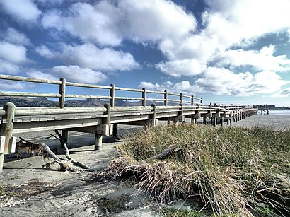
South New Brighton Address: Christchurch, Canterbury street in Christchurch
Attractions near South New Brighton
Estuary Rd,Steven Overend - Licensed Real Estate Salesperson Reaa2008,Champagne Developments,South New Brighton Beach,South Brighton Surf Life Saving Club,The Urban Monk,Uav Services,Bayside Plumbing Maintenance,Herbies Takeaways,Avon River,Tax Value Group,New Brighton Rugby Football Club,Heart Firetherapy,South New Brighton,Moore Fencing,Poms Thai Kitchen,Grace Vineyard Church,Valerie Attrill Counselling,Shosha New Brighton - Specialist Vape Shop & Hookah,Belish BoutiqueHow to get to popular attractions in Christchurch with public transportation
Cashmere Hills, Christchurch,Canterbury Technology Park, Christchurch,Hawarden Garage & Transport, Waimakariri,Quake City, Christchurch,Hei Hei, Christchurch,South City Shopping Centre, Christchurch,opawa, Christchurch,Sweethearts Cafe, Christchurch,Woolston Club Inc, Christchurch,Saint Martins, Christchurch,Villa Maria College, Christchurch,Wainoni, Christchurch,Hillmorton Hospital, Christchurch,Westpark Chapel, Lamb & Hayward Funeral Directors, Christchurch,Addington, Christchurch,St Margaret's College, Christchurch,Hillmorton High School, Christchurch,Papanui High School, Christchurch,Arthur's Pass, Christchurch,Papanui, ChristchurchGet around Christchurch by public transport!
Travelling around Christchurch has never been so easy. See step by step directions as you travel to any attraction, street or major public transport station. View bus and train timetables, arrival times, service alerts and detailed routes on a map, so you know exactly how to get to anywhere in Christchurch.
When travelling to any destination around Christchurch use Moovit's Live Directions with Get Off Notifications to know exactly where and how far to walk, how long to wait for your line , and how many stops are left. Moovit will alert you when it’s time to get off — no need to constantly re-check whether yours is the next stop.
Wondering how to use public transport in Christchurch or how to pay for public transport in Christchurch? Moovit public transport app can help you navigate your way with public transport easily, and at minimum cost. It includes public transport fees, ticket prices, and costs. Looking for a map of Christchurch public transport lines? Moovit public transport app shows all public transport maps in Christchurch with all bus routes and stops on an interactive map.
Christchurch has 1 transport type(s), including: bus, operated by several transport agencies, including Metro Christchurch and Metro Christchurch