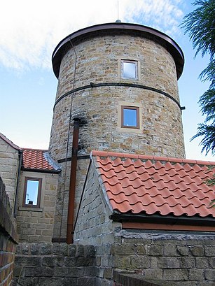
See South Normanton, Bolsover, on the map
Directions to South Normanton (Bolsover) with public transport
The following transport lines have routes that pass near South Normanton
Bus:
Train:
How to get to South Normanton by Bus?
Click on the Bus route to see step by step directions with maps, line arrival times and updated time schedules.
How to get to South Normanton by Train?
Click on the Train route to see step by step directions with maps, line arrival times and updated time schedules.
Bus stations near South Normanton in Bolsover
- Church Street, South Normanton,1 min walk,
- Downing Street, South Normanton,3 min walk,
Bus lines to South Normanton in Bolsover
- 9.1|NINES,Derby,
- 231,Alfreton,
What are the nearest stations to South Normanton?
The nearest stations to South Normanton are:
- Church Street, South Normanton is 72 meters away, 1 min walk.
- Downing Street, South Normanton is 179 meters away, 3 min walk.
Which Bus lines stop near South Normanton?
These Bus lines stop near South Normanton: 9.1
Which Train lines stop near South Normanton?
These Train lines stop near South Normanton: EAST MIDLANDS TRAINS
What’s the nearest bus stop to South Normanton in Bolsover?
The nearest bus stop to South Normanton in Bolsover is Church Street, South Normanton. It’s a 1 min walk away.
See South Normanton, Bolsover, on the map

Public Transit to South Normanton in Bolsover
Wondering how to get to South Normanton in Bolsover, United Kingdom? Moovit helps you find the best way to get to South Normanton with step-by-step directions from the nearest public transit station.
Moovit provides free maps and live directions to help you navigate through your city. View schedules, routes, timetables, and find out how long does it take to get to South Normanton in real time.
Looking for the nearest stop or station to South Normanton? Check out this list of stops closest to your destination: Church Street; Downing Street.
Bus:Train:
Want to see if there’s another route that gets you there at an earlier time? Moovit helps you find alternative routes or times. Get directions from and directions to South Normanton easily from the Moovit App or Website.
We make riding to South Normanton easy, which is why over 1.5 million users, including users in Bolsover, trust Moovit as the best app for public transit. You don’t need to download an individual bus app or train app, Moovit is your all-in-one transit app that helps you find the best bus time or train time available.
For information on prices of Bus and Train, costs and ride fares to South Normanton, please check the Moovit app.
Use the app to navigate to popular places including to the airport, hospital, stadium, grocery store, mall, coffee shop, school, college, and university.
South Normanton Address: South Normanton street in Bolsover

Attractions near South Normanton
- St Michaels C E
- White Hart
- Main Street
- Albert Street Bus Stop
- Cedar Doors
- A B Shutters
- General Property Services
- Archmaker
- Castlewood Loft Ladders
- Old Market Place
- The Schoolhouse
- The Old Schoolhouse Restaurant At The White Hart
- The School House Restaurant
- The Villager
- 1 Albert Street
- De55 2hh
- De55 2bt
- Iftys
- Golden Spice
- Church Street
How to get to popular attractions in Bolsover with public transportation
- Burton Latimer, Kettering
- Forest Fields, Nottingham
- M1 Junction 30, Bolsover
- Currys PC World, Blaby
- Great Billing Sewage Treatment Works, Northampton
- British Gas Museum, Leicester
- Chequered Flag (Hungry Horse), Corby
- Nuffield Health Nottingham Fitness & Wellbeing Gym, Gedling
- Holiday Inn Express Peterborough, Peterborough
- RAF Wittering, Peterborough
- De Montfort University, Leicester
- Colwick Country Park, Nottingham
- YBS Group - Lynch Wood, Peterborough
- Ratcliffe Power Station, Rushcliffe
- Currys PC World, Lincoln
- Wingerworth, North East Derbyshire
- Riverside Retail Park, Northampton
- Immingham Docks, North East Lincolnshire
- Bradgate Park & Swithland Wood Country Park, Charnwood
- Tottle Bakery, Nottingham