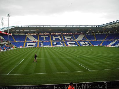
St Andrew's Stadium stop - Wednesday schedule
| Line | Direction | Time |
|---|---|---|
| 60 | Mapledene Rd | 04:43 |
| 60 | Mapledene Rd | 05:13 |
| 17 | Cumberford Ave | 05:40 |
| 60 | Mapledene Rd | 05:43 |
| 60 | Mapledene Rd | 05:58 |
| 17 | Cumberford Ave | 06:10 |
| 60 | Mapledene Rd | 06:13 |
| 60 | Mapledene Rd | 06:28 |
| 17 | Cumberford Ave | 06:30 |
| 60 | Mapledene Rd | 06:44 |
| 17 | Cumberford Ave | 06:50 |
| 60 | Mapledene Rd | 06:59 |
| 17 | Cumberford Ave | 07:00 |
| 60 | Mapledene Rd | 07:08 |
| 17 | Cumberford Ave | 07:10 |
| 60 | Mapledene Rd | 07:17 |
| 17 | Cumberford Ave | 07:19 |
| 891 | Coleshill School | 07:26 |
| 17 | Cumberford Ave | 07:27 |
| 60 | Mapledene Rd | 07:27 |
| 17 | Cumberford Ave | 07:35 |
| 60 | Mapledene Rd | 07:37 |
| 17 | Cumberford Ave | 07:43 |
| 60 | Mapledene Rd | 07:47 |
| 17 | Cumberford Ave | 07:52 |
Directions to St Andrew's Stadium stop (Bordesley Green) with public transport
The following transport lines have routes that pass near St Andrew's Stadium
How to get to St Andrew's Stadium stop by bus?
Click on the bus route to see step by step directions with maps, line arrival times and updated time schedules.
How to get to St Andrew's Stadium stop by train?
Click on the train route to see step by step directions with maps, line arrival times and updated time schedules.
Bus stops near St Andrew's Stadium stop in Bordesley Green
- Tilton Rd, 1 min walk,
- Bordesley Circus, 5 min walk,
Train stations near St Andrew's Stadium station in Bordesley Green
- Bordesley, 53 min walk,
Bus lines to St Andrew's Stadium stop in Bordesley Green
- 97, Chester Rd,
- 97A, Birmingham International Station,
- 17, Cumberford Ave,
- 60, Moor St Selfridges,
- 891, Coleshill School,
What are the nearest stations to St Andrew's Stadium?
The nearest stations to St Andrew's Stadium are:
- Tilton Rd is 41 meters away, 1 min walk.
- Bordesley Circus is 344 meters away, 5 min walk.
- Bordesley is 4133 meters away, 53 min walk.
Which bus lines stop near St Andrew's Stadium?
These bus lines stop near St Andrew's Stadium: 60, 97A.
Which train line stops near St Andrew's Stadium?
WEST MIDLANDS RAILWAY (Worcester Foregate Street)
What’s the nearest bus station to St Andrew's Stadium in Bordesley Green?
The nearest bus station to St Andrew's Stadium in Bordesley Green is Tilton Rd. It’s a 1 min walk away.
What time is the first light rail to St Andrew's Stadium in Bordesley Green?
The METRO is the first light rail that goes to St Andrew's Stadium in Bordesley Green. It stops nearby at 07:41.
What time is the last light rail to St Andrew's Stadium in Bordesley Green?
The METRO is the last light rail that goes to St Andrew's Stadium in Bordesley Green. It stops nearby at 00:13.
What time is the first bus to St Andrew's Stadium in Bordesley Green?
The 97A is the first bus that goes to St Andrew's Stadium in Bordesley Green. It stops nearby at 03:12.
What time is the last bus to St Andrew's Stadium in Bordesley Green?
The 97A is the last bus that goes to St Andrew's Stadium in Bordesley Green. It stops nearby at 02:55.
See St Andrew's Stadium stop, Bordesley Green, on the map
Public transport to St Andrew's Stadium stop (ID: nwmajwjw) in Bordesley Green
Looking for directions to St Andrew's Stadium in Bordesley Green, United Kingdom?
Download the Moovit App to find the current schedule and step-by-step directions for Bus, Train or Light rail routes that pass through St Andrew's Stadium.
Looking for the nearest stops closest to St Andrew's Stadium ? Check out this list of closest stops to your destination: Tilton Rd; Bordesley Circus; Bordesley.
Bus: 60, 97A, 97, 17, 891.Train: WEST MIDLANDS RAILWAY.
We make riding on public transit to St Andrew's Stadium easy, which is why over 1.5 million users, including users in Bordesley Green trust Moovit as the best app for public transit.
Use the app to navigate to popular places including to the airport, hospital, stadium, grocery store, mall, coffee shop, school, college, and university.
St Andrew's Stadium stop’s code is nwmajwjw
The first line to this stop is 60, at 04:43, and the last line is 60 at 00:16.
This stop serves National Express West Midlands’s lines
Train station near St Andrew's Stadium station
Popular public transport stations in Bordesley Green
Get around Bordesley Green by public transport!
Travelling around Bordesley Green has never been so easy. See step by step directions as you travel to any attraction, street or major public transport station. View bus and train timetables, arrival times, service alerts and detailed routes on a map, so you know exactly how to get to anywhere in Bordesley Green.
When travelling to any destination around Bordesley Green use Moovit's Live Directions with Get Off Notifications to know exactly where and how far to walk, how long to wait for your line , and how many stops are left. Moovit will alert you when it’s time to get off — no need to constantly re-check whether yours is the next stop.
Wondering how to use public transport in Bordesley Green or how to pay for public transport in Bordesley Green? Moovit public transport app can help you navigate your way with public transport easily, and at minimum cost. It includes public transport fees, ticket prices, and costs. Looking for a map of Bordesley Green public transport lines? Moovit public transport app shows all public transport maps in Bordesley Green with all Bus, Train and Light rail routes and stops on an interactive map.
West Midlands has 3 transport type(s), including: Bus, Train and Light rail, operated by several transport agencies, including National Express West Midlands, National Express Coventry, National Express, Diamond Bus, Arriva Midlands, Stagecoach Midlands, West Midlands Metro, Stagecoach West, Stagecoach South Wales, First Potteries, First Worcestershire, LandFlight, trentbarton, D & G Bus and Flexibus