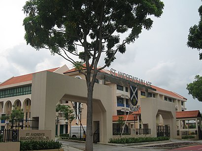
Directions to St. Andrew's Village (Southeast) with public transport
The following transport lines have routes that pass near St. Andrew's Village
How to get to St. Andrew's Village by bus?
Click on the bus route to see step by step directions with maps, line arrival times and updated time schedules.
How to get to St. Andrew's Village by metro?
Click on the metro route to see step by step directions with maps, line arrival times and updated time schedules.
Bus stops near St. Andrew's Village in Southeast
- Potong Pasir Ave 3 - Bet Blks 138/144 (61089), 5 min walk,
- Upp S'Goon Rd - 18 Woodsville (60201), 7 min walk,
- Potong Pasir Ave 1 - Potong Pasir Stn Exit A (61069), 8 min walk,
- Upp S'Goon Rd - Potong Pasir Stn Exit B (60269), 9 min walk,
- Bendemeer Rd - Mom Svcs Ctr (60179), 10 min walk,
- Jln Kolam Ayer - Bef Bendemeer Rd (60079), 10 min walk,
- Jln Toa Payoh - Opp St. Andrew's Village (60089), 11 min walk,
- Jln Toa Payoh - St. Andrew's Village (60081), 13 min walk,
Metro stations near St. Andrew's Village in Southeast
- Woodleigh (NE11), 12 min walk,
- Geylang Bahru (DT24), 14 min walk,
Bus lines to St. Andrew's Village in Southeast
- 142, Toa Payoh Int,
- 142A, Upp S'Goon Rd (Sant Ritz),
- 13, Yio Chu Kang Int ↔ Upper East Coast Ter,
- 107, Hougang Ctrl Int ↔ Shenton Way Ter,
- 133, Ang Mo Kio Int ↔ Shenton Way Ter,
- 147, Hougang Ctrl Int ↔ Clementi Int,
- 506, Jurong East Int ↔ Serangoon Int,
- 853, Yishun Int ↔ Lor 1 Geylang Ter,
- 107M, Hougang Ctrl Int ↺ Raffles Blvd,
- 853M, Yishun Int ↔ Upp East Coast Ter,
- CALVARY BAPTIST CH SHUTTLE, Calvary Baptist Church,
- 147A, New Bridge Rd (Opp Pearl’S Ctr),
- 23, Tampines Int ↺ Rochor Canal Rd,
- 26, Bedok Int ↔ Toa Payoh Int,
- 31, Tampines Int ↔ Toa Payoh Int,
- 61, Bt Batok Int ↔ Eunos Int,
- 64, Sims Place Ter ↺ Mei Ling St,
- 65, Tampines Int ↔ HarbourFront Int,
- 125, St Michael’s Ter ↺ Sims Dr,
- 140, Lor 1 Geylang Ter ↺ St. Wilfred Rd,
What are the nearest stations to St. Andrew's Village?
The nearest stations to St. Andrew's Village are:
- Potong Pasir Ave 3 - Bet Blks 138/144 (61089) is 275 meters away, 5 min walk.
- Upp S'Goon Rd - 18 Woodsville (60201) is 422 meters away, 7 min walk.
- Potong Pasir Ave 1 - Potong Pasir Stn Exit A (61069) is 494 meters away, 8 min walk.
- Upp S'Goon Rd - Potong Pasir Stn Exit B (60269) is 592 meters away, 9 min walk.
- Bendemeer Rd - Mom Svcs Ctr (60179) is 697 meters away, 10 min walk.
- Jln Kolam Ayer - Bef Bendemeer Rd (60079) is 712 meters away, 10 min walk.
- Jln Toa Payoh - Opp St. Andrew's Village (60089) is 845 meters away, 11 min walk.
- Woodleigh (NE11) is 940 meters away, 12 min walk.
- Geylang Bahru (DT24) is 1005 meters away, 14 min walk.
- Jln Toa Payoh - St. Andrew's Village (60081) is 1011 meters away, 13 min walk.
Which bus lines stop near St. Andrew's Village?
These bus lines stop near St. Andrew's Village: 147, 154, 61, 64, 857, 966, 985.
Which metro line stops near St. Andrew's Village?
NORTH EAST LINE
What’s the nearest metro station to St. Andrew's Village in Southeast?
The nearest metro station to St. Andrew's Village in Southeast is Woodleigh (NE11). It’s a 12 min walk away.
What’s the nearest bus stop to St. Andrew's Village in Southeast?
The nearest bus stop to St. Andrew's Village in Southeast is Potong Pasir Ave 3 - Bet Blks 138/144 (61089). It’s a 5 min walk away.
What time is the first metro to St. Andrew's Village in Southeast?
The NORTH EAST LINE is the first metro that goes to St. Andrew's Village in Southeast. It stops nearby at 06:16.
What time is the last metro to St. Andrew's Village in Southeast?
The DOWNTOWN LINE is the last metro that goes to St. Andrew's Village in Southeast. It stops nearby at 00:36.
What time is the first bus to St. Andrew's Village in Southeast?
The 31 is the first bus that goes to St. Andrew's Village in Southeast. It stops nearby at 05:35.
What time is the last bus to St. Andrew's Village in Southeast?
The 154 is the last bus that goes to St. Andrew's Village in Southeast. It stops nearby at 01:31.
See St. Andrew's Village, Southeast, on the map
Public Transit to St. Andrew's Village in Southeast
Wondering how to get to St. Andrew's Village in Southeast, Singapore? Moovit helps you find the best way to get to St. Andrew's Village with step-by-step directions from the nearest public transit station.
Moovit provides free maps and live directions to help you navigate through your city. View schedules, routes, timetables, and find out how long does it take to get to St. Andrew's Village in real time.
Looking for the nearest stop or station to St. Andrew's Village? Check out this list of stops closest to your destination: Potong Pasir Ave 3 - Bet Blks 138/144 (61089); Upp S'Goon Rd - 18 Woodsville (60201); Potong Pasir Ave 1 - Potong Pasir Stn Exit A (61069); Upp S'Goon Rd - Potong Pasir Stn Exit B (60269); Bendemeer Rd - Mom Svcs Ctr (60179); Jln Kolam Ayer - Bef Bendemeer Rd (60079); Jln Toa Payoh - Opp St. Andrew's Village (60089); Woodleigh (NE11); Geylang Bahru (DT24); Jln Toa Payoh - St. Andrew's Village (60081).
Bus: 147, 154, 61, 64, 857, 966, 985, 142, 142A, 13, 107, 133, 506, CALVARY BAPTIST CH SHUTTLE, 147A.Metro: NORTH EAST LINE, DOWNTOWN LINE.
Want to see if there’s another route that gets you there at an earlier time? Moovit helps you find alternative routes or times. Get directions from and directions to St. Andrew's Village easily from the Moovit App or Website.
We make riding to St. Andrew's Village easy, which is why over 1.5 million users, including users in Southeast, trust Moovit as the best app for public transit. You don’t need to download an individual bus app or train app, Moovit is your all-in-one transit app that helps you find the best bus time or train time available.
For information on prices of bus, metro and MRT & LRT, costs and ride fares to St. Andrew's Village, please check the Moovit app.
Use the app to navigate to popular places including to the airport, hospital, stadium, grocery store, mall, coffee shop, school, college, and university.
St. Andrew's Village Address: Leicester Road street in Southeast
Attractions near St. Andrew's Village
How to get to popular places in Singapore with public transit
Get around Singapore by public transport!
Travelling around Singapore has never been so easy. See step by step directions as you travel to any attraction, street or major public transport station. View bus and train timetables, arrival times, service alerts and detailed routes on a map, so you know exactly how to get to anywhere in Singapore.
When travelling to any destination around Singapore use Moovit's Live Directions with Get Off Notifications to know exactly where and how far to walk, how long to wait for your line , and how many stops are left. Moovit will alert you when it’s time to get off — no need to constantly re-check whether yours is the next stop.
Wondering how to use public transport in Singapore or how to pay for public transport in Singapore? Moovit public transport app can help you navigate your way with public transport easily, and at minimum cost. It includes public transport fees, ticket prices, and costs. Looking for a map of Singapore public transport lines? Moovit public transport app shows all public transport maps in Singapore with all Bus, Train, Metro, MRT & LRT, Ferry and Cable Car routes and stops on an interactive map.
Singapore has 6 transport type(s), including: Bus, Train, Metro, MRT & LRT, Ferry and Cable Car, operated by several transport agencies, including SMRT, SBS Transit, MRT/LRT Replacement Services, Tower Transit, Go-Ahead Singapore, Premium Bus, City Direct Bus, Changi Airport, Sentosa Development Corporation, Cross Border Bus, Singapore Cable Car Network, NUS Shuttle (ComfortDelGro), NTU Shuttle (ComfortDelGro), JTC Corp, Shuttle Bus (Appx. Schedule)